The Fontaine des Abîmes

Marked route No. 98.
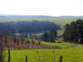
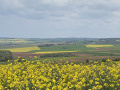
A very hilly route featuring numerous springs, wash houses and other water sources, contrasting with the vast expanses of farmland. In short, plenty of variety.

Details

2610941
Creation:
Last update:
Last review:
  • Walking
    Activity: Walking
  • ↔
    Distance: 7.98 mi
  • ◔
    Average duration: 4h 25 
  • ▲
    Difficulty: Moderate

  • ⚐
    Back to start: Yes
  • ↗
    Ascent: + 896 ft
  • ↘
    Descent: - 879 ft

  • ▲
    Highest point: 988 ft
  • ▼
    Lowest point: 646 ft

Description of the walk

The route starts from the car park at the foot of the Coulangeron wash house, below the church (there is another car park 100 metres away, very close to the town hall).

(S/E) Walk to the church and, facing it, turn left. At the three-way junction, keep right into Rue de la Chaumotte. This road ends as a track at the last houses.

(1) At the junction, carry straight on, ignoring the side roads. On the plateau, pass a first turn-off on the left, then a second on the right. Head down towards the woodland to reach a cross-valley path at the bottom of the valley.

(2) Turn slightly left. A stream often runs alongside you on the right; at one point it disappears from view as it winds its way into a field. This path joins the road as you reach the first houses of Pesteau-le-Bas. Stay on this road until the next crossroads.

(3) In front of the farm shed, cross the road, curving slightly left then right, and begin a fairly steep climb. Halfway up the slope, head left. After a flat section, go downhill and reach the crossroad.

(4) Cut across this road and immediately set off again along an ascending track. At the junction, follow the track with the fenced enclosure on your left. You’ll come to a Fork in the road and see the first wind turbine opposite.

(5) Continue uphill for a short while to the left. You’ll find yourself facing a second wind turbine. Turn left and carry on along this main track, keeping the wind turbines on your right at all times. At the riding school, continue downhill until you reach the hamlet of La Grilletière.

(6) Take the road on the left overlooking the wash house. At the first junction, turn right and at the next one, turn right again. You’ll soon reach a left-hand bend in the road.

(7) Take the path opposite; it climbs steeply at first but then levels out as it follows the edge of the woodland. At the end, you’ll reach a compacted track.

(8) Turn left to reach a cross-track. There, turn left and follow it for a good hundred metres, then turn right. Continue along this gravel track, which descends and leads to a tarmac road; take this road to the right towards the wash house.

(9) At the wash house, leave the road and head up the path on the left.

(10) At the T-junction, turn left (beforehand, it is advisable to make a round trip to the Chapelle de Chéry, on the right). Pass under a power line and, facing the village of La Grilletière, on the descent, turn right onto a grassy track (a row of cherry trees runs perpendicular to this track). This track leads down to Les Chocats.

(11) Cross the road and head up the street with the central gutter. At the top, where the road curves, take the path on the right.

(12) After a fairly steep climb, keep to the right towards the woodland. Stay at the edge of the woodland, ignoring a path branching off to the left.

(13) Take the path on the left which passes under a farm building and follow it to return to the junction where you started.

(1) Head down the tarmac road on the right and make your way to the car park (S/E).

Waypoints

  1. S/E : mi 0 - alt. 856 ft - Washing-up area car park - Église Saint-Charles (Coulangeron)
  2. 1 : mi 0.12 - alt. 899 ft - Junction on the circular loop
  3. 2 : mi 0.63 - alt. 823 ft - Cross-valley path at the bottom of the valley
  4. 3 : mi 1.6 - alt. 722 ft - Route – Lavoir
  5. 4 : mi 2.25 - alt. 732 ft - Cross-country path near Prénereau Farm
  6. 5 : mi 2.71 - alt. 869 ft - Fork in the road – Wind turbines opposite
  7. 6 : mi 4.12 - alt. 663 ft - La Grilletière – junction - Ru de Baulche (rivière)
  8. 7 : mi 4.38 - alt. 650 ft - Uphill path
  9. 8 : mi 5.21 - alt. 843 ft - Cross-country trail
  10. 9 : mi 5.75 - alt. 741 ft - Former wash house at Chéry
  11. 10 : mi 6.03 - alt. 843 ft - Chapelle de Chéry
  12. 11 : mi 6.51 - alt. 682 ft - The trail emerges onto a road at the entrance to Les Chocats
  13. 12 : mi 7 - alt. 873 ft - Y-junction paths
  14. 13 : mi 7.58 - alt. 804 ft - Junction with a path
  15. S/E : mi 7.98 - alt. 856 ft - Washing-up area car park - Église Saint-Charles (Coulangeron)

Notes

There are numerous springs, wash houses and pools along this route; none of these water sources is safe to drink.

Bring a hat, water and a packed lunch if you’re planning to have a picnic.
Picnic areas and shelters are available at the following points: (S/E), (6), (10).

This signposted route, which complies with the signposting guidelines of the Puisaye-Forterre Community of Communes, is marked with the number 98 on yellow-backed signs.
The signposting was carried out by the association ‘À chacun son chemin en Puisaye-Forterre’ in December 2021.
If you encounter any issues, please complete this questionnaire (it only takes 1 to 2 minutes).
Take care when crossing roads.
However, even though the route is signposted, you must set off with at least this route description and the accompanying IGN map or the Visorando app.

Worth a visit

(6) The Grilletière washhouse, with a catchment area and a glass roof. Suitable for picnics. The spring is located on the grassy area a little further upstream. It feeds the stream, which is channelled through a tunnel before supplying the washhouse and flowing into the waters of the Ru de Bauche(s).

Reviews and comments

5 / 5
Based on 2 reviews

Reliability of the description
5 / 5
Ease of following the route
5 / 5
Route interest
5 / 5
Bois vert
Bois vert

Overall rating : 5 / 5

Date of your route : Aug 27, 2026
Reliability of the description : ★★★★★ Very good
Ease of following the route : ★★★★★ Very good
Route interest : ★★★★★ Very good
Very busy route : No

Thank you for that lovely walk!

Machine-translated

remi2000
remi2000

Overall rating : 5 / 5

Date of your route : Feb 28, 2022
Reliability of the description : ★★★★★ Very good
Ease of following the route : ★★★★★ Very good
Route interest : ★★★★★ Very good
Very busy route : No

A lovely, hilly walk with a beautiful little chapel along the route – highly recommended. Thank you to those who mapped it out.

Machine-translated

Other walks in the area

For more walks, use our search engine .

The GPS track and description are the property of this route's author. Please do not copy them without permission.