The Vassy Valley

Marked route No. 56.
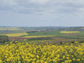
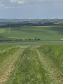
The Hauts-de-Forterre plateau offers some stunning views and a charming heritage, highlighted by the orientation table and the route of old trade signs dotted around the village.

Details

188381
Creation:
Last update:
Last review:
  • Walking
    Activity: Walking
  • ↔
    Distance: 8.05 mi
  • ◔
    Average duration: 4h 10 
  • ▲
    Difficulty: Moderate

  • ⚐
    Back to start: Yes
  • ↗
    Ascent: + 577 ft
  • ↘
    Descent: - 584 ft

  • ▲
    Highest point: 1,266 ft
  • ▼
    Lowest point: 846 ft

Description of the walk

The route starts from the car parks between the town hall and the village hall.

(S/E) On leaving the town hall courtyard, turn immediately right onto Grande Rue de Taingy. At the Fork in the road, take the gravelled path straight ahead to reach the first path on the left.

(1) Follow this path until you reach the D125. Walk alongside it on the right for about 400 metres.

(2) Take the track on the left, which is flat at first, before descending shortly afterwards to join a small road. Take this to the left to reach the entrance to Vassy.

(3) Turn left onto Rue de Druyes-Taingy. When you reach a crossroads, first turn left then right to continue due south. The tarmac quickly gives way to a path of stones and grass. The descent continues until you reach the edge of a wood on your left.

(4) Carry on straight ahead, continuing past the woodland until you reach the crossroad.

(5) Turn right and, just before the bend in the road, take a path on the left at the edge of the woodland. At the end of the woodland, turn left onto a road.

(6) Keep to the left, with the farm on your left. Carry on this way, ignoring the Chemin de la Vallée, until you reach a four-way junction.

(7) Take the second on the right and you’ll reach the wash house. Follow the same route in the opposite direction. Turn into thefirst street on the left (Rue du Bois). After the last few houses, leave the service road and take the path opposite for about 200 metres.

(8) Turn left to reach a cross-path.

(9) Turn left and head back up onto the plateau. Ignore the path leading down to the right and continue to the path leading to the orientation point.

(10) Turn right to reach the orientation area. On your return from this viewpoint, take the path on the right, with a tower and a transmission mast directly opposite you. At the road, head down to the left until you reach the first garden on the left.

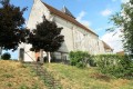
(11) Walk down the dirt track. As you continue along it, ignore the path on the right and you’ll arrive in front of the church. Head back up to the right to return to the car park (S/E).

Waypoints

  1. S/E : mi 0 - alt. 1,125 ft - Taingy Town Hall
  2. 1 : mi 1.14 - alt. 1,148 ft - Junction of paths
  3. 2 : mi 1.99 - alt. 1,184 ft - Leave the road and head off to the left
  4. 3 : mi 3.03 - alt. 991 ft - Arrival in Vassy
  5. 4 : mi 3.64 - alt. 886 ft - Edge of the wood
  6. 5 : mi 4.22 - alt. 892 ft - Leads onto a road
  7. 6 : mi 5.38 - alt. 984 ft - Crossing road and building on the left
  8. 7 : mi 5.68 - alt. 1,033 ft - Round-trip junction at the wash house
  9. 8 : mi 6.04 - alt. 1,093 ft - Junction of paths
  10. 9 : mi 6.61 - alt. 1,125 ft - Side path
  11. 10 : mi 7.17 - alt. 1,243 ft - Table d'orientation de Taingy (Hauts-de-Forterre)
  12. 11 : mi 7.69 - alt. 1,175 ft - A small dirt track on the left leading downhill
  13. S/E : mi 8.05 - alt. 1,125 ft - Car park at the start

Notes

This route is very exposed. Strong sunshine or wind mean you must take appropriate precautions. The springs and wash houses do not provide drinking water. You can have a picnic at the playground at the start or along the route, depending on the weather conditions.
This route, signposted in accordance with the signposting guidelines of the Puisaye-Forterre Community of Communes, is marked with the number 56 on yellow-backed signs. It was created by the association ‘À chacun son chemin en Puisaye-Forterre’ in January 2020.
If you encounter any issues, please complete this questionnaire (it only takes 1 to 2 minutes).
Take care when crossing roads.
However, even though the route is signposted, you must set off with at least this route description and the accompanying IGN map or the Visorando app.

Worth a visit

The signpost route within the village is to be explored separately from this route.

Reviews and comments

4.6 / 5
Based on 3 reviews

Reliability of the description
4.3 / 5
Ease of following the route
4.3 / 5
Route interest
5 / 5
Bois vert
Bois vert

Overall rating : 5 / 5

Date of your route : Sep 28, 2025
Reliability of the description : ★★★★★ Very good
Ease of following the route : ★★★★★ Very good
Route interest : ★★★★★ Very good
Very busy route : No

Thank you for this lovely walk on the roof of Forterre!

Machine-translated

User 10252006

Overall rating : 3.7 / 5

Date of your route : Aug 04, 2025
Reliability of the description : ★★★☆☆ Average
Ease of following the route : ★★★☆☆ Average
Route interest : ★★★★★ Very good
Very busy route : No

Machine-translated

FRAN
FRAN

Overall rating : 5 / 5

Date of your route : Apr 29, 2024
Reliability of the description : ★★★★★ Very good
Ease of following the route : ★★★★★ Very good
Route interest : ★★★★★ Very good
Very busy route : No

A lovely hike in the open countryside
Thanks to the person who mapped out the route
A bit of a climb
Some lovely unobstructed views

Machine-translated

Other walks in the area

For more walks, use our search engine .

The GPS track and description are the property of this route's author. Please do not copy them without permission.