Country:

 City:
City:


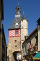
The start of this route is at the post office car park, at the foot of the town hall.
(S/E) From the car park, head towards the Grande Rue and, without crossing it, turn right immediately. Cross the Route d’Arquian with care. Continue along the main road, passing the next two streets leading into the car park. Just after the speed bump, leave the pavement and take the Chemin Cadet on the right. Walk between the farm buildings until you reach a crossroads. Take the path on the right (the one on the left is partially blocked (March 2020)) and continue until you reach a road.
(1) Turn left onto this road and carry on until you find a track on the right signposted ‘Les Doutants’. Head in this direction, cross the Cheuille and turn left shortly afterwards. Pass through Les Doutants and, as the road curves, go straight on along the grassy track. At the end, head down the road on the left, cross the Cheuille again and arrive at the junction.
(2) Cross the junction and head straight up the road. After the last house, ignore a path on the left. At the next crossroads, turn right onto the road signposted ‘Dead end’. When you reach the tennis court on your left, turn right. When you come to a field, turn left and you’ll arrive at Les Haberts.
(3) Go down the road on the right and, at the crossroads, turn right to reach a junction.
(4) Head uphill towards Les Chalmains, crossing the ford. After leaving the farm, turn left and then continue straight on. You’ll come out onto the tarmac road, passing the access road to La Poterie farm, and carry on to the junction.
(5) Head off to the right. After the pond, take the path through the coppiced woodland on the right. You’ll come out onto a road.
(6) Turn left. Pass the access path to Le Taureau to reach a cross-road.
(7) Cross this and take the path on the right. The access path to Les Gallons is blocked by a gate and its exit downstream of the pond is obstructed. Pass below the Étang des Gallons (private). As you walk, ignore a few side paths but take the first fairly wide path on the right. Walk alongside a field bordered by pollarded trees on the left. When the wooded strip ends, enter an open area.
(8) Cross the stream carefully via the footbridge. Enter the woodland again. When you reach a field opposite, keep to the right (path not shown on the IGN map), ignoring the path on the left. The farm buildings at La Hudinerie are clearly visible. At the three-way junction, turn left, this time with a field on your right. You’ll reach a fairly wide track leading to Les Gibelins. Take it on the right to reach a tarmac road.
(9) Cross over and take the path opposite, theGR®3G. Be careful: shortly afterwards, the vegetation obscures the actual path somewhat. Keep to the side with a wooded area on your left and a hedge on your right. You’ll reach Les Thorins and then a road.
(10) Carry straight on along the path and stay on it, ignoring any side branches. You’ll reach a crossroad (D74).
(11) Carry straight on. Pass a turn-off on the right to reach another tarmac road.
(12) Turn right. Pass through Les Charretiers and reach the Y-junction on the road.
(13) Take the path branching off to the right between two hedges. This leads to the access road to Malvau. Continue on to Les Girardins.
(14) Turn right, then immediately left before the building. You’ll reach Jubin. Head left, following the road (which is grassed in the middle). After passing a path on the right and walking for about 200 metres, you’ll come to a path on the left.
(15) Leave the road and take this partly shaded path, which leads onto a road; follow this road to the left for about fifty metres.
(16) Turn right. The path passes between two hedges, curves widely, then turns at a right angle and descends onto a road.
(17) Turn right, then left onto the path that runs alongside the pond. Continue to the left, keeping the pond on your left. Cross the bridge over the Cheuille, enter the playground and head back up towards the car park (S/E).

 Visorando Member
 Tourist office
 Easy
Easy  Association / Club / Walk leader