Country:

 City:
City:



The walk starts from the Colette Museum (car park at the Maison de Santé, below the museum).
Signposted section: Colette Trail No. 1
(S/E) Facing the avenue of lime trees, walk down for a few metres to reach Rue de La Roche; turn right onto this street for 50 metres, then turn left into Rue Colette. Walk between Colette’s house on the left and the ‘front’ garden on the right. Immediately afterwards, turn right into Rue des Gros Bonnets, then opposite, into Rue du Bourg Gelé (the post office building will be on your left). At the junction, opposite the War Memorial, head down the left-hand side of Route de Saint-Amand for 80 metres; leave it at the 90° bend to turn opposite into Rue de Moutiers.
(1) After the bridge under the railway line, turn right onto the path leading to La Marseillaise.
Once you reach this hamlet, take the path on the left before the railway line. Continue along this main path.
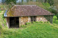
Cross the River Loing via the small bridge and head towards Moutiers by turning right twice onto the small tarmac road. On arriving in the village, take in the wash house on your left, then the church and the square, which is adorned by the fountain of the monk Glabert, with the ruins of the former abbey on your right.
Signposted section: Three Ponds Route No. 44
(2) At the Stop sign, turn slightly right and follow Rue de la Forge. Pass Rue du Four à Chaux on your left and, at the junction with the cross street, take the dirt track opposite.
At the main road, keep to the left-hand verge for 400m.
(3) Turn left towards Les Proux de la Route. This narrow lane continues as a dirt track. Stay on this main track and turn right at the sharp bend (ignore the path on the left which disappears into the woods). Join the D66.
(4) Cross it and follow the road leading to Les Belles Fontaines. Walk for 150 metres before turning right onto the track. Follow it, ignoring the occasional paths leading into the woods or a field. Almost at the end, the sunken track becomes difficult to follow, so turn left onto the path running between the woods and the old sunken track to reach the first pond on this route: the Étang de Charmoy.
(5) Head up the road on the right and take the first path on the left. At the crossroads where four paths meet (the one on the left – a private road – is flanked by two stone pillars), choose the path straight ahead; it runs alongside a wooded heathland that separates you from the Réservoir du Bourdon (a very wild stretch). On the left, a few paths lead down to the lake’s shore.
(6) Ignore the path on the right, marked by a signpost. At this point, stop following the ‘Route des trois étangs’ signpost no. 44; you will follow it again further on.
(7) When you reach the campsite on your right, cross the road and follow the banks of the Bourdon or the path running parallel to the water’s edge.
(8) Turn left and follow the footpath overlooking the lake. At the end of the embankment, just before the sharp bend, cross carefully and enter the spillway gardens on the right through the gate (which is sometimes closed) or via the natural openings in the boundary hedge. Head down to the left of the spillways; at the end, cross the Ruisseau du Bourdon via the two consecutive footbridges. After crossing the last footbridge, head up to the right and, immediately afterwards, turn left. This path is not shown on the IGN map.
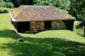
(9) When you reach the road, continue to the left for 150 metres. Cross this road and head uphill along the stony path. Pass by the foot of an old farmhouse with a distinctive roof. Turn onto the next path on the right. Continue through fields and woodland until you reach a main road (D385)
(10) Cross the road and take the dirt track opposite. This track is muddy in places. Follow it, heading south-east/east. At the Guérins farm, you’ll come to a tarmac track; follow this until you reach the D85 crossroad.
Signposted section: ‘Route des trois étangs’ (No. 44)
(11) Cross the D85 and head down the small tarmac road towards Les Clergeaux. In front of the property entrance, turn right onto the dirt track. Continue until you reach a through road, turn left, and pass through Les Petits Clergeaux. The road becomes a track and crosses the railway line.
(12) Cross the Loing and head back up onto the road. Take it to the right to reach the embankment of the Étang de Moutiers.
Do feel free to take a stroll along the dyke and back.
End of signposting for the Three Lakes Route
(13) Back at the start of the dyke, take the path on the left heading north-east. Cross a road, go down a sunken track (slippery in places) and come out onto a tarmac road.
(14) Turn left and follow this track, which runs along the right-hand side of the Bois des Louptières. At the first junction, go straight on. Join the D184.
Signposted section: Route de la Folie No. 2
(15) Cross the road and continue straight ahead. Walk 200m and take the path on the left, which leads to a small road serving a few houses and ends at the edge of a woodland (Les Vrines). Turn right onto the dirt track that enters the woodland and runs alongside the property fence in places. At the first junction, turn right. Carry on and leave the fairly wide track to turn left and head down the path between the woodland on the right and the field on the left. This path ends at the D7 road.
(16) Take the tarmac road opposite, crossing the embankment of the Étang des Barres (also known as the Étang des Gouttes).
(17) At the sharp bend in this small road, take the path leading off to the right (at the gate in sight, the path turns right). This leads onto the D955 road.
(18) Cross this road with care and continue along the path opposite. Once you reach the outskirts of Saint-Sauveur, at the end of this path, turn right and head downhill. Take the road towards Ouanne (to the left) for 50 metres.
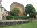
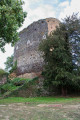
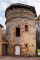
(19) Enter the park’s avenue, lined on both sides with lime trees. Walk past the base of the Saracen Tower and the Colette Museum to reach the car park (S/E).



 .
.
 Visorando Member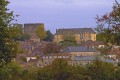
 Moderate

 Easy
Easy