


 Country:

 City:


Start from the Champ de Foire car park in Lainsecq.
(S/E) From the bus shelter, cross the road and turn left onto Rue du Muguet (heading north-east), which runs alongside a wall (there are rings set into the wall used to tether livestock on market days). Stay on this street until you reach the last houses in the village. Continue on and, at the three-way junction, turn left.
(1) At the entrance to the woods, turn left. Follow the edge of the woods, then enter the woods at the crossroads. Join the tarmac road. Turn left. The road soon turns into a track. Continue straight on.
(2) At the left-hand bend, join a cross-road. Turn left.
(3) Turn onto the track on the right and head towards the edge of the woodland. Follow it to the next cross-track.
(4) Turn right and head straight down to the tarmac road. Take it on the right; 150 metres further on, turn left at the bend. Pass through the village of Sougères-en-Puisaye, heading south-east.
(5) Shortly after Les Simons, turn right twice in quick succession to take a path. Walk uphill to the next road, where you turn left. Continue uphill and turn left at the first path (marked by a hiking marker on the ground).
(6) At a pile of stones topped by a cairn, head into the woodland. As soon as you see a field on your right, turn right and continue along the edge of the woodland.
(7) At the road (cross on the right), turn left onto the dirt track and you’ll come out onto Rue des Carrouges. Turn right and head up this street. At the pond on your left, a right-then-left turn takes you onto an ancient Roman road.
(8) Take this ancient Roman road, which is very stony on the ascent. Keep to it as your main route until you reach the sign at the summit marked ‘Montagne des Alouettes 365m’.
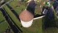
(9) Shortly afterwards, turn onto the path on the right, then left at the next junction. Pass the old mill on your left.
(10) In the middle of the plain (hiking marker on the ground), turn right onto a descending path and then left at the next junction. Continuing downhill, this section of the path ends at Les Guillons du Ravan, where it joins a road. Follow this road, keeping to the left.
(11) Cross the road (D6) and take the path opposite, flanked by a hedge (which was young in 2018), on the right. At the junction with a path coming from the left, turn right onto a tarmac section. Cross La Villeneuve, then the cross-road.
(12) Carry on straight ahead until you reach a crossroads. Turn onto the path on the right. The climb takes you back onto the D6 you crossed earlier.
(13) Head straight on along the track. At the strip of woodland crossing the path, turn left and continue until you reach a tarmac road.
(14) Turn left to cross Champ Martin Bas. Reach the D6 and cross it straight ahead. Ignore the track branching off to the left and the one branching off to the right. Carry on along this track, leaving the farm and the Château de Beauvais on your left.
(15) Cross the D3 towards Moulin Barjot and carry straight on at the junction leading to the houses in this hamlet. At the bottom of the descent, ignore the road on the right which leads to Les Guirtelles. Head up this track, ignoring the tracks branching off to the left. Reach Montreparé and pass between a farm and the houses. Head downhill until you reach the centre of the hamlet of Chappe.
(16) Turn at the fire hydrant (on the left-hand side) onto the small track signposted “Source de la Pisserotte”.
(17) After visiting the three springs (la Pisserotte, le Bouillon, la Vigueur), turn back.
(16) Turn left, walk down a few metres and head off to the right.
(18) At the Croix de la Guirtelle, carry straight on. At the four-way junction, turn left. Then take the second right, followed by the next left. Cross the D6 and head for the car park (S/E).



 Visorando Member

 Association / Club / Walk leader
 Tourist office
 Easy

