Country:
 City:
City:


The route starts at the Migennes Tourist Office.
- By car: there is a car park very close to the Tourist Office, on Place François Mitterrand.
- By train (Laroche-Migennes station): on leaving the platforms, take the underpass and head towards “Migennes town centre”.
(S) From the Tourist Office, take the footbridge and the underpass which runs the entire length of Laroche-Migennes station. At the exit, on the Cheny side, turn left onto Rue Paul Bert until you reach the junction with Rue Henri Surier and Rue Jules Rimet. Turn slightly right, then left after crossing the latter.
(1) Take the tarmac path to the left of the pavilion. Cross the Armançon via the metal bridge and continue past the sports ground on your right. After about 200 metres, turn right onto Chemin Rondino.
(2) Pass the first path on your left, walk between the ponds, and ignore another path that branches off to the left and runs alongside the pond. Carry on; at the next junction, turn left.
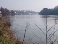
(3) Follow the river (do not cross the bridge), pass the farm, and stay on the main path which, on reaching Bonnard, is called Rue du Port des Fontaines.
(4) At the end of this street, turn right onto the D164 and cross the River Yonne via the main bridge. Carry on and turn right onto Rue de la Rivière.
(5) Turn left onto the path that runs alongside the River Yonne as far as Migennes (this time, you’ll be walking downstream).
(6) On your right is the Écluse de la Gravière. Carry on and pass under the first bridge. You’ll come out onto a wider path; turn right. Pass under a second bridge, then turn sharply left to rejoin the road.
(7) Turn left, follow the road and cross over the River Yonne. Continue along the Route de Charmoy
(8) At the main junction, veer left, go under the bridge and the railway lines. Cross the Canal de Bourgogne.
(9) As you come off the bridge spanning the canal, turn right onto the street running alongside it. At the footbridge, turn left; the Tourist Office (S/E) is 50 metres ahead.



 Tourist office
 Visorando Member
 Moderate