Camerolle

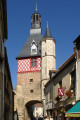
Starting from the heart of the village, dominated by the spire of Saint-Privat Church, set off to explore the sunken paths and then the farmland dotted with flint, before returning – still amidst this man-made landscape – along the Rigole de Saint-Privé.

Details

2730561
Creation:
Last update:
Last review:
  • Walking
    Activity: Walking
  • ↔
    Distance: 5.62 mi
  • ◔
    Average duration: 2h 40 
  • ▲
    Difficulty: Easy

  • ⚐
    Back to start: Yes
  • ↗
    Ascent: + 108 ft
  • ↘
    Descent: - 108 ft

  • ▲
    Highest point: 666 ft
  • ▼
    Lowest point: 548 ft

Description of the walk

Marked route No. 90.
The starting point is at the foot of the church and the War Memorial.

(S/E) Walk up Rue Henri Harpignies, passing Rue Saint-Cartaud. When you reach the junction signposted ‘Bléneau – Camerolle’, don’t fall into the trap – turn left and ignore this sign.

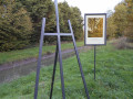
(1) In the wide bend of Rue des Étangs, turn left onto the path flanked by hedges. Follow this path uphill and turn at a right angle at an old crossroads (partly blocked on the opposite side – November 2019). On the left, through a gap in the hedge, there’s a lovely view of the village and a reproduction of a painting by Henri Harpignies.

(2) Turn right and continue along this fairly wide, tree-lined path, which leads to a tarmac road. Take the right-hand side of this road.

(3) Cross the D221 by turning left then right and head down the grassy, well-shaded path. At the crossroads, turn right. Head downhill, cross over the Ruisseau de l’Étang de la Filonnière, then head back uphill, keeping to this path as it curves (the track opposite, between two fences, has been made by animals).

(4) At the farm with an outdoor poultry run, turn left. Opposite the Maison du Petit Magny, turn left onto the path again.

(5) Turn right. After a right-angle bend, continue alongside the ditch on your right, cross it shortly afterwards via the culvert, then turn left immediately after this crossing. Continue keeping the stream on your left. The path ends and gives way to a tarmac road leading to the Foyards farm.

(6) Cross the junction and take the road opposite leading to the Guenins’ houses. This quickly turns into a track leading to a crossroads. Facing the field bordered by woodland, turn right (the track is not shown on the IGN map).
Cross the road and head straight ahead along the stony track, which zigzags at the start. Pass under the power line. You’ll reach the Camerolle farm via a tarmac road.

(7) Go straight across at the crossroads and head downhill opposite, following the road signs for “Le Moulin de Camerolle”. Ignore a path on the right and cross the bridge over the Rigole de Saint-Privé.

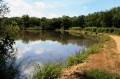
(8) Immediately after this bridge, turn right and continue along the watercourse. It will remain on your right-hand side until you reach Rue Henri Harpignies. This well-shaded stretch runs alongside wild areas, gardens and the pond in turn.

(9) Walk up the street on the right-hand side to return to the starting point (S/E).

Waypoints

  1. S/E : mi 0 - alt. 561 ft - Église Saint-Privat de Saint-Privé
  2. 1 : mi 0.14 - alt. 591 ft - Path on the left, flanked by hedges
  3. 2 : mi 0.39 - alt. 646 ft - Crossroads
  4. 3 : mi 1.2 - alt. 643 ft - Road junction
  5. 4 : mi 1.95 - alt. 617 ft - Livestock farm on the right
  6. 5 : mi 2.51 - alt. 650 ft - Cross-country path
  7. 6 : mi 3.17 - alt. 650 ft - Road junction
  8. 7 : mi 4.06 - alt. 600 ft - Camerolle Farm
  9. 8 : mi 4.19 - alt. 554 ft - Rigole de Saint-Privé
  10. 9 : mi 5.51 - alt. 551 ft - Rue Henri Harpignies
  11. S/E : mi 5.62 - alt. 561 ft - Église Saint-Privat de Saint-Privé

Notes

In wet weather, the path between (4) and (6) may become muddy and slippery in places. The tarmac roads are quiet and offer very good visibility when crossing; nevertheless, please remain very vigilant.
If you are with children, take particular care on the section running alongside the Rigole de Saint-Privé. Its banks are concrete and offer little grip in the event of a fall.
This marked route, which complies with the marking guidelines of the Puisaye-Forterre Community of Communes, is marked with the number 90 on yellow-backed plaques.
The signposting was carried out by the association ‘À chacun son chemin en Puisaye-Forterre’ in November 2021.
If you have any concerns, please complete this questionnaire (it only takes 1 to 2 minutes).
Take care when crossing roads.
However, even though the route is signposted, you must set off with at least this route description and the accompanying IGN map or the Visorando app.

Worth a visit

In the village, at the start of the Saint-Privé canal, the River Loing splits into two: one branch continues towards Bléneau and Montargis, flowing into the River Seine – which in turn flows into the English Channel – whilst the other branch feeds the canal and serves as a supplementary water source for the Briare Canal. The canal itself continues into the Loire, which in turn flows into the Atlantic.
For more on the history of this canal, see this fairly comprehensive and well-researched article.

Reviews and comments

4.1 / 5
Based on 4 reviews

Reliability of the description
4.7 / 5
Ease of following the route
4.3 / 5
Route interest
3.3 / 5
Ludal89
Ludal89

Overall rating : 2.3 / 5

Date of your route : May 24, 2026
Reliability of the description : ★★★★☆ Good
Ease of following the route : ★★☆☆☆ Disappointing
Route interest : ★☆☆☆☆ Very disappointing
Very busy route : No

Very disappointing, very quiet, more than half the route is poorly maintained; over several hundred metres, the grass is nearly 1.60m high, so you have to walk with your arms raised...and on the last kilometre, a 700-metre stretch is impassable; fortunately there is a bridge to get onto the road on the other side of the ditch.
It would be good if the residents of Saint-Privé got their act together to maintain what little there is to attract tourists.
Honestly, the worst hike I’ve done so far

Machine-translated

pascault
pascault

Overall rating : 4.7 / 5

Date of your route : Sep 07, 2024
Reliability of the description : ★★★★★ Very good
Ease of following the route : ★★★★★ Very good
Route interest : ★★★★☆ Good
Very busy route : Yes

A lovely, shaded walk.
Thank you

Machine-translated

Revelatta2B
Revelatta2B

Overall rating : 4.7 / 5

Date of your route : Sep 26, 2022
Reliability of the description : ★★★★★ Very good
Ease of following the route : ★★★★★ Very good
Route interest : ★★★★☆ Good
Very busy route : No

A pleasant walk.
One or two stretches of road where you need to be careful with the children.
A really lovely finish.

Machine-translated

Bernard 10
Bernard 10

Overall rating : 4.5 / 5

Date of your route : Nov 17, 2019
Reliability of the description : Not used / Not applicable
Ease of following the route : ★★★★★ Very good
Route interest : ★★★★☆ Good

A pleasant walk. However, I’d recommend doing it in summer to avoid the grassy paths that have been trampled by livestock moving from one meadow to another, leaving them very muddy. This is particularly true between points 3 and 5.
A very pleasant start through the woodland. Walking alongside the ditch is interesting. Do be careful not to fall in, though – it would no doubt be very difficult to climb back up onto the bank. At the end of the walk, tables and benches by the pond await you – a lovely spot for a picnic.

Machine-translated

Other walks in the area

For more walks, use our search engine .

The GPS track and description are the property of this route's author. Please do not copy them without permission.