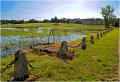
The small and large ponds of Puisaye

You’ll discover no fewer than eight ponds, each with a different shape, size and habitat, not to mention the pools and streams you’ll come across in this region where Colette certainly admired them all – and, in some cases, loved them.
The icing on the cake is that you can have a picnic by the banks of one of them and take a dip in the Bourdon reservoir!

Details

326967
Creation:
Last update:
Last review:
  • Touring/Gravel
    Activity: Touring/Gravel
  • ↔
    Distance: 26.28 mi
  • ◔
    Duration according to the author: 5 hrs 
  • ▲
    Difficulty: Difficult

  • ⚐
    Back to start: Yes
  • ↗
    Ascent: + 988 ft
  • ↘
    Descent: - 991 ft

  • ▲
    Highest point: 997 ft
  • ▼
    Lowest point: 705 ft

Description of the route

For parking, the car parks at the château, the Place du Marché or the Maison de Santé are available.
(S/E) From the Place de la Maison de Santé (also known as Place Blanche), go to the right of the noticeboard and head uphill. Pass the Colette Museum and turn left after the Saracen tower. Go through the gate and follow Rue de Bel Air uphill to the ‘Stop’ sign. Cross straight ahead and continue, ignoring all roads on both the right and left.

(1) As you walk alongside the D955, at the first junction, turn left and walk down for 50 metres, cross this departmental road and continue straight ahead.

(2) Cross the embankment of the Étang des Barres (private), and carry on until you reach the D7. Turn left.

(3) With the Étang de la Folie on your right, carry on straight ahead. In a wide bend to the right, opposite the fir trees, turn right towards Les Boulmiers. At the first ‘Stop’ sign, go straight on. Carry on past Les Boulmiers, then head downhill to reach the junction by the Étang de Moutiers. You can just make it out behind the trees.

(4) At this junction, take the second turning on the right. Follow the edge of the lake, which is sometimes hidden from view and sometimes clearly visible, depending on the season. When you reach the embankment, follow it as far as the railway lines.

(5) Cross the tracks straight ahead, then follow this road uphill to the next junction with the D85. Cross over to take the right-hand road, towards Les Quinaux – Charmoy.

(6) Ride along the dyke of Charmoy Pond. At the top of this track, turn right (you’ll see large metal gates in front of you). Then ride alongside the woods, with a fence on your left forming the northern boundary of Boutissaint Wildlife Park.

(7) Turn right onto a small track with a house on the right and, a little further on, another on the left. Cycle for 200 metres and turn right at the bottom of the descent.

(8) Turn left (campsite on the right). Ignore the next left and the next right. Pass between a small development of wooden houses on the right and the horse farm on the left. Take the next left-hand track, which descends to the edge of the reservoir and then runs alongside a holiday camp (this section along the Bourdon is not as easy to cycle on).

(9) On arrival, take the road along the embankment; continue along this track which overlooks the reservoir, veering slightly away from it in places, and leads to Les Midoux.

(10) Carry straight on. Ride along the western boundary of Boutissaint Park, leaving the entrances on your left. After the large bend to the right, continue until you reach the junction with the D955.

(11) Turn left.

(12) Pass Guédelon Castle and, as the road winds, Guédelon Pond on your left.

(13) A few houses, then, on the right, Chassin Pond. Carry on, passing a first junction with four roads, then a second. Begin a descent and, halfway down the straight stretch, after three houses on the left, at the four-way junction, turn right.

(14) Head towards Les Veillats and take the first left (passing La Bussière des Bois on the opposite side). Ignore the next road on the right, then the road leading into the Jacquots farm, and continue along this lovely but winding little road. Pass through Les Dubois, then carry on straight down at the next junction.

(15) You’ll reach the Orme du Pont pond on your right; follow it until you reach the Stop sign. First turn right then left, then head up the well-shaded track.

(16) At the first junction where four roads meet, turn left. At the Fork in the road, keep slightly to the right, follow the path alongside a wooded area, and cross the industrial estate.

(17) Cross the railway tracks, turn left and continue straight on.

(18) When you reach Rue des Renards, head uphill, staying on this road which becomes Rue de la Roche. You’ll find the car park entrance on your right and the starting point (S/E).

Waypoints

  1. S/E : mi 0 - alt. 879 ft - Musée Colette
  2. 1 : mi 2.06 - alt. 856 ft - Turn left for 50 metres, cross the road and continue straight ahead
  3. 2 : mi 2.94 - alt. 748 ft - Pond on the left; Château des Barres (private property)
  4. 3 : mi 4.04 - alt. 810 ft - On the right, the Étang de la Folie (private)
  5. 4 : mi 6.25 - alt. 728 ft - At the crossroads, take the second right
  6. 5 : mi 7.16 - alt. 715 ft - Level crossing on the lake’s embankment - Etang de Moutiers en Puisaye
  7. 6 : mi 8.78 - alt. 725 ft - Charmoy Pond, straight ahead
  8. 7 : mi 9.95 - alt. 745 ft - Turn right onto the small track
  9. 8 : mi 11.24 - alt. 715 ft - Car park, Calanque campsite - Camping de la Calanque
  10. 9 : mi 13.04 - alt. 712 ft - Turn left onto the sea wall road - Lac du Bourdon
  11. 10 : mi 15.96 - alt. 748 ft - Les Midoux, straight ahead
  12. 11 : mi 17.81 - alt. 935 ft - Turn left at the four-way junction
  13. 12 : mi 19.12 - alt. 850 ft - Chantier médiéval de Guédelon
  14. 13 : mi 20.24 - alt. 879 ft - On the right, Chassin pond
  15. 14 : mi 21.2 - alt. 883 ft - On the right, after the last houses
  16. 15 : mi 23.2 - alt. 794 ft - On the right, the Orme du Pont pond
  17. 16 : mi 24.03 - alt. 902 ft - Turn left at the four-way junction
  18. 17 : mi 25.37 - alt. 853 ft - On the left after the level crossing - La Poéterie (Saint-Sauveur-en-Puisaye)
  19. 18 : mi 26.06 - alt. 820 ft - Climb Rue des Renards
  20. S/E : mi 26.28 - alt. 879 ft - Musée Colette

Notes

This cycle tour requires strict compliance with the Highway Code. Please remain extremely vigilant when crossing railway tracks. Whether approaching from the right or the left, the tourist train has right of way. Please do not hesitate to dismount for your own safety when crossing these tracks.

Good cycle touring kit is absolutely essential; you may also need to bring a swimsuit during the warmer months.
(8) Swimming is permitted at this location only.

Drinking water is scarce, except at (8).

Worth a visit

Visit to the village of Saint-Sauveur: Colette’s museum and house, art galleries, the Saracen tower…

(8) Swimming is permitted at this spot only.

Between (10) and (11), passing by the gates of Boutissaint and Guédelon is a good reason to stop and visit these sites.

Reviews and comments

4.8 / 5
Based on 2 reviews

Reliability of the description
4.5 / 5
Ease of following the route
5 / 5
Route interest
5 / 5
POULIN Gérard
POULIN Gérard ★

Hello Cirotte,
thank you for your feedback on the hike. The section on the D955 does indeed have heavier traffic than the other roads on this route. However, it does have the advantage of passing by the Guédelon site and the Chassin pond. An alternative route could be considered, but it would significantly lengthen the hike.

Machine-translated

cirotte
cirotte

Overall rating : 5 / 5

Date of your route : Aug 22, 2025
Reliability of the description : ★★★★★ Very good
Ease of following the route : ★★★★★ Very good
Route interest : ★★★★★ Very good
Very busy route : No

A magnificent route with beautiful ponds. It's a shame that after Bourdon Lake, there aren't any smaller, less busy roads.

Machine-translated

Daniel ROGER
Daniel ROGER
• Edited:

Overall rating : 4.7 / 5

Date of your route : May 15, 2022
Reliability of the description : ★★★★☆ Good
Ease of following the route : ★★★★★ Very good
Route interest : ★★★★★ Very good
Very busy route : No

A lovely route along quiet back roads as far as Lac du Bourdon, as the return journey to Saint-Sauveur takes a busier road that’s less peaceful for cycling, if I’m not mistaken… Beautiful ponds and scenery, with some shaded stretches. Well worth doing again and again.

Machine-translated

Other walks in the area

For more walks, use our search engine .

The GPS track and description are the property of this route's author. Please do not copy them without permission.