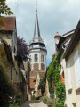
The Sauvage Forest

Marked route No. 78.
Fountains: ‘Shall I not drink your water?’
And yet, from the wash house at Impluvium to Les Bidons, from springs to streams, water is everywhere.

Details

n°2975982
Creation:
Last update:
Last review:
  • Walking
    Activity: Walking
  • ↔
    Distance: 4.29 mi
  • ◔
    Average duration: 2h 15 
  • ▲
    Difficulty: Easy

  • ⚐
    Back to start: Yes
  • ↗
    Ascent: + 299 ft
  • ↘
    Descent: - 315 ft

  • ▲
    Highest point: 1,056 ft
  • ▼
    Lowest point: 748 ft

Description of the walk

Start from the car park of the village hall, located at the northern end of the village.

(S/E) On leaving the car park, head towards the village of Fontaines. You’ll soon reach a four-way junction; take the pavement on the right. Cross the main road and walk down the street towards Lalande. At the first junction, turn left and then immediately turn right, continuing for about twenty metres. Take the path on the left known as Chemin Saint-Laurent or Chemin du Lavoir.

(1) Take the path leading to the wash house. With your back to the wash house, turn right. The track becomes partly grassy, partly tarmac. It runs past a house. When you reach the T-junction, turn left onto the dirt track, which subsequently becomes sunken.

(2) Cut across the road heading towards Les Varennes. Keep to the left-hand verge running alongside the main road. Walk past the Platières property. At the edge of the woodland, carry on straight ahead. Pass a path on the left and a property entrance on the right. You will reach almost the end of the woodland.

(3) As the road curves, turn right onto a wide, gently sloping track. To cross the Forêt du Sauvage, stay on this main track until you reach a road.

(4) Follow it to the left and ignore the path on the left before reaching Les Drions.

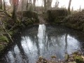
(5) Turn right, continue straight on, passing a lovely pond on your left. Follow the track at the end of this access road. At the first house, join a partially tarmac-surfaced track and follow it to reach the D955.

(6) Cross with care and turn right. Keep to the left-hand verge. Carry straight on at the junction with the Allée des Sapins and the Chemin de Ronde. Return to the village’s main crossroads and carry straight on to reach the car park (S/E).

Waypoints

  1. S/E : mi 0 - alt. 1,047 ft - Car park at the village hall
  2. 1 : mi 0.36 - alt. 981 ft - Impluvium wash house
  3. 2 : mi 1.01 - alt. 853 ft - The route ends at a junction of four roads
  4. 3 : mi 1.63 - alt. 761 ft - S-bends and a sunken lane on the right
  5. 4 : mi 2.5 - alt. 873 ft - Leads onto a road
  6. 5 : mi 2.82 - alt. 938 ft - Les Drions
  7. 6 : mi 3.63 - alt. 1,027 ft - Junction with the D955
  8. S/E : mi 4.29 - alt. 1,047 ft - Car park at the village hall

Notes

The paths are sometimes muddy. After a period of heavy rain, they can be rutted in places as they wind through the forest. There are springs, but the water is not drinkable.

This signposted route, which complies with the signposting guidelines of the Puisaye-Forterre Community of Communes, is marked with the number 78 on yellow-backed signs.
The signposting was carried out by the association ‘À chacun son chemin en Puisaye-Forterre’ in December 2021.
If you encounter any issues, please complete this questionnaire (it only takes 1 to 2 minutes).
Take care when crossing roads.
However, even though the route is signposted, you must set off with at least this route description and the accompanying IGN map or the Visorando app.

Worth a visit

Towards the end of the route, between (3) and (4), temporary art installations can be found in various spots...

Reviews and comments

3.8 / 5
Based on 2 reviews

Reliability of the description
4 / 5
Ease of following the route
4.5 / 5
Route interest
3 / 5
marcus c2
marcus c2

Overall rating : 4.3 / 5

Date of your route : Oct 22, 2024
Reliability of the description : ★★★★☆ Good
Ease of following the route : ★★★★★ Very good
Route interest : ★★★★☆ Good
Very busy route : No

Good evening – a lovely little walk along the Artists’ Trail

Machine-translated

Ludal89
Ludal89

Overall rating : 3.3 / 5

Date of your route : Aug 07, 2022
Reliability of the description : ★★★★☆ Good
Ease of following the route : ★★★★☆ Good
Route interest : ★★☆☆☆ Disappointing
Very busy route : No

A shame – it’s not very well looked after, and there are a few trees blocking the path.

Machine-translated

Other walks in the area

For more walks, use our search engine .

The GPS track and description are the property of this route's author. Please do not copy them without permission.