La Haie Brûlée

Marked walk No. 84
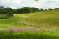
A hike through lush green countryside, starting from one of the villages in the Puisaye-Forterre mural network.

Details

3076180
Creation:
Last update:
Last review:
  • Walking
    Activity: Walking
  • ↔
    Distance: 4.57 mi
  • ◔
    Average duration: 2h 10 
  • ▲
    Difficulty: Easy

  • ⚐
    Back to start: Yes
  • ↗
    Ascent: + 69 ft
  • ↘
    Descent: - 72 ft

  • ▲
    Highest point: 820 ft
  • ▼
    Lowest point: 722 ft

Description of the walk

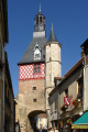
The route starts from Place Maurice de Vergennes at the foot of the church (around ten parking spaces).

(S/E) With your back to the church, head left along the long straight stretch of Rue de Montréal. At the very start, ignore the cul-de-sac leading to the houses and turn right onto Rue Périllier (towards Les Minards). At the junction with Rue de Saint-Fiacre, turn right up the road marked ‘No Entry’.

(1) In front of a wrought-iron gate and a small square, take the path on the left. Continue until you reach the D965 road (the halfway junction shown on the IGN map is closed off by a gate).

(2) Cross this straight road with care. Immediately take the path that appears. At the first Y-junction, take the left-hand branch.

(3) At the cross-path (not shown on the IGN map), turn left. This path, known as the ‘Haie Brûlée’, runs through a ravine; ignore any side paths. You will reach a tarmac road.

(4) Turn left onto it. A wire mesh fence on your right will continue all the way to the next junction with the D965.

(5) Turn right and walk carefully alongside the D965. At the junction signposted ‘Ronchères’, turn left towards the village.

(6) Head down to the right for a return trip to the Lavoir and the Fontaine Saint-Fiacre. On the way back, continue by turning right to return to the starting car park (S/E).


Waypoints

  1. S/E : mi 0 - alt. 781 ft - Église Saint-Fiacre de Ronchères
  2. 1 : mi 0.44 - alt. 814 ft - Opposite, there is a small square at the corner of the dirt track
  3. 2 : mi 1.24 - alt. 810 ft - D965 junction
  4. 3 : mi 1.8 - alt. 768 ft - Crossing path
  5. 4 : mi 2.79 - alt. 722 ft - Small cross-road
  6. 5 : mi 3.63 - alt. 758 ft - D965 junction
  7. 6 : mi 4.1 - alt. 764 ft - Junction with the path leading to the wash house
  8. S/E : mi 4.57 - alt. 781 ft - Église Saint-Fiacre de Ronchères

Notes

In wet weather, the section known as the Chemin de la Haie Brûlée can sometimes be very muddy.
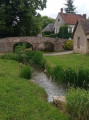
There are picnic spots at the Lavoir and Fontaine Saint-Fiacre.

Please note: you must take great care when crossing the D965 on both occasions. Although visibility is generally good, it may be impaired by the speed of passing vehicles.
This signposted route, which complies with the signposting guidelines of the Puisaye-Forterre Community of Communes, is marked with the number 84 on yellow-backed signs. It was created by the association ‘À chacun son chemin en Puisaye-Forterre’ in February 2023.
If you encounter any issues, please complete this questionnaire (it only takes 1 to 2 minutes).

However, as the route is signposted, you must set off with at least this description and the accompanying IGN map or the Visorando app.

Take care when crossing roads.

Worth a visit

Reviews and comments

3.5 / 5
Based on 6 reviews

Reliability of the description
4 / 5
Ease of following the route
3.7 / 5
Route interest
2.8 / 5
Titus89
Titus89

Overall rating : 4.3 / 5

Date of your route : Apr 27, 2026
Reliability of the description : ★★★★★ Very good
Ease of following the route : ★★★★☆ Good
Route interest : ★★★★☆ Good
Very busy route : No

A lovely walk, particularly through the woodland. However, the path is difficult to navigate in places as it follows a small, dry stream bed. This is littered with branches and all sorts of rubbish, which is a real shame as the walk through the woodland is otherwise very pleasant. I imagine this path must flood in autumn and winter, so I wouldn’t recommend it during those seasons.

Machine-translated

POULIN Gérard
POULIN Gérard ★

Hello Eric,
It's a good idea to avoid the road by taking this alternative route. The section you suggest is private property. Under no circumstances will we suggest this route, as we respect private property and avoid any risks.
As for water concerns on this route, which mainly follows sunken lanes, this very rainy season (130 mm of rainfall in February) has demonstrated the usefulness of these lanes as water collectors from upstream.
Conclusion: summer and autumn route, as indicated on the Practical Information sheet.

Machine-translated

prini
prini
• Edited:

Overall rating : 2.7 / 5

Date of your route : Feb 27, 2026
Reliability of the description : ★★★★☆ Good
Ease of following the route : ★★☆☆☆ Disappointing
Route interest : ★★☆☆☆ Disappointing
Very busy route : No

1) Dangerous passage between point 1 and the intersection and Blanchetterie (tree lying across the entire width of the path).
2) Once you turn left to reach point 2, it is not a path but a stream of water all the way to point 2.
In summer, there will be no problem with water, but it will be a very rough path with tree branches on either side.
3) From point 2 to the junction to turn left, same problem as above, I couldn't get through this passage, I had to go along the left side of the field to reach the junction at the orange arrow.
4) Too much road from point 4 to point 5. It is possible to avoid some of the road by taking a wide path between points 3 and 4 at the orange arrow. You therefore need to turn left onto a wide path (not marked on the IGN map) for about 400 metres, then take the next path on the right and arrive at the road opposite the castle entrance. Then turn left to rejoin the current route.

Machine-translated

anat
anat

Overall rating : 3.7 / 5

Date of your route : Sep 23, 2024
Reliability of the description : ★★★★☆ Good
Ease of following the route : ★★★★☆ Good
Route interest : ★★★☆☆ Average
Very busy route : No

A hike best undertaken during the dry season.
A lot of road walking, including a long stretch on a busy road

Machine-translated

scalp92
scalp92

Overall rating : 3 / 5

Date of your route : Aug 02, 2024
Reliability of the description : ★★★★☆ Good
Ease of following the route : ★★★☆☆ Average
Route interest : ★★☆☆☆ Disappointing
Very busy route : No

Some muddy sections, which have not been used for several years; fallen branches and stinging nettles encroaching on the path
No markings after crossing the road

Machine-translated

Ludal89
Ludal89

Overall rating : 2.7 / 5

Date of your route : Sep 09, 2023
Reliability of the description : ★★☆☆☆ Disappointing
Ease of following the route : ★★★★☆ Good
Route interest : ★★☆☆☆ Disappointing
Very busy route : No

It’s a shame – several sections are impassable, forcing you to cut down trees and branches, or to go through the neighbouring fields.

Machine-translated

Slowduke
Slowduke

Overall rating : 4.7 / 5

Date of your route : Aug 21, 2020
Reliability of the description : ★★★★★ Very good
Ease of following the route : ★★★★★ Very good
Route interest : ★★★★☆ Good
Very busy route : No

A pleasant walk through the forest and countryside.
A slightly long stretch on the road, but no traffic.
Don’t miss the murals at Roncières Church.

Machine-translated

Other walks in the area

For more walks, use our search engine .

The GPS track and description are the property of this route's author. Please do not copy them without permission.