


Le randonneur breton

 Visorando Member
 Moderator
 Premium user
 - Location: Fougères (35300|35133)
- Gender: man
Sign up:
Published route(s)
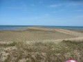
 East of the Sillon de Talbert
 9.86 mi
 +194 ft
 -174 ft
 4h 40
4h 40
 Average
 Departure from Pleubian (Côtes-d'Armor)
Close to a natural curiosity that must be seen at high tide, known as the "Sillon de Talbert", this journey allows you to discover the history of seaweed with the CEVA (Centre for the Study and Promotion of Seaweed), enjoy the results of the work of shellfish farmers (oyster and mussel farmers) and learn how artichokes are obtained. This walk between sea and land, with no difficult terrain, can be enjoyed by all ages.
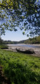
On the banks of the Leff and Trieux rivers
 8.84 mi
+525 ft
-525 ft
4h 30
Average
Departure from Quemper-Guézennec (Côtes-d'Armor)
8.84 mi
+525 ft
-525 ft
4h 30
Average
Departure from Quemper-Guézennec (Côtes-d'Armor)
A sometimes uneven walk through the undergrowth along two Breton rivers, offering a different view depending on the tide level.
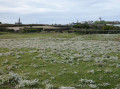
The Tour of Batz Island
 8.09 mi
+174 ft
-167 ft
3h 50
Average
Departure from Île-de-Batz (Finistère)
8.09 mi
+174 ft
-167 ft
3h 50
Average
Departure from Île-de-Batz (Finistère)
With alternating fine white sandy beaches, rugged rocky coastlines and green landscapes, the island of Léon enjoys a microclimate where early potatoes are the main crop, grown in soil fertilised by seaweed.
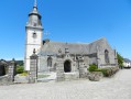
The Fountain and Cromlec'h of Lorette and the Rigole d'Hilvern
 6.56 mi
+636 ft
-636 ft
3h 35
6.56 mi
+636 ft
-636 ft
3h 35
 Easy
Departure from Le Quillio (Côtes-d'Armor)
Easy
Departure from Le Quillio (Côtes-d'Armor)
In the footsteps of the Toileux: 19th-century linen manufacturers; a journey back in time with the Cromlec'h de Lorette (an ancient covered burial passage) ending with the Rigole d'Hilvern: a man-made stream dug to feed the Nantes-Brest Canal - a little-known aspect of Brittany.
Around Guerlesquin
 10.74 mi
+781 ft
-774 ft
5h 35
Average
Departure from Guerlesquin (Finistère)
10.74 mi
+781 ft
-774 ft
5h 35
Average
Departure from Guerlesquin (Finistère)
Guerlesquin, a small town full of character, was known in the 11th century for its fairs. From the 17th century, beautiful buildings remain in the town centre: the Présidial, the Market Halls and the Church. The town is close to the Étang du Guic, where two fine sandy beaches await walkers.After walking around the lake, we explore the nearby forest, moving in turn from Finistère into Côtes-d’Armor before returning to Finistère. Indeed, it is the river ‘Le Guic’ that forms the departmental boundary.
From Vieux-Marché to Sept-Saints
 9.29 mi
+656 ft
-653 ft
4h 50
Average
Departure from Le Vieux-Marché (Côtes-d'Armor)
9.29 mi
+656 ft
-653 ft
4h 50
Average
Departure from Le Vieux-Marché (Côtes-d'Armor)
This walk, suitable for walkers of all ages, takes you through wooded, shaded areas along sunken paths as well as fields and meadows. It features three remarkable sites: the centuries-old beech tree, the Chapel of the Seven Saints and the Saint-Éturien stream, where the lucky ones may find amethyst crystals.
In the forest of Coat an Noz
 9.21 mi
+745 ft
-738 ft
4h 55
Average
Departure from Belle-Isle-en-Terre (Côtes-d'Armor)
9.21 mi
+745 ft
-738 ft
4h 55
Average
Departure from Belle-Isle-en-Terre (Côtes-d'Armor)
To the south of Belle-Île-en-Terre, a forest hides many secrets. It comprises two parts separated by the Léguer river: to the east, the Coat an Hay State Forest (Le Bois du Jour) and to the west, the Coat an Noz State Forest (Le Bois de la Nuit). In the latter, with a 19th-century castle undergoing restoration and a former ironworks site (lead mine), the route follows wide paths that are sometimes poorly lit by daylight.
The mills of Léon
 7.71 mi
+322 ft
-328 ft
3h 50
Average
Departure from Plouzévédé (Finistère)
7.71 mi
+322 ft
-328 ft
3h 50
Average
Departure from Plouzévédé (Finistère)
A stroll through the countryside of Plouzévédé in the Léon region (Province of Léon) where early vegetables reign supreme: artichokes, cauliflowers and other vegetables.
It is also the region of parish enclosures, small chapels and wayside crosses marking crossroads, as well as the former residences (manors and castles) of the ancient Breton nobility.
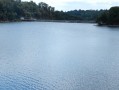
Caurel Woods and Lake Guerlédan
 9.81 mi
+748 ft
-771 ft
5h 10
Average
Departure from Caurel (Côtes-d'Armor)
9.81 mi
+748 ft
-771 ft
5h 10
Average
Departure from Caurel (Côtes-d'Armor)
This hike was completed and written during the summer of 2015, an exceptional period when the lake was drained for dam maintenance.We invite hikers to do this walk in spring, when the colours and scents are at their best, with the clear waters of the lake as a backdrop.
Since 2024, major work has been underway between points 3 and 4 with a view to building a free Himalayan footbridge for crossing the Blavet, which cuts the complete tour of the lake in two. This will still be possible for the most experienced walkers. (See note in "Practical information".
To the west of Vieux-Marché
 8.30 mi
+846 ft
-837 ft
4h 35
Average
Departure from Le Vieux-Marché (Côtes-d'Armor)
8.30 mi
+846 ft
-837 ft
4h 35
Average
Departure from Le Vieux-Marché (Côtes-d'Armor)
The Trégor region boasts a rich religious heritage. This walk allows you to discover several examples, which, whilst not exceptional, are classic in their beauty and aesthetic appeal.
This walk also allows you to enjoy the lush countryside and the Breton bocage.
Moments of tranquillity and exertion are always welcome in this mild climate.
Along the Anse de Térénez
 7.74 mi
+295 ft
-295 ft
3h 50
Average
Departure from Plougasnou (Finistère)
7.74 mi
+295 ft
-295 ft
3h 50
Average
Departure from Plougasnou (Finistère)
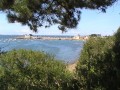
Discover the Finistère region of Trégor and the Bay of Morlaix, protected by Vauban with the Château du Taureau. Discover that here too you are in oyster country.
You will also see the Barnénez peninsula, famous for its spectacular cairns: stone tombs dating from the Neolithic period (around 4,000 BC).
Tréguier and its surroundings
 7.32 mi
+525 ft
-545 ft
3h 50
Average
Departure from Minihy-Tréguier (Côtes-d'Armor)
7.32 mi
+525 ft
-545 ft
3h 50
Average
Departure from Minihy-Tréguier (Côtes-d'Armor)
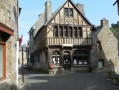
During this walk, you will discover Tréguier with its Saint-Yves cathedral, narrow cobbled streets and stone houses, including that of Ernest Renan, a famous writer of the late 19th century. You will also enjoy the banks of the Guindy, a small river that flows into the Jaudy. As both rivers are subject to tidal influences, it is advisable to set off an hour before high tide to make the most of the scenery.
Brélidy and its surroundings
 7.94 mi
+515 ft
-545 ft
4h 05
Average
Departure from Brélidy (Côtes-d'Armor)
7.94 mi
+515 ft
-545 ft
4h 05
Average
Departure from Brélidy (Côtes-d'Armor)
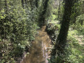
A very pleasant walk through the forest with a few slightly challenging sections, but these should not put off beginners as they are more than made up for by the lovely views of the local rivers, far from the noise of the town.
It ends with the panoramic view from the oppidum.
To the east of Tonquédec
 7.15 mi
+236 ft
-236 ft
3h 30
Average
Departure from Tonquédec (Côtes-d'Armor)
7.15 mi
+236 ft
-236 ft
3h 30
Average
Departure from Tonquédec (Côtes-d'Armor)
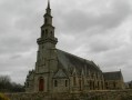
We are not inviting you to hike towards Tonquédec Castle, which was dismantled around 1626 on the orders of Richelieu and is situated to the north-west of the village of the same name, but rather to the south-east of this village. There we will find the Guindy, a river dear to the people of Trégor, as well as green sunken paths in lush countryside.
Tonquédec Castle and Kerfons Chapel
 4.90 mi
+643 ft
-633 ft
2h 50
Easy
Departure from Tonquédec (Côtes-d'Armor)
4.90 mi
+643 ft
-633 ft
2h 50
Easy
Departure from Tonquédec (Côtes-d'Armor)
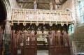
Two historic sites along this walk: Tonquédec Castle with its walls and restoration work, and the magnificent little Chapel of Kerfons. All this is complemented by a relaxing stroll along the Léguer.
From Goas Lagorn beach to the Lann ar Waremm woods
7.03 mi
+430 ft
-436 ft
3h 35
Average
Departure from Lannion (Côtes-d'Armor)
Fine sandy beaches, separated by rocky granite headlands, await you both at the start and end of this walk, which will give you the chance to cross the Lann ar Waremm woods and admire the little chapel of Saint-Dourien.
Saint-Uzec et l'Île Grande
 7.23 mi
+331 ft
-328 ft
3h 35
Average
Departure from Pleumeur-Bodou (Côtes-d'Armor)
7.23 mi
+331 ft
-328 ft
3h 35
Average
Departure from Pleumeur-Bodou (Côtes-d'Armor)
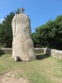
Lorsque l'on pense "Mégalithes" en Bretagne, c'est à Carnac et ses alignements que l'on pense en premier. Mais il faut savoir que partout en Bretagne il en existe une multitude. Le Trégor est riche de ces monuments datant de plusieurs millénaires. Au cours de cette randonnée, vous en verrez certains mais vous découvrirez aussi une superbe île aux paysages variant suivant la situation aux vents.
Pluzunet – Le Danot
6.36 mi
+482 ft
-479 ft
3h 20
Average
Departure from Pluzunet (Côtes-d'Armor)
In the green Trégor region, a walk through wooded countryside with a brief visit to the Léguer before discovering the rolling landscape of the foothills of the ancient Montagnes Noires.
Trestel and Port-Blanc
 7.11 mi
+305 ft
-299 ft
3h 30
Average
Departure from Trévou-Tréguignec (Côtes-d'Armor)
7.11 mi
+305 ft
-299 ft
3h 30
Average
Departure from Trévou-Tréguignec (Côtes-d'Armor)
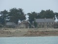
This hike in Trégor is not particularly difficult. After following the coast along the customs officers' path and catching a glimpse of Île des Femmes and Île Saint-Gildas, you will discover Port Blanc before heading inland to explore the Trestel marshes.
Between Saint-Quay-Perros and Louannec
5.05 mi
+341 ft
-341 ft
2h 35
Easy
Departure from Saint-Quay-Perros (Côtes-d'Armor)
The hinterland of Perros-Guirec, with, at the end of the route, the footpath running alongside the Étang du Lenn.
La Roche-Derrien and the Hortence Garden
7.58 mi
+469 ft
-472 ft
3h 55
Average
Departure from Langoat (Côtes-d'Armor)
This walk begins and ends on the banks of the ponds at La Roche-Derrien (Crec’h an Goué). The route first takes us to St Anne’s Chapel, which is part of Kermézen Castle. We then cross the Hortence Garden (10ha), where a Dutch couple grow hydrangeas to export to the land of tulips. We finish by admiring the view of Le Jaudy from a promontory, the Oppidum de La Roche, with the Calvaire Chapel.
The Corniche de l'Armorique starting from Plestin-les-Grèves
 6.80 mi
+407 ft
-410 ft
3h 30
Average
Departure from Plestin-les-Grèves (Côtes-d'Armor)
6.80 mi
+407 ft
-410 ft
3h 30
Average
Departure from Plestin-les-Grèves (Côtes-d'Armor)
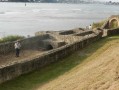
Setting off from Plestin-les-Grèves, you very quickly catch sight of Grève Saint-Michel, where, at low tide, the English Channel recedes into the horizon, creating a vast expanse for all kinds of wind sports: sand yachting, windsurfing, kite flying, etc...
Then, following theGR®34, you walk along the Corniche de l’Armorique, discovering Lannion Bay and the mouth of the Douron. Opposite lies Locquirec and Finistère.
History is also present in the form of the Gallo-Roman thermal baths.
The Pointe de Plougrescant
 8.20 mi
+308 ft
-315 ft
4h 00
Average
Departure from Plougrescant (Côtes-d'Armor)
8.20 mi
+308 ft
-315 ft
4h 00
Average
Departure from Plougrescant (Côtes-d'Armor)
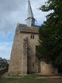
The Pointe de Plougrescant is recognised around the world due to Castel-Meur: the house between the rocks. The hike starts at Saint-Gonery Chapel, equally famous for its crooked lead bell tower. The hike continues via the Baie de l'Enfer where you can admire the Jaudy estuary, then on to Pointe du Château - the most northerly point of this route - to see Castel Meur (private property) and finally to discover the gulf before returning to the departure point along the west coast of the point.
Around the Roche Jaune
 7.15 mi
+387 ft
-387 ft
3h 40
Average
Departure from Plouguiel (Côtes-d'Armor)
7.15 mi
+387 ft
-387 ft
3h 40
Average
Departure from Plouguiel (Côtes-d'Armor)
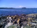
What could be more unusual than a hike in the bed of an estuary? What could be more romantic than a walk up the bed of a rushing stream? What could be more relaxing than a stroll through the green countryside of Trégor? What could be more spectacular than a panoramic view of an estuary?
You will discover all this during this walk, which we recommend you do at high tide with low or medium coefficients (below 80).
In the woods of Penhouat-Lancerf
 5.49 mi
+482 ft
-489 ft
2h 55
Easy
Departure from Plourivo (Côtes-d'Armor)
5.49 mi
+482 ft
-489 ft
2h 55
Easy
Departure from Plourivo (Côtes-d'Armor)
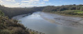
A magnificent walk through a pine forest. After following the Trieux river and passing through a tunnel through the hill, we walk alongside the Trieux tourist railway line to admire the chimneys of the Château de la Roche Jagu in the distance and reach the Saint-Jean Chapel. Don't be alarmed by the sound of gunshots: there is a clay pigeon shooting range nearby.
From Plouézec to the Pointes de Plouézec and Minard
 8.59 mi
+673 ft
-669 ft
4h 30
Average
Departure from Plouézec (Côtes-d'Armor)
8.59 mi
+673 ft
-669 ft
4h 30
Average
Departure from Plouézec (Côtes-d'Armor)
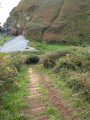
There are exceptional panoramic views along this section of theGR®34long-distance hiking trail, with the Anse de Paimpol, the panorama stretching from Beauport Abbey in the west to Paimpol and Ploubazlanec to Île de Bréhat, Roc'h du Chenel du Dénau, Grand Mez and Petit Mez de Goëlo, ending at Pointe de Plouézec in the east. To the south is Pointe de Minard, which marks the entrance to the Bay of Saint-Brieuc.
Exploring the Léguer south of Lannion
7.27 mi
+420 ft
-440 ft
3h 45
Average
Departure from Lannion (Côtes-d'Armor)
Whilst the level of the Léguer, as it flows through Lannion, is influenced by the tides, further upstream, thanks to several retaining walls, the flow is much more steady. Moreover, the entire area is protected as it serves as a water catchment area for the region.
This route therefore offers an exploration of this coastal river, upstream of Lannion, with a return journey through the surrounding hills.
Locquirec and its beaches
 5.69 mi
+410 ft
-430 ft
3h 00
Easy
Departure from Locquirec (Finistère)
5.69 mi
+410 ft
-430 ft
3h 00
Easy
Departure from Locquirec (Finistère)
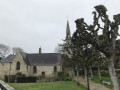
A small seaside resort, Locquirec is the gateway to Finistère when approaching from the east via the north coast. The D142 crosses the River Douron, which marks the boundary between the Côtes d’Armor and Finistère.During this walk, before reaching the golden sandy beaches, you’ll discover the rocky headland of Le Corbeau, then, further inland, some beautiful holiday homes, before arriving at the small fishing harbour and finally reaching the second rocky headland: the Pointe du Château.
From Port L'Epine to the Vallée des Moulins via Trestel
 7.17 mi
+446 ft
-427 ft
3h 40
Average
Departure from Trélévern (Côtes-d'Armor)
7.17 mi
+446 ft
-427 ft
3h 40
Average
Departure from Trélévern (Côtes-d'Armor)
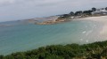
This walk in the Trégorrois region will take you first to Palud beach (Port l'Epine), then to the woods of Trévou-Tréguirec, before visiting the hinterland of Trélévern with its streams and lakes, and finally to the Vallée des Moulins along the Ruisseau de Dourdu. Finally, the coastal path runs along the cove of Perros, with Perros-Guirec filling the horizon to the west.
The Pennélé Valley and the River Morlaix
7.08 mi
+686 ft
-715 ft
3h 50
Average
Departure from Saint-Martin-des-Champs (Finistère) (Finistère)
After crossing a residential area via shaded paths, don’t be put off by a short stretch of tarmac running parallel to the main road. After Bot-Balan, the route consists solely of forest paths along the river. After the Chapel of La Salette, a magnificent covered walkway will take you back to the start.
Milliau Island, Pointe de Bihit and the beaches of Trébeurden
 5.21 mi
+476 ft
-466 ft
2h 50
Easy
Departure from Côtes-d'Armor
5.21 mi
+476 ft
-466 ft
2h 50
Easy
Departure from Côtes-d'Armor
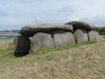
From the small port of Trébeurden, set off to explore Le Castel and Île Milliau with its covered walkway, then continue along the beach and admire the panoramic view from Pointe de Bihit.
La Pointe du Yaudet via the Léguer
6.97 mi
+676 ft
-643 ft
3h 50
Average
Departure from Lannion (Côtes-d'Armor)
Walking through a pine forest, you will follow the Léguer river in its tidal section, so the landscape is more pleasant at high tide.You will walk to the Pointe du Yaudet to discover the mouth of the Léguer and then the Baie de la Vierge.On the way back, after following the small meanders of the river (the Yaudet), you will pass not far from the Château de Kerninon (private property, not open to visitors) and descend towards the Léguer.
From Plougonven to the two menhirs via the Bois de Gaspern
9.48 mi
+732 ft
-735 ft
5h 00
Average
Departure from Plougonven (Finistère)
A gateway into Finistère via the Monts d’Arrée: the small medieval town of Plougonven, with its parish enclosure, lies close to the Gaspern forest. At the southern end of this route, two menhirs stand alone in a field.
The cliffs of Plouha
 9.81 mi
+1,083 ft
-1,056 ft
5h 25
Average
Departure from Plouha (Côtes-d'Armor)
9.81 mi
+1,083 ft
-1,056 ft
5h 25
Average
Departure from Plouha (Côtes-d'Armor)
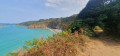
This walk can be split into two sections: a 9km circular route to the north-west, which takes in Bonaparte Beach, and a second 6.5km circular route to the south, offering views of Plouha Head.Both circular loops follow theGR®®34along the coast and each includes ascents and descents that may prove challenging for less experienced walkers.
Locquémeau and the cliffs of Trédrez
 6.67 mi
+459 ft
-453 ft
3h 30
Average
Departure from Trédrez-Locquémeau (Côtes-d'Armor)
6.67 mi
+459 ft
-453 ft
3h 30
Average
Departure from Trédrez-Locquémeau (Côtes-d'Armor)
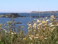
From the small village of Locquémeau, after discovering Pointe du Dourven, which marks the southern side of the Léguer estuary, you are invited to explore the inland countryside of the "Lokémaltèques" before returning down the customs officers' path to admire the cliffs of Trédrez and the magnificent panorama of the Trégor coast.
Please note: GR® trail diversion, see here
The Guillec Valley
 6.81 mi
+164 ft
-141 ft
3h 15
Easy
Departure from Plougoulm (Finistère)
6.81 mi
+164 ft
-141 ft
3h 15
Easy
Departure from Plougoulm (Finistère)
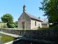
All kinds of landscapes can be enjoyed throughout this hike, which is virtually flat.After walking alongside fields and crossing a farm, walkers arrive at a sandy bay that opens up to the English Channel. Then, after the point, they walk alongside a river that flows freely in a wide cove.Finally, a path through a wooded area alongside the river completes the route.
The moors of Ploumanac’h
 4.86 mi
+249 ft
-253 ft
2h 25
Easy
Departure from Perros-Guirec (Côtes-d'Armor)
4.86 mi
+249 ft
-253 ft
2h 25
Easy
Departure from Perros-Guirec (Côtes-d'Armor)
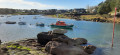
Ploumanac’h, “France’s favourite village in 2015”, is a small tourist port linked to Perros-Guirec.It is the town of pink granite, as walkers can discover in the sculpture park (currently being refurbished in 2016). The coastal path (GR®®34), the Tertre de la Clarté, the small sandy beaches of La Bastille and Saint-Guirec with its oratory and chapel, and finally the chaotic piles of granite are the main attractions.
The Douron Valley
6.64 mi
+381 ft
-361 ft
3h 25
Average
Departure from Plestin-les-Grèves (Côtes-d'Armor)
Discover the banks of the Douron, the coastal river that separates the Côtes d'Armor and Finistère departments. Right from the start, you will have to cross a pass: the Col de Saint-Haran (24 metres!), as indicated on the sign at the top. You will cross into a different department when you cross the bridge next to the Moulin de Moualhic, and again at Pont Menou.
Pommelin Bay
 7.25 mi
+446 ft
-433 ft
3h 45
Average
Departure from Lézardrieux (Côtes-d'Armor)
7.25 mi
+446 ft
-433 ft
3h 45
Average
Departure from Lézardrieux (Côtes-d'Armor)
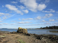
We are now on theGR®34, a long-distance hiking trail dear to the Bretons as it runs along the entire coastline of our region. On this hike, we follow it northwards and, when we leave it, cross Le Paradis and finally rejoin it to admire the Trieux estuary.
Rosanbo Castle
7.46 mi
+449 ft
-423 ft
3h 50
Average
Departure from Tréduder (Côtes-d'Armor)
Winding through the Trégor countryside, this route will take you past the most imposing castle in Brittany. Built between the 14th and 18th centuries, it has belonged to the same family for several generations. It is furnished with period pieces and open to the public.
In the Bois Meur
 4.84 mi
+230 ft
-230 ft
2h 25
Easy
Departure from Lanrodec (Côtes-d'Armor)
4.84 mi
+230 ft
-230 ft
2h 25
Easy
Departure from Lanrodec (Côtes-d'Armor)
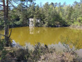
A walk almost entirely in the forest with sections along sunken paths. This route leads to a disused quarry that is now a pond (see photo).
The Chaos du Gouët
 6.47 mi
+561 ft
-561 ft
3h 30
Average
Departure from Plaine-Haute (Côtes-d'Armor)
6.47 mi
+561 ft
-561 ft
3h 30
Average
Departure from Plaine-Haute (Côtes-d'Armor)
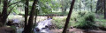
Historically dedicated to Marc Faucon (a pioneer of hiking in the Côtes d'Armor), this hike will allow nature lovers to explore the foothills of the Gouët and the wooded hills of the surrounding countryside.
From Porz Mabo to the Quellen Marshes around Trébeurden
8.69 mi
+489 ft
-492 ft
4h 25
Average
Departure from Trébeurden (Côtes-d'Armor)
Walking around Trébeurden means discovering this little town in Trégor through its tourist attractions: the harbour, the beach and Pointe de Bihit, but also through its coastal town side with its beautiful villas and residential neighbourhoods.
The Landrellec Point
7.02 mi
+98 ft
-102 ft
3h 20
Average
Departure from Pleumeur-Bodou (Côtes-d'Armor)
TheGR®34takes us along the coastline and, after passing through several small copses, we discover the Kerguntuil passage grave next to the dolmen, before returning to the coastline to admire the myriad islands and rocks at low tide.
The Pointe de Loguivy de la Mer
 15.77 mi
+1,066 ft
-1,050 ft
8h 10
15.77 mi
+1,066 ft
-1,050 ft
8h 10
 Difficult
Departure from Paimpol (Côtes-d'Armor)
Difficult
Departure from Paimpol (Côtes-d'Armor)
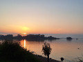
From the port of Paimpol, once famous as the departure point for the Grand Cod Fishery with the Terre-Neuvas, and now known for its "Sailors' Songs" festival, we set off for Pointe de l'Arcouest, where the pier for the Île de Bréhat is located, and then on to Loguivy-de-la-Mer. We leave the shores of the English Channel for the mouth of the Trieux. Finally, after crossing the Pointe, we return to Paimpol to explore its pedestrianised streets.
The Traouïéro Valley
 6.61 mi
+318 ft
-325 ft
3h 20
Average
Departure from Trégastel (Côtes-d'Armor)
6.61 mi
+318 ft
-325 ft
3h 20
Average
Departure from Trégastel (Côtes-d'Armor)
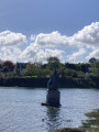
Along with the pink granite chaos, the Vallée des Traouïéro is the region's second most popular tourist site. It consists of two steep-sided valleys through which the Kérougant river winds its way before separating and joining the natural harbour of Ploumanac'h. This stream forms the natural boundary between the municipalities of Perros-Guirec and Trégastel. The Petit-Traouïero flows into the Ploumanac'h ice mill (Milin Ru), while the Grand-Traouïero flows into the Trégastel wheat mill (Milin Glaz).
The circular routes of the Chapelles route south of Plestin-les-Grèves
7.68 mi
+384 ft
-413 ft
3h 50
Average
Departure from Plestin-les-Grèves (Côtes-d'Armor)
This is an easy walk, except for the distance, which combines sunken paths and wide forest lanes, as well as chapels and castles, not to mention streams and brooks, with the English Channel as a backdrop.
The Grand Rocher and the Pointe de l'Armorique
 8.90 mi
+823 ft
-810 ft
4h 50
Average
Departure from Plestin-les-Grèves (Côtes-d'Armor)
8.90 mi
+823 ft
-810 ft
4h 50
Average
Departure from Plestin-les-Grèves (Côtes-d'Armor)
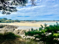
Discovering Grève Saint-Michel: a bay where the sea recedes more than 2 km; first by climbing the Grand Rocher for a breathtaking panorama, then, up close, by walking along the beach, and finally, by admiring it from across the bay on the famousGR®®34. You’ll continue to admire Lannion Bay as you round the Pointe de l’Armorique and, in particular, the Pointe de Plestin, before following the Douron estuary, admiring the chapel and fountain, and returning to Saint-Efflam.
Tréduder and its streams
 6.15 mi
+673 ft
-643 ft
3h 25
Average
Departure from Tréduder (Côtes-d'Armor)
6.15 mi
+673 ft
-643 ft
3h 25
Average
Departure from Tréduder (Côtes-d'Armor)
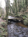
The commune of Tréduder is bounded by three streams: to the west, the Roscoat; to the south, the Dour Plat, which flows into the Yar, marking the commune’s eastern boundary. This walk takes you along these streams, but numerous small streams feed into them, making certain sections very wet in spring.
From Lancerf to the Trieux
8.16 mi
+636 ft
-636 ft
4h 20
Average
Departure from Plourivo (Côtes-d'Armor)
The magnificent Penhoat-Lancerf pine forest and the majestic banks of the Trieux are the two main attractions of this hike. In addition to the Lancerf Chapel, this hike allows you to discover the Maison de l'Estuaire. This is infamous because, in 1924, the Traou-Nez site belonged to Pierre Quemeneur and Guillaume Seznec had agreed to buy it: this is where one of the very first episodes of the Seznec Affair took place...