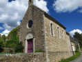
The Chapelle du Cerisier in Domfront-en-Poiraie

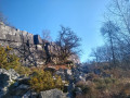
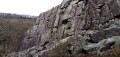
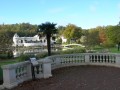
The landscapes and views to the east serve as a reminder that the Alpes Mancelles are not far away. Consequently, some sections involve elevation changes which may present a few difficulties for those who are not used to them.
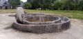
At the (5), do pop into the Chapelle du Cerisier for a short break.

Details

39818391
Creation:
Last update:
Last review:
  • Walking
    Activity: Walking
  • ↔
    Distance: 7.71 mi
  • ◔
    Average duration: 4h 00 
  • ▲
    Difficulty: Moderate

  • ⚐
    Back to start: Yes
  • ↗
    Ascent: + 561 ft
  • ↘
    Descent: - 531 ft

  • ▲
    Highest point: 751 ft
  • ▼
    Lowest point: 453 ft

Photos

Description of the walk

A few parking spaces on the left, just after the cemetery.

White and redGR® 22 markings

(S/E) Head north via Impasse de la Gloriette. At the crossroads, carry on straight ahead.

(1) At La Gloriette, carry on straight ahead, ignoring the turn-off to La Goëtière on the right. Cross the ford over the Varenne and continue for about 200 m.

YellowPR® signposting (See note in Practical Information)

(2) At thesecond left-hand bend in the road, turn right. At Friloux, take the first turn left then right to pass in front of La Mogisière and reach a T-junction at La Basse Auvraire.

(3) Turn right and, after 200 m, turn right again. 200 m further on, follow the path to the left. Cross the road and continue straight ahead to the Moulin de la Nocherie.

(4) Cross the small bridge and cross the cycle path, taking two bends to the right. Follow the path round a bend to the left, then another to the right, and you’ll reach Le Cerisier. If the chapel is open, its recent restoration is well worth a quick visit.

(5) On leaving the village, cross the D21 with great care and continue straight ahead.

Unmarked

This section is a variant ofthe PR® but has no signposting
Temporarily leave thePR®, which turns right, and carry on straight ahead. Turn right onto thefirst path and cross Le Tertre to the crossroads.

(6) Turn right, then veer left.

YellowPR® signposting

You rejoin thePR® just before the bridge over the Andainette. When the track bends to the left, carry on straight ahead along the path and, 100 m further on, turn right, heading west.

(7) Follow the Route de la Haie au Gué to the left. After a right-hand bend, turn left towards the Ferme du Haut Riantel. Continue straight on and pass under a high-voltage power line. Leave the Ferme de la Californie on your left.

(8) Take the path on the right, which runs close to the high-voltage power line before moving away from it. Follow the road to the left and cross the D908 with care to continue on the opposite side.

Red and white markings forthe GR® 22

At the junction by the recycling centre, turn right and enter Domfront. At the end of the road, turn right, cross Rue du Maréchal Joffre and return to the car park (S/E).

Waypoints

  1. S/E : mi 0 - alt. 715 ft - Cemetery car park
  2. 1 : mi 0.57 - alt. 636 ft - La Gloriette
  3. 2 : mi 1.11 - alt. 515 ft - GR junction with PR
  4. 3 : mi 2.07 - alt. 614 ft - Basse Auvraire crossroads
  5. 4 : mi 3.03 - alt. 476 ft - Moulin de la Nocherie - Varenne (rivière)
  6. 5 : mi 3.68 - alt. 614 ft - Le Cerisier (chapel)
  7. 6 : mi 4.68 - alt. 587 ft - Le Tertre
  8. 7 : mi 5.43 - alt. 558 ft - La Haie au Gué
  9. 8 : mi 6.67 - alt. 725 ft - Before Beauvent and the departmental road
  10. 9 : mi 7.27 - alt. 751 ft - Junction at the recycling centre
  11. S/E : mi 7.71 - alt. 715 ft - Cemetery car park

Notes

Yellow markings
At (2), please note: at the top of the post there is a Yellow Cross (recent) and, below theGR® cross, you can see a yellow line (older). It is this older marking that we follow.
Throughout the route, the markings we have seen consist, after a change of direction, of Yellow Crosses. These serve to reassure walkers, who must follow our detailed description to the letter.

Worth a visit

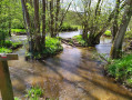
Please note: Between (2) and Friloux, the path may be very wet or even flooded, making it impassable. In this case, you must turn back to (2) and follow the Haut Moulin Plein road to the Puits crossroads. There, turn right and continue along the road to reach Basse Auvraire, which is the (3) of the route.

At the end of the walk, be sure to visit the medieval town of Domfront. The upper town is well worth a visit.

Always be cautious and plan ahead when you're outdoors. Visorando and the author of this route cannot be held responsible for any accidents occurring on this route.

The GR® and PR® markings are the intellectual property of the Fédération Française de Randonnée Pédestre.

Reviews and comments

4.8 / 5
Based on 2 reviews

Reliability of the description
5 / 5
Ease of following the route
5 / 5
Route interest
4.5 / 5
User 21605707

Overall rating : 4.7 / 5

Date of your route : Jun 01, 2025
Reliability of the description : ★★★★★ Very good
Ease of following the route : ★★★★★ Very good
Route interest : ★★★★☆ Good
Very busy route : No

Hello,
I did the route in the opposite direction - I wasn't the leader of the 37-strong group. There were a few areas that were still wet, and rivers were crossed by stone bridges.
Due to a foot problem, I cut off (alone) along the green route between 4 and 2. The rest of the group did the whole circuit.
At lunchtime, the group was welcomed in the village of Le Cerisier at the farm "le zinzin de sarrazin" (Champsecret). The Chapelle du Cerisier was open and well worth a visit, see the stained glass windows with the cherries.
Warm regards to the hikers
Alain GAILLARD

Machine-translated

stephaned61
stephaned61

Overall rating : 5 / 5

Date of your route : May 07, 2024
Reliability of the description : ★★★★★ Very good
Ease of following the route : ★★★★★ Very good
Route interest : ★★★★★ Very good
Very busy route : No

Although I’ve lived in Domfront for many years, this route introduced me to places and landscapes I hadn’t seen before. Make sure you wear good, waterproof shoes – some sections of the route were very waterlogged. Thank you for this wonderful walk.

Machine-translated

Other walks in the area

For more walks, use our search engine .

The GPS track and description are the property of this route's author. Please do not copy them without permission.