Roland’s Leap

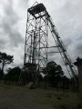
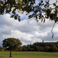
Le Saut Roland is the first designated area of natural beauty in the Marches de Bretagne. The steep cliffs rise to a height of 173 metres, and the wooded slopes stretching down to the valley floor form a landscape traversed from east to west by the Ruisseau Saint-Blaise.

Details

4296365
Creation:
Last update:
Last review:
  • Walking
    Activity: Walking
  • ↔
    Distance: 4.35 mi
  • ◔
    Average duration: 2h 15 
  • ▲
    Difficulty: Easy

  • ⚐
    Back to start: Yes
  • ↗
    Ascent: + 289 ft
  • ↘
    Descent: - 299 ft

  • ▲
    Highest point: 561 ft
  • ▼
    Lowest point: 394 ft

Description of the walk

Coming from Fougères, drive through Dompierre-du-Chemin and continue towards Prince until you reach the car park for the site on the right-hand side of the road.

(S/E) Leave the car park heading south-west towards the Rochers du Saut Roland.

Red and white markings forthe GR® 34

Shortly afterwards, you’ll come to theGR® 34, which you should follow to the left as you descend the steps: take care not to slip in wet weather.

(1) Cross the Ruisseau de Saint-Blaise and turn right to climb up the other side.

(2) At the junction with another path, turn left, following the GR®. The path widens and leads to a road. Follow it to the right until you reach a crossroads.

(3) Leave theGR® briefly – it continues straight on – and take thesecond road on the right, heading due north and running alongside a small wood. When you reach the Chaussée Neuve, do not take the road but follow the path on the right which runs alongside it and crosses the Ruisseau de Saint-Blaise.

(4) Join theGR® on the right and follow it as it bends to the left. Stay on it until you reach a sharp left-hand bend.
There, leave theGR® again temporarily to take the path on the right which runs alongside the pumping station, cross the D798 with care and take the dirt track opposite, slightly to the left.

(5) At the crossroads, rejoin theGR® coming from the left. Continue straight on to the end of the track. Follow the small road to the left for 30 metres, then take the fork further on. Continue along this road.

(6) At the end of the field, take a sharp right-hand bend onto the dirt track on the right. It runs south-east and ends at a crossroads.

Yellow markings only

(7) At the crossroads, whilst theGR® heads off to the left, turn right to cross the Champ des Vallées. Continue left along the downhill path, which veers twice to the right and then to the left before entering the hamlet of Les Vallées.

(8) Turn right to cross the hamlet and continue right along the uphill path. This leads onto the road, which you should follow to the left. Continue along this road to reach the D 798 departmental road.
Cross it carefully and head to the car park at the start of the route on the opposite side (S/E).

Waypoints

  1. S/E : mi 0 - alt. 541 ft - Saut Roland car park
  2. 1 : mi 0.31 - alt. 433 ft - Saint-Blaise Stream - Cantache (rivière)
  3. 2 : mi 0.52 - alt. 430 ft - At the top of the steps
  4. 3 : mi 0.97 - alt. 499 ft - Temporary departure from the GR
  5. 4 : mi 1.31 - alt. 410 ft - Back on the GR
  6. 5 : mi 1.74 - alt. 466 ft - Crossroads
  7. 6 : mi 2.62 - alt. 459 ft - Dirt track on the right after a field
  8. 7 : mi 3.22 - alt. 558 ft - Crossroads
  9. 8 : mi 3.73 - alt. 463 ft - The Valleys
  10. S/E : mi 4.35 - alt. 541 ft - Saut Roland car park

Notes

In wet weather, certain sections of the sunken path can prove problematic; these are the stretches between (4) and (5), then between (6) and (7), and finally the descent towards the valleys ((8)).

Le Saut Roland: the name derives from a legend dating back to time immemorial.

Roland, Charlemagne’s nephew, was prefect of the Marches of Brittany. After fighting against the Saracens, he crossed the Pyrenees via the Brèche de Roland to return to Brittany and defend the Empire against the indomitable Bretons (the English). He attempted to cross this site by leaping with his horse from one rock to another. The first leap was dedicated to God, the second to the Virgin Mary and the third to his lady. Unfortunately, this final leap proved fatal and he and his horse plummeted to the bottom of the ravine.

Worth a visit

The entire route is signposted in yellow. However, be sure to follow the route description carefully, as theGR® markings (red and white) are often present without any additional yellow markings.

At (2), there is the option of afirst shortcut to avoid the circular route: turn right and join the road.

At (4), there is asecond possible shortcut: continue straight ahead up the path and, at the junction, turn left onto the path you took in the opposite direction at the start.

At (5), there is athird possible shortcut: continue straight ahead along the path and, when you reach the road, turn right.

Finally, you can avoid the valleys by continuing straight on along the road.

Always be cautious and plan ahead when you're outdoors. Visorando and the author of this route cannot be held responsible for any accidents occurring on this route.

The GR® and PR® markings are the intellectual property of the Fédération Française de Randonnée Pédestre.

Reviews and comments

4.6 / 5
Based on 3 reviews

Reliability of the description
5 / 5
Ease of following the route
4.7 / 5
Route interest
4 / 5
User 9099562

Overall rating : 4.3 / 5

Date of your route : Aug 10, 2026
Reliability of the description : ★★★★★ Very good
Ease of following the route : ★★★★☆ Good
Route interest : ★★★★☆ Good
Very busy route : No

Le Saut de Roland: a beautiful, well-maintained site.

Machine-translated

Martial DUCRET
Martial DUCRET

Overall rating : 5 / 5

Date of your route : Dec 30, 2021
Reliability of the description : ★★★★★ Very good
Ease of following the route : ★★★★★ Very good
Route interest : ★★★★★ Very good
Very busy route : No

No comment

Machine-translated

jeanmichelhue
jeanmichelhue
• Edited:

Overall rating : 4.3 / 5

Date of your route : Aug 30, 2021
Reliability of the description : ★★★★★ Very good
Ease of following the route : ★★★★★ Very good
Route interest : ★★★☆☆ Average
Very busy route : No

It’s busy around the rocks but not on the route itself.
Otherwise, apart from the road, the route is very decent, although you do need to keep an eye out for the track markings.

Machine-translated

Other walks in the area

For more walks, use our search engine .

The GPS track and description are the property of this route's author. Please do not copy them without permission.