La Lande de la Rencontre in Saint-Aubin-du-Cormier

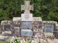
Throughout this route, the whole of Brittany unfolds before you across moors, streams and forests. Do take a short detour to see the memorial stone commemorating the battle of 28 July 1488.

Details

18990840
Creation:
Last update:
Last review:
  • Walking
    Activity: Walking
  • ↔
    Distance: 6.48 mi
  • ◔
    Average duration: 3h 05 
  • ▲
    Difficulty: Easy

  • ⚐
    Back to start: Yes
  • ↗
    Ascent: + 105 ft
  • ↘
    Descent: - 85 ft

  • ▲
    Highest point: 397 ft
  • ▼
    Lowest point: 312 ft

Photos

Description of the walk

As you pass through Saint-Aubin-du-Cormier along Rue de Rennes, turn left onto Rue de Dinan and then left again onto Rue des Monts d’Arrée. The car park is on your right.

Red and white markings forthe GR® 37 and 39

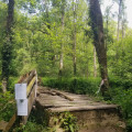
(S/E) Join Rue de Dinan and turn left. After about 200 m, look for a path on the right and take it heading north-east. After a few bends, it leads to the footbridge spanning the A84 motorway. Cross it and join an old, disused tarmac road.

(1) This track turns into a path running alongside the road towards Combourg. Further on, the path makes a first turn right then left. After a few dozen metres, leave the signposted route by taking a path on the left which leads to the memorial stone.

(2) Turn round and rejoin the signposted path to continue northwards. The path runs alongside the Bois d’Uzel for almost a kilometre.

(3) Turn left, following theGR®37signposts. Cross a road and continue straight ahead along a path at the edge of the woods, which leads to the road to Combourg.

(4) Walk very carefully along the right-hand side of the road for about 300 m. Cross the road by turning left and continue southwards to a crossroads.

YellowPR® signposts

(5) Ignore theGR® signs heading to the right and carry on straight ahead. Cross the Ruisseau de Moroval and reach the D202.

(6) Cross the road and walk alongside the military camp. Continue southwards, letting the road branch off to the left, then turn right onto a path which leads to a crossroads with a wayside cross.

(7) Turn left and continue eastwards. The path gets closer and closer to the motorway. Follow it as it bends left then right and reach Le Placis.

(8) Ignore the forest track on the left and head towards the Combourg road. First turn right then left as you cross it carefully, and rejoin the path you took on the way out.

(1) Take a sharp right-hand bend and follow the path you took on the way there to return to the footbridge, then head back to the car park via the same route you took at the start (S/E).

Waypoints

  1. S/E : mi 0 - alt. 377 ft - Car park on Rue des Monts d’Arrée
  2. 1 : mi 0.76 - alt. 381 ft - Path running alongside the road
  3. 2 : mi 1.35 - alt. 371 ft - Commemorative stele marking the battle of 28 July 1488
  4. 3 : mi 2.03 - alt. 367 ft - Path on the left
  5. 4 : mi 2.6 - alt. 361 ft - Combourg Road
  6. 5 : mi 3.12 - alt. 358 ft - Abandoned GR°°®°°
  7. 6 : mi 3.47 - alt. 361 ft - Crossing the D202
  8. 7 : mi 4.33 - alt. 331 ft - Petite Lande crossroads (calvary)
  9. 8 : mi 5.52 - alt. 351 ft - Le Placis
  10. S/E : mi 6.48 - alt. 377 ft - Car park on Rue des Monts d’Arrée

Notes

Route taken from the Pays de Saint-Aubin-du-Cormier walking guide.

The Camp de la Lande d’Ouée: since 1979, it has been home to the11th Naval Artillery Regiment. Prior to that, it housed the41st Infantry Regiment, formed after the Revolution from the Régiment de la Reine, which dated back to 1634.

Worth a visit

Memorial marking the Battle of 28 July 1488:
This battle, which lasted just four hours (from 2 pm to 6 pm), saw the deaths of 6,000 Bretons and 1,500 Frenchmen, resulting in Brittany’s defeat. The Breton army, numbering 11,500 men and commanded by Marshal Rieux Alain d’Albert and Chateaubriant, faced the 15,000-strong French army commanded by General Louis La Trémaille.

Always be cautious and plan ahead when you're outdoors. Visorando and the author of this route cannot be held responsible for any accidents occurring on this route.

The GR® and PR® markings are the intellectual property of the Fédération Française de Randonnée Pédestre.

Reviews and comments

4.6 / 5
Based on 3 reviews

Reliability of the description
4.7 / 5
Ease of following the route
4.7 / 5
Route interest
4.3 / 5
Padrig ar brikir
Padrig ar brikir

Overall rating : 4 / 5

Date of your route : Jun 09, 2025
Reliability of the description : ★★★★☆ Good
Ease of following the route : ★★★★☆ Good
Route interest : ★★★★☆ Good
Very busy route : No

Hello, a lovely walk; there were a couple of bits where we weren’t quite sure which way to go, but nothing too complicated.
Lots of shaded paths through the countryside and natural surroundings.
We stopped at the memorial stone marking the beginning of the end of Breton sovereignty.
Breizh da Virviken.

Machine-translated

muche63
muche63
• Edited:

Overall rating : 4.7 / 5

Date of your route : Mar 31, 2025
Reliability of the description : ★★★★★ Very good
Ease of following the route : ★★★★★ Very good
Route interest : ★★★★☆ Good
Very busy route : No

This walk is very pleasant, combining forest paths, woodland trails and quiet roads. However, you must take care when crossing the county road linking St Aubin to Combourg.
I did this walk as a recce before taking a group out. I really enjoyed it, even though I didn’t see the Stèle aux Bretons.

Machine-translated

imberti andré
imberti andré

Overall rating : 5 / 5

Date of your route : Dec 19, 2023
Reliability of the description : ★★★★★ Very good
Ease of following the route : ★★★★★ Very good
Route interest : ★★★★★ Very good
Very busy route : Yes

It was a bit wet when we arrived. The section that runs alongside the motorway – but that was in winter. That’s hardly surprising. Otherwise, the walk is pleasant and steeped in history about the Bretons and the people of the Vendée.
Thank you

Machine-translated

Other walks in the area

For more walks, use our search engine .

The GPS track and description are the property of this route's author. Please do not copy them without permission.