Country:
 City:


There are 5 to 6 parking spaces at the bend in Rue du Poirier. If these are all taken, you can park in the church car park and adjust the start and end points of the route accordingly.
(S/E) Follow Rue du Poirier southwards, then turn right into Rue de Bellevue. At the end, turn left into Rue de l’Église and then left again into Rue Le Tertre Haut. Cross the River Vilaine and the railway lines.
(1) At the bend, carry on straight ahead along the path with the Château du Val on your right. Continue to the right towards the Pommier Rouge and carry on along the departmental road (D105) to reach the Chêne Dêt.
(2) At the road on the left, turn right between the houses onto the path (not shown on IGN maps but present on OSM). The path descends to Pont Riou. After the houses, follow the road to the right. Pass the Moulin du Pont Riou and cross the Vilaine again.
(3) Turn left towards Vau Bouttier and walk alongside the railway line on your right. At the end of the road, turn right and go under the tracks. At thefirst bend, turn right to join Rue de la Janaie. Follow it to the left for 30 metres and take the tarmac path on the right which crosses the residential area.
(4) Cross the road and continue straight ahead, keeping slightly to the left on the path. Go round the retention basin and turn left onto Rue du Champ Derré. When the street bends to the left, turn right onto the paved path and carry on straight ahead, crossing Rue des Landelles.
(5) Turn left, cross Avenue de la Bretonnière and continue straight ahead along the path, which continues as Impasse des Mazières, to reach Saint-Mélaine, Place de l’Église.
(6) Leave the church on your left and continue along the left-hand side, following the cemetery wall, then turn right. Cross Rue de Vitré at the pedestrian crossing, follow it to the right for 30 metres and turn left into Rue de la Forge. Then turn right into Allée des Bourgeons. Continue along the paved path and cross Avenue des Genets.
(7) Climb the steps on the right to walk alongside the rugby pitch behind the goals, go round the changing rooms on the right and then the athletics track on the left to reach the road. Leave the Châtaignier on your left. Pass Les Maisons Neuves and Les Noës.
(8) At the junction, carry straight on. After La Vallée, the road becomes a footpath.
(9) Turn right to cross the Ruisseau de la Vallée via the footbridge. Follow the path as it bends to the right and reach the road that runs alongside the Grand Étang de Fayelle.
(10) Turn left. After the houses at Les Basses Feugettes, turn right and then right again before Les Hautes Feugettes. Continue north-east. Before passing under a power line, turn right and then left 60 metres further on.
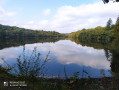
(11) Pass under the power line and follow the edge of the Bois du Breil. Turn left to join the departmental road. Turn right onto the D 29 departmental road and cross the southern part of the Forêt de la Corbière, passing two small lakes on your right.
(12) Turn right, then left 75 metres further on. The path bends to the right, then to the left, and leads onto a departmental road (D105). Follow it to the left for 150 metres and continue along the path on the right, which heads due south.
(13) Go round the buildings at La Bâte on the left, cross the road and turn right onto the path. Pass under the power line. After a bend to the left, carry on straight ahead, ignoring a path on the right. You’ll reach La Fouquetière.
(14) Keep going in the same direction to pass Le Plessis. Follow the path round a bend to the right and then, further on, round a right-left bend. Continuing straight on, cross the La Morandière neighbourhood.
(15) Turn right onto the footpath running alongside Rue de Vitré. Cross at the pedestrian crossing and retrace your steps slightly to turn right onto Rue de la Touche, then onto Rue de la Basse Touche. At a left-hand bend, take the path on the right and head towards the Poirier neighbourhood in Saint-Jean-sur-Vilaine. Walk through the Coteaux housing estate to return to the car park (S/E).

 Local authority

 Easy
 Visorando Member