The Writers’ Circular in Saint-Germain-en-Coglès

Whilst Balzac perfectly described Les Couardes, one of the gems of this circular ‘Writers’ Loop’, the route will also take you on a journey to discover Chateaubriand and the early life of Jean Guéhenno.

Details

4234548
Creation:
Last update:
Last review:
  • Walking
    Activity: Walking
  • ↔
    Distance: 6.93 mi
  • ◔
    Average duration: 3h 35 
  • ▲
    Difficulty: Moderate

  • ⚐
    Back to start: Yes
  • ↗
    Ascent: + 436 ft
  • ↘
    Descent: - 463 ft

  • ▲
    Highest point: 604 ft
  • ▼
    Lowest point: 354 ft

Photos

Description of the walk

Car park opposite the Town Hall, on the left on Rue de Lécousse

(S/E) On leaving the car park, head right towards the roundabout. Continue north along Rue Principale, then turn right into thesecond street, Rue de l’Église. Continue left onto Rue de la Grotte.

Yellow signposting

(1) Before a right-hand bend, take a path on the right, signposted for the “Boucle des Écrivains” route, which heads uphill into the woods. Continue to the left and join Rue du Pontavice. Cross the road and follow the path running alongside it, then veer left to rejoin the road. Walk 10 metres to the right.

Red and white markings forthe GR®34

(2) Turn left towards Monhabeul. Walk through the hamlet, keeping to the left, until you reach the D19 county road.

(3) Head right, ignoring La Chevetelais on your left. Turn left onto the next road and pass the Heussé campsite on your right. The road becomes a track.

(4) Alternative route No. 1 described below via the Bois de l’Essart
Continue straight on, heading downhill to the barrier at the entrance to the Moulin de Bas Châtellier. Turn left.

Yellow markings

Let theGR® head off to the right and follow the road to reach the Vau Besnard.
As you approach the houses, turn left.

(5) At the left-hand bend, carry on straight ahead along the path heading south. The path veers to the right and joins the road.

Off the route
On the left, head towards the thatched cottage at Pesnel, now private property. (see note below)

Turn right and you’ll reach a T-junction. Turn left and carry on until you reach the departmental road.

(6) Cross carefully and carry on straight ahead on the right. Pass through Loisance, keeping westwards. Continue along this road, passing through La Saudrais and then L’Épinay.
Although it no longer appears on IGN maps, continue along the path, cross the Ruisseau du Champ Travers and emerge onto a track heading almost due south. Follow it to the left.

(7) Alternative route No. 2 described below
Turn right, then left, towards Rochumaux.
In Rochumaux, head down the winding track to the right to reach Les Couardes. Continue along the path.

(8) At the junction, turn left to cross the footbridge over the Loisane and head up to the road. Ignore La Bérangerais on the left and continue to the right to reach a T-junction.

(9) Follow the road to the left for 120 m, then continue left, heading first towards Chemin Neuf and then towards Marigny.
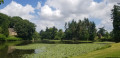
Admire the lake and the chapel on your right. Reach the hamlet of La Gélinais.

(10) At the fork in the road, take the path on the right. Cross the Gapaillère and follow the same road as it bends first to the left, then to the right and finally to the left.
When you reach a Y-junction, continue left towards the north.

(11) Turn right to cross the Bazillais. Before the bridge over the stream, turn right into the valley and, following the stream, reach a road. Follow it to the left for 100 m.

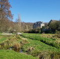
(12) Enter the Jardin des Eaux by turning right. On leaving the garden, after a few steps, follow Rue de la Gare to the left to pass in front of the town hall and join the car park at the start on the right (S/E).


Waypoints

  1. S/E : mi 0 - alt. 407 ft - Car park near the Town Hall
  2. 1 : mi 0.29 - alt. 466 ft - Path on the right
  3. 2 : mi 0.74 - alt. 574 ft - On the left, following the GR
  4. 3 : mi 1.14 - alt. 522 ft - Turn right
  5. 4 : mi 1.63 - alt. 525 ft - Straight ahead – option 1 on the left
  6. 5 : mi 2.16 - alt. 443 ft - Path on the right – end of variant 1 on the left
  7. 6 : mi 2.6 - alt. 390 ft - Departmental road – straight ahead
  8. 7 : mi 3.51 - alt. 430 ft - Path on the right – alternative route 2 straight ahead
  9. 8 : mi 4.12 - alt. 364 ft - Path on the left
  10. 9 : mi 4.62 - alt. 427 ft - Turn left
  11. 10 : mi 5.15 - alt. 417 ft - Path on the right – end of variant 2 on the left
  12. 11 : mi 6.06 - alt. 413 ft - Turn right
  13. 12 : mi 6.65 - alt. 400 ft - Jardin des Eaux on the right
  14. S/E : mi 6.93 - alt. 407 ft - Car park near the Town Hall

Notes

In some sections, the route follows blue markings featuring a scallop shell, indicating the routes for pilgrims wishing to reach Mont-Saint-Michel.

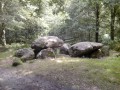
The granite chaos of Les Couardes, which you’ll discover during this walk, is one of those magical spots typical of the Coglais region. It is against this mystical backdrop that Balzac sets the scene of the clandestine mass in his novel *Les Chouans*. Legend has it that the largest of the boulders has a nasty habit of coming down to drink from the stream on Christmas Eve… And woe betide anyone who happens to be in its path: they’d be crushed to bits!

This walk is called the ‘Circular Writers’ walk’ because several of the sites it takes you to have inspired famous authors such as Balzac, Chateaubriand and Jean Guéhenno, a writer born in Fougères. It’s moving to think that such illustrious figures have trodden this ground before us!
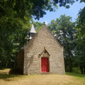
You’ll discover the magnificent site of Marigny. This is a very ancient estate that once belonged to the seigneury of the same name. Here you can admire the 16th-century Saint-Jacques Chapel, a former vicarage converted into a lodge, an old castle and a 19th-century mill. The mill is still in operation, producing organic flour. The whole estate overlooks a pond and is surrounded by woods and meadows: it is a very romantic setting that inspired Balzac for his novel *Les Chouans*. Chateaubriand stayed at the château after his sister married the Count of Marigny in 1780 and mentions it in his *Mémoires d’Outre-Tombe*,

Worth a visit

Please note: some sections may be very wet or even flooded during the winter months.

Pesnel: an old, isolated thatched cottage where Jean Guéhenno spent his holidays as a young man. He describes it in his book *Changer la vie*.

Rocher de la Boulais: Les Couardes

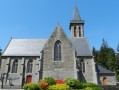
The Marigny site and the Chapel of Saint-Jacques
After your walk, be sure to take a stroll through the Jardin des Eaux, where there are picnic tables and a children’s playground.

Alternative Route No. 1: At (4), turn left towards the Bois de l’Essart. Take the first path, which bends sharply to the right, to reach (5).

Alternative Route No. 2: At (7), turn left to reach (10) directly. You will not pass through Les Couardes.

Always be cautious and plan ahead when you're outdoors. Visorando and the author of this route cannot be held responsible for any accidents occurring on this route.

The GR® and PR® markings are the intellectual property of the Fédération Française de Randonnée Pédestre.

Reviews and comments

4.3 / 5
Based on 3 reviews

Reliability of the description
4 / 5
Ease of following the route
4 / 5
Route interest
5 / 5
pierre jean marie
pierre jean marie

Overall rating : 5 / 5

Date of your route : Nov 15, 2024
Reliability of the description : ★★★★★ Very good
Ease of following the route : ★★★★★ Very good
Route interest : ★★★★★ Very good
Very busy route : No

A lovely walk. The route was very well chosen, taking us through some beautiful natural and man-made landscapes: views, sunken paths, woodland, castles and traditional houses

Machine-translated

domivasseur2935
domivasseur2935

Overall rating : 4.3 / 5

Date of your route : Jun 11, 2023
Reliability of the description : ★★★★☆ Good
Ease of following the route : ★★★★☆ Good
Route interest : ★★★★★ Very good
Very busy route : No

The start is, admittedly, a bit chaotic. My advice: park at the church square and head up the D19 road (towards Le Chatellier). Turn right into the woods at the sign explaining the walk.

A lovely walk, very green and shaded, at least for the first half. Don’t miss the Church of Saint-Jacques: it’s the perfect spot for a picnic on the grass with a view of the pond.

Machine-translated

jeambeau
jeambeau

Overall rating : 3.7 / 5

Date of your route : Apr 19, 2021
Reliability of the description : ★★★☆☆ Average
Ease of following the route : ★★★☆☆ Average
Route interest : ★★★★★ Very good
Very busy route : Yes

This route, which starts from the town hall car park, is sorely lacking in signposting at the start. On leaving the village (after the church), you find yourself a bit lost between a path leading off to the right into the woodland and a track to the left… it’s difficult to find the right route at the start! You have to walk several hundred metres before you come across a sign for the ‘circular route of writers’.

After that, the whole route is very pretty and peaceful, taking in countryside, woodland and a few short stretches of road.

A must-see is the 16th-century Saint-Jacques Chapel, an idyllic spot by the water for a break.

Machine-translated

Other walks in the area

For more walks, use our search engine .

The GPS track and description are the property of this route's author. Please do not copy them without permission.