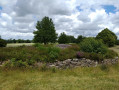
The La Grée to Plumelec route

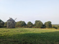
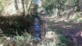
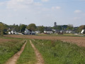
Dotted with sunken lanes, this route will take you on a journey through history: the early days of the liberation of France in 1944, marked by this monument to Corporal Bouétard; then back in time to the Revolution, commemorating General Cadoudal; before returning to the present day as you catch sight of the famous Plumélec climb, so dreaded by cyclists; and finally, through the lush Claye valley.

Details

n°67533149
Creation:
Last update:
Last review:
  • Walking
    Activity: Walking
  • ↔
    Distance: 7.36 mi
  • ◔
    Average duration: 4h 00 
  • ▲
    Difficulty: Moderate

  • ⚐
    Back to start: Yes
  • ↗
    Ascent: + 699 ft
  • ↘
    Descent: - 719 ft

  • ▲
    Highest point: 541 ft
  • ▼
    Lowest point: 131 ft
  • ⚐ Country: France
  • ⚐ City: Plumelec (56420)
  • ⚑
    Start/End: N 47.832386° / W 2.643646°
  • ❏
    IGN map(s): Ref. 0920SB
  • Hour-by-hour weather

Description of the walk

Park on Allée de la France Libre on the site of a former mine near the memorial.

(S/E) Head south-west, then, after 100 m, take the small path on the left which very quickly joins another path; follow this one to the left as well. When you reach a Y-junction, take the right-hand branch and continue to the right for a further 100 m. The path veers to the right, eventually leading onto a small road. Continue straight on until you reach the D126 departmental road.

(1) Turn right onto this road and continue left towards Coëtny; immediately afterwards, take the path on the right.

(2) When you reach a road, follow it to the right for 150 m, then turn left onto another road. Follow this road to the left to reach Le Halliguen, passing a wayside cross on your right.

(3) After thefirst house, follow the path to the left to reach Kerrivalen. At the fork in the road, turn left, then after 50 m follow the path to the right. At another fork in the road, turn left again; at the end of the path you’ll find theGR®38.

Red and white markings forthe GR®38

(4) Turn left. After crossing a road, carry on straight ahead and you’ll reach Linier.

(5) When you reach the last house on the left, turn right, heading towards Poulan whilst ignoring it on your right. The road becomes a path and veers to the right, first towards the south-east and then towards the south. When you reach a road, take it to the left and follow it as it curves to the left, passing, on your right-hand side, close to Cadoudal Castle and the Manor House. Join the D126.

(6) Follow this road to the right for a good hundred metres, then turn left towards Létiernan. Pass through the hamlet and continue for 50 metres.

No further signposting

(7) In the bend, where theGR® path follows the road, turn left before a small bridge spanning the Claie. Head due north until you reach a road. Follow it to the right for 150 metres, then turn left to cross Treuzel, veering to the right. Walk due north to the Kerfiloué crossroads.

(8) Very soon after crossing the junction, turn right. The path curves widely to the right. Shortly after passing the junction of another path on your right and before reaching the houses, turn left, heading due west, to join the Route de Bout de Ville.

(9) Turn right, then immediately left. The path leads to the old mine and thus to the car park (S/E).

Waypoints

  1. S/E : mi 0 - alt. 541 ft - Former mine
  2. 1 : mi 0.85 - alt. 367 ft - Departmental Road 126
  3. 2 : mi 1.44 - alt. 417 ft - Road junction
  4. 3 : mi 2.07 - alt. 453 ft - Le Halliguen
  5. 4 : mi 2.91 - alt. 335 ft - GR 38
  6. 5 : mi 3.56 - alt. 325 ft - Linier
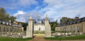
  7. 6 : mi 4.52 - alt. 207 ft - Cadoudal: castle and manor house
  8. 7 : mi 5.37 - alt. 131 ft - Leaving the GR 38 - Claie (rivière) - Affluent de l'Oust
  9. 8 : mi 6.35 - alt. 344 ft - Kerfiloué
  10. 9 : mi 7 - alt. 476 ft - Route de Bout de Ville
  11. S/E : mi 7.36 - alt. 541 ft - Former mine

Notes

Between Cadoudal and Plumelec, this stretch of the D126 is famous in the world of cycling: it is the renowned Cadoudal climb, with an average gradient of 6.2 per cent over a distance of 1.7 km, rising from an altitude of 50 metres at the Manoir de Cadoudal and the bridge over the Claie to 156 metres in the village. It features in all races, whether departmental, regional or even national, such as the Tour de France.

Georges Cadoudal was born on1 January 1771 in Brec’h, a small town in Morbihan near Saint-Anne d’Auray. The son of wealthy farmers and endowed with Herculean strength, he became a general in the Chouan army and commander of the Catholic and Royal Army of Brittany. He was eventually guillotined on 25 June 1804 in Paris.

Worth a visit

At (3) La Croix Bouétard: a monument erected in honour of Corporal Bouétard, the first casualty among the allied paratroopers dropped to organise the liberation of France.

Near (7) the Migourdy dolmens: there used to be two chamber dolmens here; one has crumbled away without leaving a trace, whilst the other still has a fine capstone.

Always be cautious and plan ahead when you're outdoors. Visorando and the author of this route cannot be held responsible for any accidents occurring on this route.

The GR® and PR® markings are the intellectual property of the Fédération Française de Randonnée Pédestre.

Reviews and comments

4.2 / 5
Based on 2 reviews

Reliability of the description
3.5 / 5
Ease of following the route
4 / 5
Route interest
5 / 5
User 18868473

Overall rating : 5 / 5

Date of your route : Aug 22, 2026
Reliability of the description : ★★★★★ Very good
Ease of following the route : ★★★★★ Very good
Route interest : ★★★★★ Very good
Very busy route : Yes

I didn’t encounter any difficulties. It was very well signposted and a real pleasure to do. I’d be happy to do it again.

Machine-translated

Pascal C56
Pascal C56

Overall rating : 3.3 / 5

Date of your route : Apr 06, 2025
Reliability of the description : ★★☆☆☆ Disappointing
Ease of following the route : ★★★☆☆ Average
Route interest : ★★★★★ Very good
Very busy route : Yes

The Grée route is a lovely route well worth exploring – but this route already exists and is fully signposted, running in the opposite direction to the one shown here! All the more so as the description leads down dead ends:
The path described to reach point 1 is impassable; gorse and brambles forced us to turn back, and the route at point 3 in Halliguen leads onto a private road where access is prohibited.
Without wishing to criticise the initiative of publishing walks online for us all to enjoy, this lovely route should be followed in the direction of the signposting, which is comprehensive and easy to follow.

Machine-translated

Other walks in the area

For more walks, use our search engine .

The GPS track and description are the property of this route's author. Please do not copy them without permission.