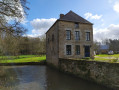
As far as Mausson Castle, staying within the Bazouge region

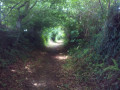
Tree-lined paths running alongside a river lead to the château. The return route mainly follows a winding path through the fields.

Details

16998643
Creation:
Last update:
Last review:
  • Walking
    Activity: Walking
  • ↔
    Distance: 4.24 mi
  • ◔
    Average duration: 2h 15 
  • ▲
    Difficulty: Easy

  • ⚐
    Back to start: Yes
  • ↗
    Ascent: + 318 ft
  • ↘
    Descent: - 305 ft

  • ▲
    Highest point: 577 ft
  • ▼
    Lowest point: 364 ft
  • ⚐ Country: France
  • ⚐ City: Landivy (53190)
  • ⚑
    Start/End: N 48.463551° / W 1.051257°
  • ❏
    IGN map(s): Ref. 1416O
  • Hour-by-hour weather

Description of the walk

Park at the hamlet of ‘La Davoudière’ beside the D 122.

(S/E) Leave the departmental road on your left and take the road on your right towards La Bouverie. Pass through this hamlet and, just before the entrance to La Doctière, take the path on your right which goes round a meadow and crosses a stream. Ignore a path on your right and follow the stream.

(1) At the end of the path, turn left to cross the stream via a large concrete footbridge and head due south. Ignore a path on the left – the entrance to a private property – and continue to La Morissais. There, the path becomes a small country lane which joins the D 122.

(2) Follow this road to the right for 150 m, then turn left onto the small road.

(3) As you approach the houses at Les Pièces, turn right onto a grassy path that descends whilst curving to the left. Continue to the right, crossing the stream.

(4) Before entering Pont Dom Guérin, turn left onto the path which leads onto a road. Follow it for 150 m, then head down to the left along a path which leads to a gate. Go through the small gate on the left, taking care to close it behind you, and walk along the left-hand side of the castle’s ramparts.

(5) Walk past the outbuildings and alongside the Ruisseau de Mausson. Pass the entrance to the Bay de Fer estate on your right and continue for about a hundred metres.

(6) Turn right onto the tree-lined path and follow it as it winds back and forth to the right and left. It ends at a road.

(7) Follow this road to the left. Cross the county road with care and return to the car park (S/E).

Waypoints

  1. S/E : mi 0 - alt. 528 ft - Car park at La Davoudière (D 122)
  2. 1 : mi 0.81 - alt. 371 ft - Path to the left
  3. 2 : mi 1.57 - alt. 522 ft - Departmental Road 122
  4. 3 : mi 1.89 - alt. 548 ft - Les Pièces
  5. 4 : mi 2.31 - alt. 466 ft - Pont Dom Guérin after crossing the - Airon (rivière) - Affluent de la Sélune
  6. 5 : mi 2.73 - alt. 492 ft - Mausson Castle
  7. 6 : mi 3.06 - alt. 564 ft - Path on the right
  8. 7 : mi 3.99 - alt. 577 ft - Road to the left
  9. S/E : mi 4.24 - alt. 528 ft - Car park at La Davoudière (D 122)

Notes

From (3) to (6), the route is the same as walk no. 4625318 from Pontmain to Pont Dom Guérin.

Worth a visit

Reviews and comments

4.5 / 5
Based on 2 reviews

Reliability of the description
4.5 / 5
Ease of following the route
4.5 / 5
Route interest
4.5 / 5
Emiiilie
Emiiilie

Overall rating : 4 / 5

Date of your route : Jun 28, 2023
Reliability of the description : ★★★★☆ Good
Ease of following the route : ★★★★☆ Good
Route interest : ★★★★☆ Good
Very busy route : No

Hike tried out today.
The section around the castle was very interesting and well described, but please note that we were unable to follow the entire route as indicated

In fact, at the start of the walk, at a place called La Bouverie, there were three large dogs running loose near the house… As we have dogs of our own, we had to alter part of the route… We walked the route in the opposite direction and returned via the road.

Machine-translated

pierre jean marie
pierre jean marie

Overall rating : 5 / 5

Date of your route : Jan 02, 2022
Reliability of the description : ★★★★★ Very good
Ease of following the route : ★★★★★ Very good
Route interest : ★★★★★ Very good
Very busy route : No

A very lovely walk, particularly in the first two-thirds: valleys, sunken paths, streams and hillsides. A very beautiful castle and park. A loop around this lovely park could have been included in the walk’s route. The southern part of the park is also interesting, with its mill (which you can just make out) and the entrance to the leat a little further on.
The final third of the walk follows some pleasant paths. The farmers have apparently allowed access through the fields, which is much appreciated. The surrounding landscape is, however, less interesting in this section.
For a short half-day outing, we really enjoyed this walk.

Machine-translated

Other walks in the area

For more walks, use our search engine .

The GPS track and description are the property of this route's author. Please do not copy them without permission.