From Vitrac to Montfort, following the course of the Dordogne

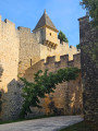
Follow the course of the Dordogne along a circular route that links Vitrac and its hamlets to Montfort, a medieval village dominated by its castle, which guards the cingle (meander) formed by its rocky spur.

Details

n°54371554
Creation:
Last update:
Last review:
  • Walking
    Activity: Walking
  • ↔
    Distance: 6.71 mi
  • ◔
    Average duration: 3h 40 
  • ▲
    Difficulty: Moderate

  • ⚐
    Back to start: Yes
  • ↗
    Ascent: + 689 ft
  • ↘
    Descent: - 686 ft

  • ▲
    Highest point: 604 ft
  • ▼
    Lowest point: 220 ft

Description of the walk

Park in the car park in front of Vitrac Town Hall.

(S/E) Head north-east along the Route du Bourg. Take thefirst road on the right, the Chemin de Bastier, which, after running alongside the cemetery, becomes a footpath and then rejoins the road. This leads onto the Route du Château de Montfort.

(1) Follow it to the right after crossing the road and, very soon after, turn left onto the Route de Caudon, which offers views of Montfort Castle on the left and the Caudon cliffs on the right. At the junction with the Route de la Plage de Caudon, carry straight on along a terraced path which widens into a track.

(2) Turn right to admire the Dordogne.

(3) Read the information board and enjoy the view over Caudon. Retrace your steps.

(2) Carry on straight ahead. The path first turns right then left and joins the Chemin du Pech de Valet. Turn right and head for the Montfort car park. Enter the medieval village and turn right onto the Ruelle des Marronniers. The castle is on your right. Continue to the Route du Château de Montfort.

(4) (Off the main route: To reach the banks of the Dordogne and back, at the wash house, turn right onto the Chemin des Pêcheurs.)
Turn left. Cross at the pedestrian crossing and take the dead-end road leading downhill. At the transformer, follow the path on the right which passes through a holm oak woodland and ends at a road.

(5) First turn left then right, and head down Chemin de Péchibral Haut. It veers left, at the edge of the woods, and ends on Route du Champ Bas.

(6) Turn right until you reach a junction. Cross it carefully and turn left onto the Route de Combelongue, which leads to Vitrac.

(7) At Les Granges, turn right and then immediately left. At the road, turn right and cross the Cluze, then a tributary. Join the Route du Port. Follow it to the left and, at the roundabout, turn right towards the bridge.

(8) After admiring the Dordogne, its current and its banks, return to the roundabout and turn right. Continue right along Rue du Golf and, shortly afterwards, turn left to reach the previous junction. Walk 50 metres to the right and turn left onto the path leading back to the town hall car park (S/E).

Waypoints

  1. S/E : mi 0 - alt. 404 ft - Town Hall
  2. 1 : mi 0.57 - alt. 315 ft - Road to Montfort Castle
  3. 2 : mi 1.89 - alt. 240 ft - Crossroads of roads
  4. 3 : mi 2.19 - alt. 236 ft - Banks of the Dordogne - Dordogne (fleuve)
  5. 4 : mi 3.37 - alt. 344 ft - Montfort – a medieval village
  6. 5 : mi 4.02 - alt. 597 ft - Péchibral
  7. 6 : mi 4.59 - alt. 361 ft - Route du Champ Bas
  8. 7 : mi 5.29 - alt. 410 ft - Les Granges
  9. 8 : mi 6.11 - alt. 220 ft - The Dordogne - Dordogne (fleuve)
  10. S/E : mi 6.71 - alt. 404 ft - Town Hall

Notes

Linguistic issue: Why is the Dordogne classified as a ‘rivière’ rather than a ‘fleuve’?
Definition of a ‘fleuve’: A major watercourse (notable for the number of its tributaries, the volume of its flow, and the length of its course) that flows into the sea. As such, the Dordogne joins the Garonne to form the Gironde, which flows into the Atlantic Ocean. The Dordogne would therefore indeed be a ‘rivière’.

But conversely, why is the Garonne – which joins the Dordogne to form the Gironde – classified as a major river rather than a river? This definition contradicts itself. So only the Gironde would be a ‘fleuve’, yet it has only five tributaries and is merely 75 km long. It is therefore regarded as an extension of the Garonne (Gironde is thought to be a corruption of Garonne in the Occitan language).

Another distinctive feature: the tidal bore that occurs in the Gironde continues into the Dordogne. This means that there is a mixture of fresh and salt water in the Dordogne: a characteristic specific to a river that flows into the sea.
What does this actually mean?
Ultimately, even if linguistic purists disagree on this name, we can conclude that there are five rivers in France, not four. The Dordogne is the fifth, after the Loire, the Rhône, the Seine and the Garonne.

Worth a visit

The Château de Montfort, a private property, is not open to visitors.

Reviews and comments

4.2 / 5
Based on 2 reviews

Reliability of the description
4.5 / 5
Ease of following the route
4.5 / 5
Route interest
3.5 / 5
groupe rando
groupe rando

Overall rating : 5 / 5

Date of your route : Sep 14, 2026
Reliability of the description : ★★★★★ Very good
Ease of following the route : ★★★★★ Very good
Route interest : ★★★★★ Very good
Very busy route : No

A lovely route – you can even go for a swim!

Machine-translated

LEPELTIER.michael@gmail.com

Overall rating : 3.3 / 5

Date of your route : May 12, 2025
Reliability of the description : ★★★★☆ Good
Ease of following the route : ★★★★☆ Good
Route interest : ★★☆☆☆ Disappointing
Very busy route : No

It involves too much driving; what’s more, whilst this route runs alongside the Dordogne, the river isn’t directly visible from the route

Machine-translated

Other walks in the area

For more walks, use our search engine .

The GPS track and description are the property of this route's author. Please do not copy them without permission.