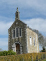
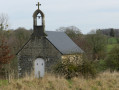
Claire-Fontaine and the Chapelle de Courbefosse in Fougerolles-du-Plessis

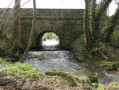
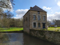
A very pleasant walk, starting with two lakes, followed by wide, straight paths through wooded countryside, before continuing along the circular western route with unobstructed views as you walk alongside a small stream. Along the way, you’ll see some beautiful country houses and two small chapels.

Details

n°3979213
Creation:
Last update:
–
Last review:
  • Walking
    Activity: Walking
  • ↔
    Distance: 9.08 mi
  • ◔
    Average duration: 4h 35 
  • ▲
    Difficulty: Moderate

  • ⚐
    Back to start: Yes
  • ↗
    Ascent: + 440 ft
  • ↘
    Descent: - 413 ft

  • ▲
    Highest point: 676 ft
  • ▼
    Lowest point: 423 ft

Photos

Description of the walk

Park at Place de l’Église.

(S/E) Head south, crossing Square Marin Marie with the town hall on your left. Take Rue des Châteaux. At the bottom of the alley, turn left onto Rue de la Filature to join the departmental road.

(1) Cross carefully and continue straight ahead. At the crossroads, turn right towards the lake and walk round it in a clockwise direction.

(2) Leave the lake via the wooden footbridge on the left and join Rue du Bardeau. At the top of the hill, turn right.

(3) Cross the D141 road with care and walk along the left-hand side of the pond’s embankment. At the junction, turn right, walk past the Chapelle Saint-Joseph and continue along this road to the Ferme de la Bruyère.

(4) Turn left onto the path towards the village of Chamossay. Before reaching the houses, turn left to rejoin the D141. Take care. Follow it to the right for 100 m, then turn left onto a dirt track which, heading north, leads to a small road.

(5) Turn left and, after 20 metres, follow another track to the right. It crosses a stream before reaching Aubigné and then La Table – where it becomes a road – eventually joining the D122.

(6) Cross carefully and continue straight ahead, keeping slightly to the left. Cross asecond road and carry on straight ahead. Finally, cross the D116 road carefully and continue straight on along the path.

(7) Cross the D588, keeping slightly to the left, and reach the village of Louzelaie. Turn left, cross the village and come out onto a small tarmac road; follow this to the right for about twenty metres

(8) Turn left onto a lovely dirt track.

(9) Turn right. The track runs alongside a private property before joining the road leading to Les Hauts Champs. Turn right, then very soon after turn left onto a road which becomes a track and leads to La Pitantonnière. Follow the D 122 for a few metres.

(10) Continue along a path that runs alongside the river and then disappears into the pastures (see note below) until you reach a small tarmac road.

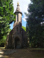
(11) Turn right and head uphill to the Chapelle de Courbe Fosse.

(12) Return to the road and continue down the slope to the left.

(13) Turn left to climb up the side of a hill and then descend through the pastures to a small road at elevation 174. Follow it to the right towards the south. Continue to the left to reach Louzelaie.

(8) Turn right onto the same path as before to reach a junction you passed on the way out.

(9) Follow the path to the left. At the end of it, continue along the road. Cross the Route de Savigny and carry on straight ahead along the Sentier de la Planche. Continue straight ahead through the Résidence de l’Aunay.

(14) Turn right to walk past the care home. Carry on along Rue de Moroge.
Note: two hundred-year-old yew trees. At the end of the street, the church car park is on the right (S/E).

Waypoints

  1. S/E : mi 0 - alt. 607 ft - Place de l’ - Église de l'Immaculée Conception (Fougerolles-du-Plessis)
  2. 1 : mi 0.27 - alt. 564 ft - Rue de Goué
  3. 2 : mi 0.83 - alt. 545 ft - Footbridge
  4. 3 : mi 1.17 - alt. 577 ft - Saint-Hubert – D141 local road
  5. 4 : mi 2.05 - alt. 630 ft - La Bruyère Farm
  6. 5 : mi 2.79 - alt. 636 ft - Turn left
  7. 6 : mi 3.73 - alt. 663 ft - Departmental Road D122
  8. 7 : mi 4.36 - alt. 656 ft - Crossing the D558
  9. 8 : mi 4.76 - alt. 636 ft - Louzelaie – Start of the shared section
  10. 9 : mi 4.98 - alt. 623 ft - End of shared section
  11. 10 : mi 5.81 - alt. 463 ft - Car park for the Chapelle circular route
  12. 11 : mi 6.64 - alt. 430 ft - Road to the right
  13. 12 : mi 7 - alt. 463 ft - Chapelle de Courbe Fosse (Fougerolles-du-Plessis)
  14. 13 : mi 7.26 - alt. 479 ft - Path on the left
  15. 14 : mi 8.85 - alt. 623 ft - Résidence du Petit Aunay
  16. S/E : mi 9.08 - alt. 607 ft - Place de l’ - Église de l'Immaculée Conception (Fougerolles-du-Plessis)

Notes

This route can be divided into two parts: the right-hand circular route, the Claire Fontaine route (approximately 9 km, marked with Yellow Triangles), and the left-hand circular route, the Chapelle de Bellefosse route (approximately 6 km, marked with Yellow Rectangles), if you start at point (10) between La Motte and Les Champs

Worth a visit

Please note: between (10) and (11), the path is barely marked. You must therefore make your way by sight, keeping as close as possible to the stream, which requires crossing several fences and barbed wire.
We encountered the same problem between (13) and the road. Furthermore, on the road there is a sign directing you to turn left, but we found no path beyond that point. Hence, we followed the road to the right to get back to Louzelaie.

Reviews and comments

4.3 / 5
Based on 2 reviews

Reliability of the description
4 / 5
Ease of following the route
4.5 / 5
Route interest
4.5 / 5
big moustache
big moustache

Overall rating : 4.3 / 5

Date of your route : Mar 06, 2023
Reliability of the description : ★★★★☆ Good
Ease of following the route : ★★★★★ Very good
Route interest : ★★★★☆ Good
Very busy route : Yes

Machine-translated

dapyjean
dapyjean

Overall rating : 4.3 / 5

Date of your route : Mar 15, 2021
Reliability of the description : ★★★★☆ Good
Ease of following the route : ★★★★☆ Good
Route interest : ★★★★★ Very good
Very busy route : No

Hello, and thank you for your route.
The route took in some lovely scenery.

Machine-translated

Other walks in the area

For more walks, use our search engine .

The GPS track and description are the property of this route's author. Please do not copy them without permission.