Country:
 City:
City:


Park in the large car park overlooking Rue de la Corderie.
The entire route is clearly signposted in yellow under the name “Circuit de la Moucherie”, taken from the ‘Bretagne Romantique’ guidebook.
(S/E) Turn left into Rue de la Corderie, then, at the bend, turn left into Rue de Saint-Michel. Continue right onto Quai d’Ille-et-Rance. Cross the Pont à l’Abesse on the left and continue along Avenue René de Chateaubriand for a few metres after crossing the Donac.
(1) Turn right onto Rue du Moulin de l’Abesse, which continues as Rue du Clos de Justice. Turn right onto a grassy area which leads onto a path through the fields. A sunken track then joins the road.
(2) Turn right and pass through Glehec. Continue along the road, passing under a power line, then take the path on the right before the crossroads and follow the road to the right.
(3) Take the first path on the left before Cohier. Pass under asecond power line. At the junction of the paths, carry on straight ahead and, at the crossroads, continue along the stony path opposite.
(4) Turn right and cross Trignoux. Continue along the road until you reach the T-junction. Turn left and join the D795. Follow it to the left for about fifty metres. Please note that this road has heavy traffic.
(5) Follow the track to the right. Cross the road near Le Grand Châtelain and continue along the gravelled track opposite. At the end of the track, turn left. Cross the road and continue straight on towards La Dairy Farm and Le Petit Châtelain.
(6) At the end of the hamlet, continue along the track to the right. At the junction, keep to the right and you’ll come to a road. Follow it to the left to reach L’Écoutel.
(7) Turn right. The path becomes a stony track. To the west-south-west, on the hills, you can see Montmuran Castle, 7 km away as the crow flies. Continue along the road as it runs on to Rouyon.
(8) Turn right, pass the Gué de Guisel and reach the Croix Saint-Joseph. Continue to the left, carefully crossing the departmental road, then carry on straight ahead along a sunken lane, then alongside a field, and enter Saint-Méloir-des-Bois.
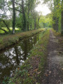
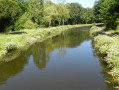
(9) Turn right. At a bend, ignore the road on the right and, at the next bend, take the road on the left. At the entrance to La Touche-aux-Aubry, follow the gravel track on the right which descends to the Ille-et-Rance Canal.
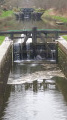
(10) Follow the right bank of the canal as far as Lock No. 32 at La Moucherie. Cross the canal via the Pont de la Moucherie on the left, then turn right to follow the canal along its left bank. You will reach the outskirts of Tinténiac.
(11) Leave the canal after the allotments by turning left towards the school. Continue to the right along Rue de la Salle Verte, which leads on to Place du Four in Ban.
(12) Turn left onto Rue du Prieuré, passing in front of the church, then continue right onto Rue Nationale. Cut right to join Rue de la Libération. Follow this road for 100 metres to the left, passing between the houses to reach Rue de la Cour Frémur and return to the car park (S/E).

 Visorando Member
 Association / Club / Walk leader
 Easy
Easy