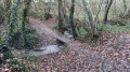
As far as Gué Guérin, following the Ernée

This route, known as the “Circuit des sentiers de l’Oscence”, originates in the Mayenne region.
It offers the pleasure of walking alongside the Ernée, a small river which flows into the Mayenne – a tributary of the Loire – as well as along some magnificent sunken paths.

Details

n°24245913
Creation:
Last update:
Last review:
  • Walking
    Activity: Walking
  • ↔
    Distance: 9.02 mi
  • ◔
    Average duration: 4h 25 
  • ▲
    Difficulty: Moderate

  • ⚐
    Back to start: Yes
  • ↗
    Ascent: + 358 ft
  • ↘
    Descent: - 335 ft

  • ▲
    Highest point: 577 ft
  • ▼
    Lowest point: 312 ft
  • ⚐ Country: France
  • ⚐ City: Montenay (53500)
  • ⚑
    Start/End: N 48.286687° / W 0.892757°
  • ❏
    IGN map(s): Ref. 1417SB, 1418SB
  • Hour-by-hour weather

Photos

Description of the walk

Use the large car park at the sports complex, on the right as you leave the village of Montenay, before the sports hall, rather than the angled parking spaces along the football pitches.

Yellow signposting

(S/E) Leave the car park by turning right towards the football pitches. Continue along this road. Cross a bridge over the Oscence and note the start of theGRP® on the left.

Yellow and Red Markings and Yellow Markings

(1) When the road curves to the left, turn right onto a dirt track. Follow it until it meets a road.

(2) Continue along this road, turning right, and pass the houses at Bois Joli. Follow the D209 local road to the left for about fifty metres.

(3) At Grand Gévereau, take the first track on the right which descends into the Ernée valley.
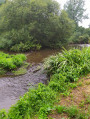
Follow the course of the Ernée. Pass the ruins of Monthéreux Castle and head towards Gué Guérin. The path turns left, moving away from the river.

Yellow markings

(4) Let theGRP® head off to the right and climb the northern slope of the Ruisseau de la Perche valley along a mule track to the Bouhameries farm.
First turn right then left onto the small road and follow the path to reach La Marguinière.

(5) Turn left onto the Chemin de la Pesgerie and continue to the right at its end.
Don’t miss the left turn onto a very pleasant sunken path before crossing the Ruisseau des Beuchetières via a small footbridge.

(6) Follow the Route de Vautorte to the left for 50 metres, then turn right towards L’Aunay. The path takes a 90° bend to the right and then leads to the Route de l’Asnerie.

(7) See note in the section: During the walk.
First turn left then right and take the small road towards the Château de la Bas-Maignée.

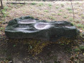
(8) On this road, temporarily leave the yellow markings by turning right towards La Berthelière, then follow the path to the right to see the Pierre Saint-Guillaume polishing stone (see photo).
Retrace your steps and rejoin the Route de la Bas-Maignée.

(8) Continue to the right. After the Château de la Bas-Maignée, turn left onto the Route de la Traverserie. Follow it for almost 2 km to rejoin the GRP®.

Yellow and red markings and yellow markings

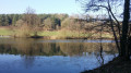
(9) Take the path on the right and head down towards the pretty valley of ponds at La Brosse.
Cross the D247 and continue along a magnificent path running alongside an orchard.

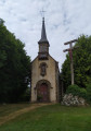
(10) Turn left onto the Route des Coqueries and enter Montenay. Walk past the church, then turn left into Rue Roullois. Turn right, then, before the town hall, turn left into Rue de l’Asnerie to return to the car park (S/E).

Waypoints

  1. S/E : mi 0 - alt. 384 ft - Large car park at the sports complex
  2. 1 : mi 0.42 - alt. 400 ft - GRP path on the right
  3. 2 : mi 1.51 - alt. 384 ft - End of the trail, turn right onto the road
  4. 3 : mi 2.19 - alt. 404 ft - Le Grand Gévereau. Heading towards the - Ernée (rivière) à finaliser
  5. 4 : mi 3.16 - alt. 318 ft - Leaving the GRP
  6. 5 : mi 4 - alt. 459 ft - La Pesgerie
  7. 6 : mi 4.49 - alt. 407 ft - Route de Vautorte
  8. 7 : mi 5.2 - alt. 479 ft - Route de l’Asnerie
  9. 8 : mi 5.59 - alt. 515 ft - Towards the Pierre Saint-Guillaume
  10. 9 : mi 7.5 - alt. 518 ft - Rejoining the GRP
  11. 10 : mi 8.26 - alt. 459 ft - Route des Coqueries
  12. S/E : mi 9.02 - alt. 384 ft - Large car park at the sports complex

Notes

At several points, in addition to the two sets of markings (the GRP®’s yellow and red, and occasionally the route’s white and red and yellow markings), you will come across several signposts indicating a change of direction for the “Oscence Trails Route”.

Whilst this route very often follows magnificent sunken paths, it should be noted that between (7) and (9) – a stretch of 3.5 km – it follows small tarmac roads. Occasionally, the verges allow you to walk on softer ground.

Worth a visit

At (7), there is the option of a shortcut: follow the road to the left and head for (1), then return to the car park via the same route as on the way out.

Route de la Traverserie:
as its name suggests, this road linked Montenay and Mayenne, winding its way along the rugged ridges of the Mayenne Forest, which stretches across the eastern horizon.

Reviews and comments

3.8 / 5
Based on 2 reviews

Reliability of the description
3.5 / 5
Ease of following the route
4 / 5
Route interest
4 / 5
charlie53
charlie53

Overall rating : 4.3 / 5

Date of your route : Oct 21, 2024
Reliability of the description : ★★★★☆ Good
Ease of following the route : ★★★★★ Very good
Route interest : ★★★★☆ Good
Very busy route : No

Lovely paths for 75 per cent of the walk. Towards the end… 3 km along a quiet road… We missed the ‘turn right’ after the Ferme des Bouhameries!!

Machine-translated

Fany
Fany

Overall rating : 3.3 / 5

Date of your route : May 28, 2023
Reliability of the description : ★★★☆☆ Average
Ease of following the route : ★★★☆☆ Average
Route interest : ★★★★☆ Good
Very busy route : No

A lovely walk along some pretty sunken paths near the Ernée. Best avoided when it’s raining, no doubt. From point 7 onwards, you’re on a small road with no traffic, but it’s tarmac. We must have missed a turn-off leading to the ‘polissoir’ and another one towards the end. You can also take the same route back via the Château de la Basmaignée. Worth doing again.

Machine-translated

Other walks in the area

For more walks, use our search engine .

The GPS track and description are the property of this route's author. Please do not copy them without permission.