Country:
 City:
City:


Park at Place de la Mairie.
(S/E) Leave the square by heading east along Rue Heurtault. Take thesecond street on the left towards the church and, opposite it, turn right into Rue du Château.
Red and white markings forthe GR® 37
The castle ruins are on your left.
Walk alongside the lake for a few dozen metres via the Butte Moquet path.
(1) Follow the path through the woods that branches off to the left, ignoring the paths leading off to the right or left (theGR® markings are very helpful for the first two hundred metres). The path runs almost along the edge of the woods. When you reach a small country road, cross it and continue straight ahead. Follow the path that branches off to the left; after a bend, it leads to a road (D103).
(2) Follow this road southwards, passing through the hamlet of Vauluisant and then crossing the D226. After 250 m, as you approach Les Landelles, turn left onto the track and follow it to the end.
(3) Turn right and, at the Fork in the road, take the left-hand path. Cross a road and continue straight ahead. Pass through the hamlet of l’Auberdière and reach la Petite Goutillais. Turn right and follow the road, negotiating two bends.
(4) At the White Cross, cross the D794 with care and continue straight ahead, keeping slightly to the right. Reach La Guibertière and walk for about a hundred metres.
(5) At this point, theGR® 37 branches off to the left and, to the right, you’ll find theGR® 39a. Turn right, heading due west. Cross the D103 and follow the path straight ahead, which curves to the left further on. As you approach Manoir Chenil, the path joins another path; follow this to the right.
(6) At Pas du Chat, turn left. After 200 m, on a bend, leave the track and take a path on the right, heading north-west. Follow it straight on, ignoring any offshoots to the right.
YellowPR® markings
(7) Let theGR® 39a continue straight on and turn right. Walk almost due north. Cross the D794 again with the same caution, continuing straight on for 80 m, then turn right to reach La Cointerie. Cross the Ruisseau des Vallées and continue to the end of this road.
(8) Follow Rue du Bourg au Loup on the left. Continue to the right through a passage between the houses to reach Allée des Cormiers, then turn into thefirst street on the left, Allée du Pré d’Antuère, which ends at Rue Anne de Bretagne.
(9) Follow this road to the left for a few metres, then turn right onto Rue du Calvaire and immediately take the path on the right leading to the pond. Walk round the pond on the left, then turn left onto Rue de l’Étang, which continues as Rue du Pont Joachim, to return to the car park at Place de la Mairie (S/E).


 Visorando Member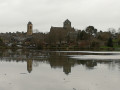
 Easy
Easy 
 Local authority