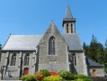
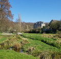
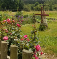
The Minette Valley as seen from Saint-Étienne-en-Coglès

You have now arrived in one of the most beautiful settings in the Coglais district: first of all, you’ll discover the Ruisseau de la Piquellerais, then the Ruisseau du Vocadieu, as you cross the magnificent Minette Valley. This small river, 25 km long, is a tributary of the Couesnon, fed by a multitude of streams: the Piquellerais and the Vocadieu, but also the Frénouse, the Aunay, the Couard, and so on.

Details

4302781
Creation:
Last update:
Last review:
  • Walking
    Activity: Walking
  • ↔
    Distance: 9.75 mi
  • ◔
    Average duration: 4h 40 
  • ▲
    Difficulty: Moderate

  • ⚐
    Back to start: Yes
  • ↗
    Ascent: + 167 ft
  • ↘
    Descent: - 167 ft

  • ▲
    Highest point: 400 ft
  • ▼
    Lowest point: 282 ft

Description of the walk

Park in a single file along Rue Monseigneur Friteaux.

(S/E) Follow this street southwards, then, very soon after, turn right at the Rocher Breton onto Impasse du Rocher Musset. Then follow the sunken lane that continues from there to reach the Voie Verte. Take this to the left as far as the old railway station.

(1) Turn right, go over the D155 and cross Croix Allée. At the junction, turn right towards La Carrée, which you’ll leave on your right as you carry on straight ahead.

(2) Turn left onto the path. Once you’ve crossed it, follow the Ruisseau de la Piquellerais, passing under the same power line three times, until you reach the D103. Follow this road to the right for a few hundred metres.

(3) Turn right. First turn left then right onto the Route du Chêne Ory and, when you reach the stream, follow it to the left until you come to the road, which you should follow to the right.

YellowPR® signposts

(4) Turn left, then, after La Robannerie, turn left onto the small country lane, passing La Réhorais.

(5) Turn right, and further on, leave Le Feuil on your right. Continue along the dirt track to the edge of the woodland housing old granite quarries.

No signposting

(6) Let thePR® route head off to the right, taking a small flight of steps and then crossing a slope (signposted path), and follow the Minette stream on the left, past the ruins of La Monneraie to the Moulin de Chaudebœuf (see note below).

(7) Head back up to the road, turn left and make your way to La Bagoterie. Follow the road to the right for 300 metres to reach the Ruisseau de Vocadieu.

(8) Turn left and follow the stream, which veers eastwards at Mée Cotel. After one kilometre, you’ll come out onto a small road.

(9) Turn left and follow the road which runs alongside the Rocher Jean. Before Bervaux, take a path on the right which, after a bend to the left, becomes a road again; stay on this until you cross over the D155.

(10) After 100 m, make a U-turn to the left to rejoin the Voie Verte. It runs alongside the departmental road before turning off into the woods to reach the railway station junction.

(1) Turn right towards Le Taillis. Head for the Rocher Breton and then the car park at the starting point (S/E).

Waypoints

  1. S/E : mi 0 - alt. 381 ft - Rue Monseigneur Friteaux, on the outskirts of the village
  2. 1 : mi 0.52 - alt. 364 ft - Saint-Étienne-en-Coglès railway station
  3. 2 : mi 1.27 - alt. 348 ft - A small path to the left
  4. 3 : mi 2.76 - alt. 331 ft - Towards the Chêne Ory
  5. 4 : mi 3.66 - alt. 344 ft - Junction with the PR
  6. 5 : mi 4.23 - alt. 344 ft - T-junction
  7. 6 : mi 4.98 - alt. 289 ft - Leaving the PR - Minette (rivière) - Affluent du Couesnon
  8. 7 : mi 5.59 - alt. 312 ft - Chaudebœuf
  9. 8 : mi 6.29 - alt. 312 ft - Vocadieu stream
  10. 9 : mi 7.44 - alt. 328 ft - Country road
  11. 10 : mi 8.91 - alt. 390 ft - Access to the greenway
  12. S/E : mi 9.75 - alt. 381 ft - Rue Monseigneur Friteaux, on the outskirts of the village

Notes

As mentioned in the introduction, the Minette region is rich in streams that form a network of salmon-fishing waters where the trout reigns supreme. It is a fisherman’s paradise.

(7) Off the route: take a few steps to the right to reach the castle’s entrance gate.

Worth a visit

Chaudebœuf Castle: this is a private estate managed by the Congregation of the Sisters of Rillé, which has continued to expand in order to fulfil its mission of caring for the most destitute. The hospice now accommodates 250 people.

Always be cautious and plan ahead when you're outdoors. Visorando and the author of this route cannot be held responsible for any accidents occurring on this route.

The GR® and PR® markings are the intellectual property of the Fédération Française de Randonnée Pédestre.

Reviews and comments

3.5 / 5
Based on 4 reviews

Reliability of the description
4 / 5
Ease of following the route
3.5 / 5
Route interest
3 / 5
EtienneBar
EtienneBar

Overall rating : 2 / 5

Date of your route : Jul 20, 2026
Reliability of the description : ★★★☆☆ Average
Ease of following the route : ★☆☆☆☆ Very disappointing
Route interest : ★★☆☆☆ Disappointing
Very busy route : No

Hike completed on 20 July 2026, in fine weather.

We didn’t enjoy this walk (at all).
There’s a lot of tarmac, even though these are small, quiet roads.

Most of the paths are very difficult to walk on, full of stinging nettles, brambles, fallen trees and large broken branches, which make progress a struggle. This is where you really see the value and necessity of maintaining the paths (by the way, a big thank you to everyone who does this).

Admittedly, there are some beautiful landscapes and a few very pleasant stretches, but I’d find it hard to recommend this walk.

Machine-translated

User 16490492

Overall rating : 2.7 / 5

Date of your route : Feb 25, 2026
Reliability of the description : ★★★☆☆ Average
Ease of following the route : ★★★☆☆ Average
Route interest : ★★☆☆☆ Disappointing
Very busy route : No

Impracticable

Machine-translated

clesaux
clesaux

Overall rating : 4.3 / 5

Date of your route : Aug 11, 2024
Reliability of the description : ★★★★★ Very good
Ease of following the route : ★★★★★ Very good
Route interest : ★★★☆☆ Average
Very busy route : No

It’s hard to answer the questions because the path isn’t maintained at all! I found myself having to cut through the maize to avoid the brambles; some sections are completely overgrown with stinging nettles… I was put off halfway through the walk. In short, the experience was largely spoiled by these difficulties.

Machine-translated

cricaille35
cricaille35

Overall rating : 5 / 5

Date of your route : Jul 17, 2023
Reliability of the description : ★★★★★ Very good
Ease of following the route : ★★★★★ Very good
Route interest : ★★★★★ Very good
Very busy route : No

A very pleasant walk through the countryside and along small streams, where we spotted lots of butterflies and dragonflies. It had a bit of a mountain valley feel to it at times, with large meadows, a few copses of trees and some very large boulders. A lovely surprise.

Machine-translated

Other walks in the area

For more walks, use our search engine .

The GPS track and description are the property of this route's author. Please do not copy them without permission.