On the heights of Saint-Marc-sur-Couesnon

Built on a promontory overlooking the Couesnon valley, Saint-Marc is a must-see for walkers heading for Mont-Saint-Michel. On this route, on a clear day, Mont-Saint-Michel is ever-present.

Details

4313022
Creation:
Last update:
Last review:
  • Walking
    Activity: Walking
  • ↔
    Distance: 4.13 mi
  • ◔
    Average duration: 2h 05 
  • ▲
    Difficulty: Easy

  • ⚐
    Back to start: Yes
  • ↗
    Ascent: + 223 ft
  • ↘
    Descent: - 210 ft

  • ▲
    Highest point: 361 ft
  • ▼
    Lowest point: 157 ft

Photos

Description of the walk

Park in the car park behind the town hall in Saint-Marc.

(S/E) Walk past the school to reach Rue de l’Église. Turn right towards the church and continue through the village.

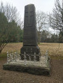
(1) When you reach the statue, follow the road to the left towards Vilaune. The road curves westwards.

(2) As you approach the Couesnon, leave the road and take the small path on the left. Follow the river to reach the Moulin du Pont. When you reach the road, follow it to the right

(3) Carry on straight ahead. Ignore the hamlet of Beaulieu on your left and continue to the T-junction. Turn left for 30 metres before continuing right until you reach the departmental road.

(4) Turn right and then left after 150 metres. At the junction, in front of a ‘No Through Road’ sign, turn right and carry on straight ahead to the end of the small country lane. Turn left and continue to the T-junction.

(5) Carry on to the right until you reach the D 103 departmental road. Follow it to the right and enter Saint-Marc via Rue de la Mairie. Just before the town hall, turn left to reach the car park, going round the school (S/E).

Waypoints

  1. S/E : mi 0 - alt. 335 ft - Car park behind the town hall
  2. 1 : mi 0.22 - alt. 338 ft - Statue of the Virgin Mary after the - Église Saint-Marc (Saint-Marc-sur-Couesnon)
  3. 2 : mi 0.86 - alt. 164 ft - Start of the path - Couesnon (fleuve)
  4. 3 : mi 1.54 - alt. 194 ft - Beaulieu
  5. 4 : mi 2.24 - alt. 249 ft - Departmental Road D 22
  6. 5 : mi 3.35 - alt. 256 ft - T-junction
  7. S/E : mi 4.13 - alt. 335 ft - Car park behind the town hall

Notes

At (2), you can follow the road and turn left in the hamlet of Vilaune to reach (3). This route is recommended after heavy rain, as the banks of the Couesnon may be flooded.

Worth a visit

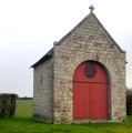
The Church: Built in the early 16th century, it houses several 15th-century statues in limestone or wood, as well as a baptismal font dating from 1554, adorned with inscriptions carved in Gothic script.

Reviews and comments

4.7 / 5
Based on 2 reviews

Reliability of the description
5 / 5
Ease of following the route
5 / 5
Route interest
4 / 5
alain dommange
alain dommange

Overall rating : 4.7 / 5

Date of your route : Feb 28, 2021
Reliability of the description : ★★★★★ Very good
Ease of following the route : ★★★★★ Very good
Route interest : ★★★★☆ Good
Very busy route : No

A short, leisurely walk – perfect for getting a breath of fresh air on a sunny Sunday afternoon.

Machine-translated

OLVMALOU
OLVMALOU

Overall rating : 4.7 / 5

Date of your route : Jan 03, 2021
Reliability of the description : ★★★★★ Very good
Ease of following the route : ★★★★★ Very good
Route interest : ★★★★☆ Good
Very busy route : No

A slight incline...
A bit of history: a monument in honour of the Resistance fighters

Machine-translated

Other walks in the area

For more walks, use our search engine .

The GPS track and description are the property of this route's author. Please do not copy them without permission.