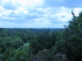
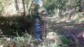
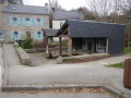
From Mangolérian to Camp de Meucon to bypass Vannes Airport

This route, which involves little change in elevation, will take you around Vannes-Golfe du Morbihan Airport. It skirts the westernmost part of the Meucon camp, where all the buildings are located; this area is safe provided you stay on the described route. It returns via the south of the airport, passing not far from the César camp (viewpoint).

Details

67537193
Creation:
Last update:
Last review:
  • Walking
    Activity: Walking
  • ↔
    Distance: 8.53 mi
  • ◔
    Average duration: 4h 10 
  • ▲
    Difficulty: Moderate

  • ⚐
    Back to start: Yes
  • ↗
    Ascent: + 236 ft
  • ↘
    Descent: - 253 ft

  • ▲
    Highest point: 489 ft
  • ▼
    Lowest point: 266 ft

Description of the walk

Park on Allée de Mangolérian, not on the road of the same name.

(S/E) Join the road and follow it to the left for a good fifty metres, then take a path on the right and another on the right a few dozen metres further on. Pass Vannes Airport on your left, going via Brémentec, then, continuing to the right, Le Cosquer. Cross a small stream, Le Linuanten, and reach the first houses of Hent Coët.

(1) Turn left, carry on straight ahead at the junction, then, as the road bends to the right, follow the path on the left which leads onto the road heading towards Kermouël. Follow it to the right, continue to the left at the Fork in the road, then turn sharply left to reach Kerolivier.

(2) Turn right towards the north. At the crossroads, carry on straight ahead, following the road’s extension along the path. At the fork in the path, take the path on the left for about 150 m before turning left onto a path that bends to the right, crosses a road and then runs alongside thefirst houses of the camp.

(3) The track leads to the right before veering due west and ending at a wider path. Take this path on the left and continue straight on to the edge of the camp. Head left, towards the east, to reach the road and follow it to the right, due south, to pass in front of the camp’s main entrance.

(4) Continue to the left, skirting the camp, then, after the sewage treatment plant, take the path heading west-south-west. At the road, carry on straight ahead, ignoring Petit Kersinon on the right, and continue until you find a path on the left.

(5) Take this path, then turn right as soon as possible. Walk past the Kerbotin stables on your right. The path bends to the right, then takes a wide curve to the left before running alongside Rue Clément Ader until you reach Rue Anne-Marie Le Luherne. Continue for 20 metres.

(6) Follow the path on the right, which quickly heads south, then winds its way eastwards to reach Mangolérian (S/E).

Waypoints

  1. S/E : mi 0 - alt. 404 ft - Mangolérian
  2. 1 : mi 1.85 - alt. 443 ft - Le Hent Coët
  3. 2 : mi 2.95 - alt. 446 ft - Kerolivier
  4. 3 : mi 3.92 - alt. 472 ft - Proximity to the camp
  5. 4 : mi 4.96 - alt. 472 ft - Main entrance to Camp Meucon
  6. 5 : mi 6.3 - alt. 440 ft - Path on the left
  7. 6 : mi 7.15 - alt. 430 ft - Path on the right.
  8. S/E : mi 8.53 - alt. 404 ft - Mangolérian

Notes

The Meucon campis strictly off-limits to the public, with‘NO ENTRY’ signs posted every 50 metres.

Themilitary campofthe 3rdMarine InfantryRegiment(RIMA) is a sensitive site wherecombatexercises take place daily.Explosive fire,grenade throwing,scaled-down mortarfiringand small-arms firing: the hundred or so military personnel present on average each day at the camp train with dedication and professionalism.

Reviews and comments

4.5 / 5
Based on 2 reviews

Reliability of the description
4.5 / 5
Ease of following the route
4.5 / 5
Route interest
4.5 / 5
User 30932264

Overall rating : 4.3 / 5

Date of your route : Sep 07, 2026
Reliability of the description : ★★★★☆ Good
Ease of following the route : ★★★★☆ Good
Route interest : ★★★★★ Very good
Very busy route : No

Top

Machine-translated

Pascal C56
Pascal C56
• Edited:

Overall rating : 4.7 / 5

Date of your route : Jun 01, 2025
Reliability of the description : ★★★★★ Very good
Ease of following the route : ★★★★★ Very good
Route interest : ★★★★☆ Good
Very busy route : No

It’s quite an original route, offering an insight into part of the airport’s history during the Second World War. And if you do it at the weekend, you might just get to see the parachutists circling as they make their way back to their base at the airfield. Gravel, tracks and paths with a bit of tarmac – it’s varied and easy, the only tricky bit being a short, steep climb on the way back to Mangolérian, where it’s very easy to park.
We really enjoyed this route!

Machine-translated

Other walks in the area

For more walks, use our search engine .

The GPS track and description are the property of this route's author. Please do not copy them without permission.