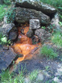
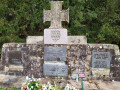
La Héllandière in Mézières-sur-Couesnon

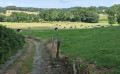
Starting from Mézières-sur-Couesnon, this walk takes you along the sunken and/or leafy paths of the Couesnon Valley. The route is relatively easy, following well-marked paths (except for the first 500 metres), making it suitable for families.

Details

14225893
Creation:
Last update:
Last review:
  • Walking
    Activity: Walking
  • ↔
    Distance: 5.91 mi
  • ◔
    Average duration: 3h 00 
  • ▲
    Difficulty: Easy

  • ⚐
    Back to start: Yes
  • ↗
    Ascent: + 295 ft
  • ↘
    Descent: - 282 ft

  • ▲
    Highest point: 351 ft
  • ▼
    Lowest point: 141 ft

Description of the walk

Coming from the centre of Mézières, follow the D102 towards Saint-Ouen-des-Alleux. The car park is 100 metres on the right after the cemetery.

(S/E) Leave the car park with your back to the road. For the first few metres, the path is marked only by the flattened grass. You will soon reach the Ruisseau de la Motte, which you follow. You will come to a small road; turn left onto it and follow it for about 150 metres. Continue along the path on the right.

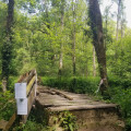
(1) As you approach Ville Olivier, turn right to cross the stream via the footbridge. Cross a road and take the path on the left opposite, which runs alongside the Ruisseau de la Motte.
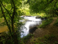
At the confluence with the Couesnon, ignore the footbridge on the left and carry on straight ahead, following the Couesnon at varying distances for about 1.5 km. When you reach a road, follow it to the left.

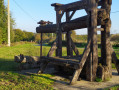
(2) In front of the Moulin de Mézières, turn right to follow the north-south path. As you approach La Chaîne, turn left onto the path which leads to a small country lane. Follow it to the right and continue straight on until you reach the Croix du Mail crossroads (granite cross on the left-hand side).

(3) Cross the road and carry on straight ahead. Before the path bends to the left, take the path on the right. Cross the D 23 road with care and carry on straight ahead. You will reach La Hellandière.

(4) Turn left onto the road, then turn right onto the north-west-facing track. At the end of this, keep right to cross the Ruisseau de la Motte again, further down. Further on, the track bends to the right and ends at the D 23. Turn left to enter Mézières via Rue de Saint-Jean.

(5) Opposite the church, turn right, walk alongside the cemetery and you’ll find the car park on your right (S/E).

Waypoints

  1. S/E : mi 0 - alt. 249 ft - Sports hall car park
  2. 1 : mi 0.91 - alt. 180 ft - La Ville Olivier. Towards the banks of the - Couesnon (fleuve)
  3. 2 : mi 2.15 - alt. 148 ft - The Mézières Mill
  4. 3 : mi 3.37 - alt. 312 ft - La Croix du Mail
  5. 4 : mi 4.31 - alt. 312 ft - La Héllandière
  6. 5 : mi 5.72 - alt. 299 ft - Church of Mézières-sur-Couesnon
  7. S/E : mi 5.91 - alt. 249 ft - Sports hall car park

Worth a visit

La Ville Olivier is the starting point for several walks listed on Visorando, allowing you to explore the Couesnon Valley in every direction.

La Ville Olivier is an18th-century château that was rebuilt between 1820 and 1830. Faced with the work required, the last occupants sold the château to the town of Mézières in 1977, which in turn sold it to a property development company to convert it into flats. Today, following the collapse of a floor, the building stands empty.

Reviews and comments

4.6 / 5
Based on 3 reviews

Reliability of the description
4.7 / 5
Ease of following the route
4 / 5
Route interest
5 / 5
Amandinelp
Amandinelp

Overall rating : 4 / 5

Date of your route : Sep 15, 2024
Reliability of the description : ★★★★☆ Good
Ease of following the route : ★★★☆☆ Average
Route interest : ★★★★★ Very good
Very busy route : No

A really lovely walk. As I was relying solely on the route map, I took a wrong turn twice, but that didn’t stop me from finding my way back easily afterwards. A walk along footpaths (with only a short stretch on a road towards the end), ideal for walking your dog (Please note: at the start, there’s a section through the woods with the county road running alongside it).

Machine-translated

rando-dr
rando-dr

Overall rating : 5 / 5

Date of your route : May 04, 2022
Reliability of the description : ★★★★★ Very good
Ease of following the route : ★★★★★ Very good
Route interest : ★★★★★ Very good
Very busy route : No

A lovely route taking in the Ruisseau de la Motte, the Couesnon Valley, woodland and countryside.
Don’t miss a visit to the Château de la Ville Olivier, and be sure to see the Mézières mill too.

An easy route, although the first few hundred metres are a bit stony and steep.
Ideal for families and best enjoyed in fine weather.

Machine-translated

patrick.guilmin@gmail.com

Overall rating : 4.7 / 5

Date of your route : Apr 18, 2022
Reliability of the description : ★★★★★ Very good
Ease of following the route : ★★★★☆ Good
Route interest : ★★★★★ Very good
Very busy route : No

A really lovely walk. Hilly and nothing but paths.

Machine-translated

Other walks in the area

For more walks, use our search engine .

The GPS track and description are the property of this route's author. Please do not copy them without permission.