Exploring the Bois de Munster

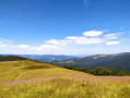
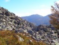
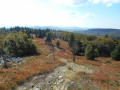
A route with little elevation gain but offering magnificent panoramic views of the peaks of the Hautes-Vosges on several occasions. Passing by two farmhouse inns, it offers the chance to sample regional specialities.

Details

35723592
Creation:
Last update:
Last review:
  • Walking
    Activity: Walking
  • ↔
    Distance: 5.27 mi
  • ◔
    Average duration: 3h 10 
  • ▲
    Difficulty: Moderate

  • ⚐
    Back to start: Yes
  • ↗
    Ascent: + 876 ft
  • ↘
    Descent: - 883 ft

  • ▲
    Highest point: 4,304 ft
  • ▼
    Lowest point: 3,760 ft

Photos

Description of the walk

On the D27, coming from the Route des Crêtes, drive past the Breitfirst car park and park 500 metres further on in a car park on the right-hand side of the road.

(S/E) From the car park, follow the wide path for a few metres before turning right and heading down towards the Biological Reserve and the headwaters of the Lauch.
Further down, turn left to cross the stream and follow the gently ascending path which, after crossing a wide track, leads to the Col d’Oberlauchen, with views over the Sondernach valley.

Blue Disc markings

(1) Turn onto the path furthest to the left. After about 1 km, pass the Blue Cross markings on your right; then, at a Fork in the road, ignore the Red Disc markings on the left and take the right-hand path. Continue due north (Blue Disc) to reach the summit of the Lauchenkopf (1,314 m).

(2) Continue northwards through a beautiful beech forest to reach the Nonselkopf, with a 360° panoramic view.

(3) Carry on climbing towards the Col du Platzerwaesel, without actually reaching it. You’ll arrive at the junction just before it, marked by a post with directional signs.

(4) Turn left and, after about 300 m, join the Route des Crêtes.

Signposting: Red Rectangle with a white cross

Follow it for 200 m before turning right onto the access path to the Ferme-Auberge de Uff Rain. Take care when crossing the road.

(5) Just in front of the farm, leave the access road by taking a path on the left (pedestrian zigzag) and head due south along the path on the left. This leads onto the “Bois de Munster” path, which veers to the right. Then follow the access road on the right, which leads to the Ferme-Auberge du Salzbach.
We’re taking a slight detour from the signposted route by passing by the farmhouse inn to sample some regional specialities.

(6) After going round the farmhouse inn, continue along the path to rejoin the signposted route and head towards the Klein Hahnenbrunnen mountain refuge.

Blue Disc signposting

(7) A few dozen metres before the refuge, take a sharp left. Head into the woods and then onto the D27 county road. Cross it (take care) to reach the car park directly opposite (S/E).


Waypoints

  1. S/E : mi 0 - alt. 4,098 ft - Car park at 1248 - Le Breitfirst
  2. 1 : mi 0.87 - alt. 3,973 ft - Oberlauchen Pass - Col d'Oberlauchen
  3. 2 : mi 1.6 - alt. 4,304 ft - Lauchenkopf summit - Lauchenkopf
  4. 3 : mi 2.03 - alt. 4,157 ft - Summit of the - Nonselkopf
  5. 4 : mi 2.49 - alt. 3,911 ft - Path on the left. - Col du Platzerwasel
  6. 5 : mi 2.96 - alt. 3,848 ft - Uff Rain Farm Inn
  7. 6 : mi 3.94 - alt. 3,763 ft - Salzbach Farm Inn. Towards the - Source de la Fecht
  8. 7 : mi 4.66 - alt. 3,914 ft - Hannenbrunnen Pass - Refuge du Hannenbrunnen
  9. S/E : mi 5.28 - alt. 4,098 ft - Car park at 1248

Notes

Worth a visit

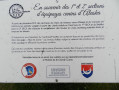
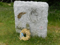
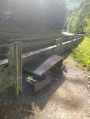
At Breitfirst: Memorial to the Canadian dogs that were so helpful during the Great War (see photo).

Please note: the Uff Rain farmhouse inn is closed on Tuesdays and Wednesdays in summer, and on Mondays and Tuesdays in winter. The Salzbach farmhouse inn is closed on Thursdays; please enquire during winter.

Reviews and comments

4.2 / 5
Based on 3 reviews

Reliability of the description
4 / 5
Ease of following the route
3.7 / 5
Route interest
5 / 5
Milizou
Milizou

Overall rating : 4.3 / 5

Date of your route : Jul 20, 2026
Reliability of the description : ★★★★☆ Good
Ease of following the route : ★★★★☆ Good
Route interest : ★★★★★ Very good
Very busy route : No

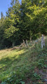
A lovely walk on 20 July 2026 (24°C) with our 10- and 14-year-old children. The walk begins with a descent through a lovely forest and continues with a gentle, very pleasant climb. At the top, there’s a stunning view near the memorial stone. This walk is very picturesque and enjoyable, punctuated by the bells of the Vosges cows as we cross their fields several times. Once at the Uff Rain inn (where the two dogs were running free – they’re certainly very friendly, but we thought it best to mention this for anyone with a fear of dogs – which is the case for our daughter), you mustn’t take the wide path leading uphill to the left, but instead head into the cows’ meadow (the Salzbach signpost is very inconspicuous). Further along the route, near the Salzbach farm, it’s true that the signposted path seems to have disappeared, but you can take another one and continue with the rest of the route as described. It was a lovely walk, with a great ‘mountain’ atmosphere and superb flora to admire.

Machine-translated

Nine 68
Nine 68

Overall rating : 4.3 / 5

Date of your route : Jun 19, 2025
Reliability of the description : ★★★★☆ Good
Ease of following the route : ★★★★☆ Good
Route interest : ★★★★★ Very good
Very busy route : Yes

Located on the ridge road, which is inevitably very busy. At the Salzbach farm, we stayed on the GR trail, as the path no longer seems to exist. The Uffrain inn is very busy. Beautiful views and very pleasant temperatures. Hike accessible to all levels.

Machine-translated

Pascal S
Pascal S

Overall rating : 4 / 5

Date of your route : Sep 25, 2023
Reliability of the description : ★★★★☆ Good
Ease of following the route : ★★★☆☆ Average
Route interest : ★★★★★ Very good
Very busy route : No

A wonderful walk in the hills, alternating between woodland and meadows. All this with a magnificent view of the Route des Crêtes on one side and the Petit Ballon on the other. One minor criticism: after the Uff-Rain farmhouse inn, the route follows a path that no longer exists, but if you head a little further uphill, you’ll come back onto an existing path.

Machine-translated

Other walks in the area

For more walks, use our search engine .

The GPS track and description are the property of this route's author. Please do not copy them without permission.