


FLOCH

 Visorando Member
 Moderator
 Premium user
- Location: Quimper (29000)
- Gender: man
Sign up:
Published route(s)
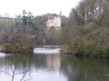
 Brunec Nature Reserve, Étang du Moros and Kériolet Castle
 5.79 mi
 +364 ft
 -354 ft
 3h 00
 Moderate
 Departure from Concarneau (Finistère)
From the village of Beuzec-Conq, a district of the town of Concarneau, which was formerly a separate commune merged with Concarneau in 1945. It is situated to the north-east of Concarneau, about 3 km away. Head down a small country road to the old Moulin de la Haie, which was one of the many water mills once in operation. Continue along a lovely wooded path, then head towards the Brunec water reservoir before overlooking first the left and then the right bank of Étang du Moros.A final shaded climb alongside a stream, passing an old fountain, then leads along a small road to the grounds of Kériolet Castle.
Towpath along the River Odet and the Bois du Corniguel
 2.64 mi
+128 ft
-121 ft
1h 20
 Easy
Departure from Quimper (Finistère)
A peaceful walk that starts on the towpath on the right bank of the Odet and offers a view of Lanniron Castle on the opposite bank. You can also see Corniguel Harbour and its facilities on the right bank. The route criss-crosses the Bois du Corniguel. The return journey takes you along quiet little streets behind the river. The route is more enjoyable at high tide (when birds are present).
Walk around Port du Corniguel
 3.42 mi
+95 ft
-95 ft
1h 40
Easy
Departure from Quimper (Finistère)
A route starting from Port du Corniguel, Quimper Harbour, with its associated activities. The route initially follows Kérogan Bay before continuing along a cove of the River Odet. A round trip takes you past Kéraval Castle, one of the many castles overlooking this river. The return journey takes you through a lovely woodland.
Walk via the Étang de Kerbernez, one bank of the Odet and the Anse de Kerdour
 2.57 mi
+49 ft
-49 ft
1h 15
Easy
Departure from Plomelin (Finistère)
An easy walk, largely in the shade, along the Kerbernez Golf Course, passing by the Trois Tourtes viewpoint. Walking round the pond allows you to watch the mallards darting between the two banks as walkers pass by. The section open from1 April to 30 September offers lovely views of the banks of the Odet. The route is suitable for families, though not for pushchairs.
Please note: the section along the Odet at the ‘4 ’ viewpoint is closed off by a barrier from1 October to 31 March: this is a protected area for wintering birds.
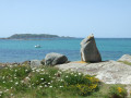
Land and sea around Trévou-Tréguignec
 4.81 mi
+217 ft
-220 ft
2h 25
Easy
Departure from Trévou-Tréguignec (Côtes-d'Armor)
After passing through the Trestel Marshes nature reserve and the woodland overlooking it to the west, this route follows sections of the GR®34 via the small ports of Kériec and Le Goff. A lovely finish at Trestel’s fine-sand beach. Panoramic views of Île Tomé and the bird sanctuary of the Archipelago of the Seven Islands.
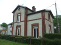
Ponds, countryside and greenway around Rosporden
 7.03 mi
+164 ft
-174 ft
3h 25
Moderate
Departure from Rosporden (Finistère)
Rosporden is known as the “town of ponds”.
After a tour of the ponds, the route continues through the Rosporden countryside to the Locjean Chapel. The return journey follows the greenway and the edge of the ponds.
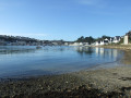
Port of Audierne from the maritime district of Plougoazec in Plouhinec
 4.22 mi
+115 ft
-135 ft
2h 00
Easy
Departure from Plouhinec (Finistère)
Audierne has a long tradition as a fishing port: first sardines, then lobsters caught in pots. After a decline in this type of fishing, in the summer months, the boats are rigged for albacore tuna fishing. In 1966, the Poulgoazec fish market was created on the other bank of the Goyen. After 1986, trawlers deserted the port of Audierne for that of Douarnenez, which was more accessible and better equipped.Currently, the main activity is line fishing and net fishing, which coexist with the increasing number of pleasure boats. This route passes through the two ports on either side of the Goyen estuary.
Urban route and green spaces in Briec
 3.46 mi
+187 ft
-190 ft
1h 45
Easy
Departure from Briec (Finistère)
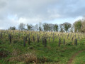
Urban route in Briec and discovery of several green spaces: Anita Conti Park with its fitness and orienteering trail, the future 8.7-hectare urban forest where 7,500 trees have been planted since 2024. The route offers several benches for resting and areas with children's games and picnic tables.
Countryside and woods around Plogastel-Saint-Germain
 6.70 mi
+427 ft
-427 ft
3h 25
Moderate
Departure from Plogastel-Saint-Germain (Finistère)
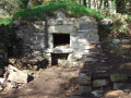
This route, along small roads and wooded paths, largely combines two small routes around the village of Plogastel-Saint-Germain:
Wooded circular in Plogastel-Saint-Germain.
- Around the village of Plogastel-Saint-Germain via the Bois du Quilliou (in the opposite direction).
Circular in the Langolen countryside
 7.04 mi
+636 ft
-650 ft
3h 50
Moderate
Departure from Langolen (Finistère)
This route alternates between small country roads and sunken paths, some of which are steep-sided. The hike, which follows a hilly route, takes you through numerous wetlands and meadows where horses and cattle graze. From the heights, there is a wide panorama of the Montagnes Noires.
Circular around the village of Langolen
 3.87 mi
+344 ft
-351 ft
2h 05
Easy
Departure from Langolen (Finistère)
This route takes you through a small part of the countryside south of Langolen along impressive sunken lanes before reaching the Odet river as it flows through a fish farm. Return to the village via Saint-Guthien Church.
Wooded circular in Plogastel-Saint-Germain
 3.54 mi
+128 ft
-138 ft
1h 45
Easy
Departure from Plogastel-Saint-Germain (Finistère)
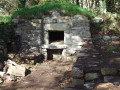
In the countryside around Plogastel-Saint-Germain, this short route mainly follows paths lined with wooded embankments and passes through small woods and wetlands, which can be crossed via a long wooden walkway.
During the walk, you’ll discover an old bread oven saved at the last minute, the house of a former farmstead and a stone washhouse.
Locronan countryside and edge of Bois du Névet
 6.72 mi
+472 ft
-463 ft
3h 30
Moderate
Departure from Locronan (Finistère)
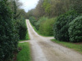
After passing through the countryside north-west of Locronan, this route turns south-west and ends at the edge of the Bois du Névet. It continues mainly along the edge of the forest before returning to Locronan.
The small troménie route of Locronan
 3.87 mi
+453 ft
-453 ft
2h 10
Easy
Departure from Locronan (Finistère)
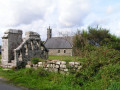
Every six years, Locronan hosts "la Grande Troménie", an unchanging pilgrimage of around 12 km around the sacred boundaries of the former monastery of Locronan. The last one took place in July 2025.
The "Petite Troménie" takes place annually, during the five years between two Grande Troménies. It only follows small roads. This route follows this route.
Between sea and land around Pointe de Trévignon
 6.09 mi
+59 ft
-59 ft
2h 50
Easy
Departure from Trégunc (Finistère)
From the coastal house, take the GR®34 towards Pointe de Trévignon and its small harbour, not forgetting the imposing lifeboat shelter on its launch ramp and the small lighthouse at the end of the breakwater sheltering the harbour. At the very tip, look out for the old fort and private castle. Continue along the coastal path, passing beautiful beaches that are also popular with surfers.
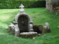
Turn your back on the sea and venture into the beautiful country lanes: tranquillity guaranteed. Discover the hamlet of Saint-Philibert with its chapel and beautiful votive fountain. End your walk in the small hamlets that have preserved some of their characteristic dwellings.
Karreg an Tan (Roche au Feu) and the countryside around Gouézec
 6.27 mi
+814 ft
-837 ft
3h 35
Moderate
Departure from Gouézec (Finistère)
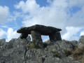
Two loops in Gouézec: at an altitude of 279 m, one of the highest points in the Montagnes Noires, the Karreg an Tan summit offers a beautiful 360° panorama of the Aulne valley, the Monts d'Arrée and the Bay of Douarnenez.Its name comes from the fact that, during the Norman invasions in the 9th century, a lookout would light a fire there to warn the population, which could be seen from across the Châteaulin basin. Back at the car park, a second loop leads through the countryside in the lower part of Gouézec.
Moulin Neuf Pond from Bonne Nouvelle Chapel
 6.35 mi
+157 ft
-157 ft
3h 05
Easy
Departure from Plonéour-Lanvern (Finistère)
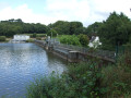
From the Bonne-Nouvelle Chapel, Kelou Mad in Breton, a route along a sunken lane and path bordering a wetland area where the Pont-l'Abbé River flows after passing through the Moulin Neuf reservoir leads to the edge of this body of water. The route continues around this reserve, created in 1977 to supply drinking water to eleven municipalities in the Pont-l'Abbé region. Visitors can enjoy the peaceful, shaded surroundings and take the time to observe the birds that frequent this stretch of water.
Garden and banks of the Moros from Cadol Chapel
 2.98 mi
+128 ft
-151 ft
1h 30
Easy
Departure from Melgven (Finistère)
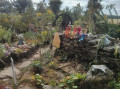
Starting from Saint-Grégoire Chapel, one of the five chapels in Melgven, this short route takes you to a beautiful garden, created during the Covid pandemic, which continues to improve: a real gem for passers-by.The return journey takes you along a fun route beside the Moros stream, where there are more surprises to discover. Many thanks to the people who have created these beautiful features, tucked away in the countryside, for us to enjoy free of charge.
Between the north and south of Pont-l'Abbé
 7.09 mi
+108 ft
-108 ft
3h 20
Moderate
Departure from Pont-l'Abbé (Finistère)
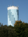
This route from north to south of Pont-l'Abbé allows you to discover pieces of the town's history. The Saint-Jacques de Lambour Chapel with its decapitated bell tower is a reminder of the Red Cap Revolt of 1675. The greenway follows a section of the old Transbigouden railway line that linked Pont-L'Abbé to Quimper and operated until 1963 the Château des Barons, built in the 13th and 14th centuries by the Barons of Pont, who became powerful lords, the inhabited bridge and, finally, the 19th-century towpath , built to cope with an increase in traffic and tonnage in the port.
Around Port Manec'h
 4.46 mi
+184 ft
-157 ft
2h 15
Easy
Departure from Névez (Finistère)
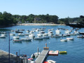
From the Saint-Nicolas Chapel in the heart of the seaside town of Port Mananec'h, this route descends to the beach, running alongside it at a height before joining the coastal path followed by the GR® 34. After a slightly steep section, the hike continues inland to reach a cove of the Karstic Cave and then the river, which you follow to Port Manec'h.
Walk in Landévennec
 2.87 mi
+115 ft
-108 ft
1h 25
Easy
Departure from Landévennec (Finistère)
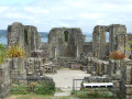
Landévennec is well known for its new Saint-Guénolé Abbey, inaugurated in 1958, which attracts many worshippers, as well as for the ruins of the 10th-century Romanesque abbey church and its museum. The village is located at the confluence of the Aulne and Rivière du Faou rivers and offers a beautiful walk, best enjoyed at high tide.
On the heights of Pointe de Séhar
 3.14 mi
+210 ft
-207 ft
1h 40
Easy
Departure from Trédrez-Locquémeau (Côtes-d'Armor)
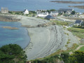
After following the coastline, this route takes you up to a higher point to discover Pointe de Séhar and the port of Locquemeau via a section of the GR®34 trail. Beautiful views of Lannion Bay.
On the heights of Locquémeau
 2.33 mi
+226 ft
-226 ft
1h 15
Easy
Departure from Trédrez-Locquémeau (Côtes-d'Armor)
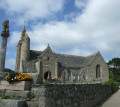
Locquémeau is known for its seaside. This short circuit takes you on a journey of discovery through the hinterland, passing through the small village and its beautiful church. You will also discover a discreet covered alley at the top of a cairn.
Pointe and site of Dourven near Locquemeau
 4.15 mi
+495 ft
-495 ft
2h 20
Easy
Departure from Trédrez-Locquémeau (Côtes-d'Armor)
The GR®34 leads to the Dourven site, which has unfortunately been partially disfigured since Storm Ciaran in November 2023, but still retains its charm for its views. The coastal path passes near Saint-Quiriou or Kirio Beach and its fountain. The rest of the route follows small roads to the village of Locquémeau and its beautiful church.
Please note: GR® diversion, see here.
Countryside and banks of the Aven and Belon rivers via the Port de Rosbraz
 6.66 mi
+446 ft
-472 ft
3h 25
Moderate
Departure from Riec-sur-Belon (Finistère)
After a peaceful walk along small country roads to discover the Allée Couverte Arc Boutée de Kerantiec, this circuit joins the karstic cave at the Rosbraz marina. The return via the GR®34 overlooks the left bank of the Aven and then the right bank of the Belon, offering views of the opposite bank of each river.
The Eckmühl Lighthouse and the Chapel of Notre-Dame de la Joie from Kérity
 3.06 mi
+10 ft
-10 ft
1h 25
Easy
Departure from Penmarch (Finistère)
From the port of Kérity, this short route takes you to Pointe de Penmarch with its imposing Eckmül lighthouse and the Notre-Dame de la Joie chapel perched right on the seafront. The return journey follows the old railway line that linked Pont-l'Abbé and Saint-Guénolé, back to Kérity and the Church of Sainte-Thumette.
Ridge, Lake Drennec and countryside from the Mougau Bihan passage grave.
 6.43 mi
+640 ft
-653 ft
3h 30
Moderate
Departure from Commana (Finistère)
Starting from the beautiful Mougau Bihan covered walkway in Commana, this route crosses the nearby peat bog and then climbs up to a ridge on Mont-d'Arrée. Following this ridge, you reach the shores of Lake Drennec before returning along small country roads.
Countryside and coastal path around Trédrez
 3.21 mi
+351 ft
-351 ft
1h 45
Moderate
Departure from Trédrez-Locquémeau (Côtes-d'Armor)
From the small village of Trédrez, where the memory of Saint-Yves still lingers, shaded paths lead to the GR®34 near Saint-Michel-en-Grève. The route then follows a section of the Trédrez Cliffs route before, after a fairly steep climb, joining a small country road and arriving opposite the imposing Church of Notre-Dame-de-Trédrez.
Coastal and countryside trail via Pointe de Séhar
 4.77 mi
+361 ft
-338 ft
2h 30
Moderate
Departure from Trédrez-Locquémeau (Côtes-d'Armor)
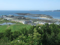
After crossing the Port of Locquémeau and the Pointe de Séhar, the route follows part of the GR®34 towards the Trédrez cliffs. The return journey is via small country roads, offering views of beautiful traditional buildings.
Mougau peat bog and the Commana ridges
 4.38 mi
+453 ft
-456 ft
2h 25
Moderate
Departure from Commana (Finistère)
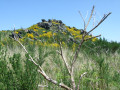
After a visit to the beautiful Mougau Vihan covered walkway, there is a long stretch through the neighbouring bog (with well-maintained boardwalks) before beginning the climb up to the ridge: discover the cross (Croaz Mélar) and its history, followed by a gentle descent.
Seaside, built-up areas and countryside in Loctudy
 7.17 mi
+23 ft
-23 ft
3h 20
Moderate
Departure from Plobannalec-Lesconil (Finistère)
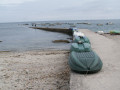
This flat route combines sections of coastal paths (GR®34 ), at least where the path is not diverted from the seafront due to buildings encroaching on the coastline, with small roads linking built-up areas to the countryside. A lovely touch of local heritage comes in the form of two small, unassuming chapels, each with its own votive fountain.
The walk around the Bois du Moustoir from Saint-Évarzec
 3.08 mi
+161 ft
-180 ft
1h 35
Easy
Departure from Saint-Évarzec (Finistère)
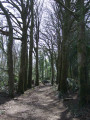
Starting from the village of Saint-Évarzec and passing through “ParK Sant Primel”, this short circular route leads to the Bois du Moustoir, which it circles. This woodland is a natural area comprising a forest of deciduous and coniferous trees, as well as a pond much loved by anglers. Covering just over 20 hectares, it is one of the largest woodlands in the Pays Fouesnantais.
Surroundings of the village of Plomelin
 4.16 mi
+108 ft
-115 ft
2h 00
Easy
Departure from Plomelin (Finistère)
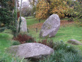
A walk along the western and then north-eastern edges of the village of Plomelin, through a mix of built-up areas and countryside. Several tree-lined paths enhance this route, which is particularly recommended in autumn. Three heritage sites: menhirs, the chapel and the fountain.
Randoligo in Plomelin
 7.61 mi
+374 ft
-381 ft
3h 50
Moderate
Departure from Plomelin (Finistère)
The “Oligocyte Bretagne” Association provides information on brain tumours, supports patients and their families, and funds medical research into innovative treatments. Every year, it organises a day of walks called “Randoligo”. Here is a suggested route for its tenth anniversary in Plomelin in October 2024, taking in the countryside, woodland and the banks of the Odet with its castles.
Combrit Cove and the Lestremeur site
 5.19 mi
+213 ft
-184 ft
2h 35
Easy
Departure from Plomelin (Finistère)
A route through the woods along the Anse de Combrit and the banks of the Odet, passing through the Lestremeur site: manor house, dovecote, fountain and bread oven.
Return via small roads lined with majestic beech trees.
Through the Beg Meil bocage
 7.18 mi
+66 ft
-79 ft
3h 20
Moderate
Departure from Fouesnant (Finistère)
The Pointe de BegMeil is bordered by the sea, yet this route turns its back on it.This circuit offers the chance to discover another aspect: the bocage. Walk along sunken lanes, through hamlets and past old farms, bordering the Mousterlin Marshes in places.
In the footsteps of Proust in Beg Meil
 2.19 mi
+43 ft
-39 ft
1h 05
Easy
Departure from Fouesnant (Finistère)
The writer Marcel Proust and the musician Reynaldo Hahn stayed at Beg-Meil from 8 September to 27 October 1895: a life of daydreaming by the sea and leisurely strolls through a landscape of remarkable beauty. Simple pleasures: the seaside and country life.
This walk will take you on a journey through Beg-Meil as it was in those days, taking in the former Hôtel Fermon where he stayed, the terrace at La Cale where he loved to write, and the beaches where he used to relax!
Around Lilia in Plouguerneau
 7.47 mi
+26 ft
-26 ft
3h 25
Moderate
Departure from Plouguerneau (Finistère)
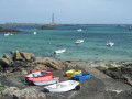
Lilia, a district of Plouguerneau, offers a coastal walk that allows you to discover various aspects of the seaside: beaches, rocky shores and dunes.
Numerous islets dot this coastline: Île Vierge with its imposing lighthouse, Île Wrac’h where another, more modest lighthouse has been built, and all the others, which have often been occupied by seaweed gatherers.
This walk also passes through three small harbours and offers a view of the mouth of the Aber Wrac’h, the largest of the three abers on this stretch of the northern coast of Finistère.
Land and sea around the Saint-Michel Chapel in Plouguerneau
 7.67 mi
+30 ft
-30 ft
3h 35
Moderate
Departure from Plouguerneau (Finistère)
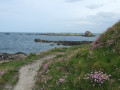
This walk, which can be split into two circular routes, invites you to discover different aspects of the wild coast of Plouguerneau: pebble beaches or white sandy beaches, an easy coastal path, rock formations and dunes, small harbours, and a chapel. This route is watched over by the 82.5-metre-high Île Vierge Lighthouse.
Paul Sérusier and Aulne River Circuit in Châteauneuf-du-Faou
 2.24 mi
+207 ft
-203 ft
1h 15
Easy
Departure from Châteauneuf-du-Faou (Finistère)
The municipality of Châteauneuf-du-Faou wanted to pay tribute to the painter Paul Sérusier, who stayed there and then lived there from 1906 until his death in 1927: creation of a museum, which opened in June 2025, and installation of a trail punctuated by eight information panels passing through places that were sources of inspiration for him.A walk along the banks of the River Aulne and through the woods completes the trail.
GR®34 via the Pointes de Dinan and Lostmarc'h and return through the countryside
 10.47 mi
+689 ft
-682 ft
5h 25
Moderate
Departure from Crozon (Finistère)
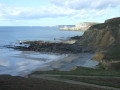
From the beaches of Kersiguénou and Goulien in Crozon, this route climbs up the cliff to reach Château de Dinan, a huge rock connected to the headland by an arch carved out by the sea, and Pointe de Dinan, offering beautiful views of Pointe de Pen-Hir in Camaret and its famous rocks, the Tas de Pois. It continues to the next point, Lostmarc'h and its barred spur.
The return journey takes you through dunes, moors and carriage roads linking hamlets that have often been restored.
Land and sea via Le Pouldu, departing from Cohars-Carnoët
 12.55 mi
+305 ft
-315 ft
6h 00
 Difficult
Departure from Clohars-Carnoët (Finistère)
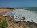
At the end of the 19th century, following Pont-Aven, Le Pouldu in Clohars-Carnoët became a refuge for several painters from the Pont-Aven School, such as Paul Gauguin, Meyer de Haan, Paul Sérusier, Charles Filiger and many others. The seaside and the lush countryside inspired these artists, who captured them in their paintings.The countryside sections have retained many lovely, shaded sunken paths. Three restored chapels and a windmill add a lovely heritage touch to this walk.
In the rolling countryside of Plozévet and Pouldreuzic
 7.19 mi
+364 ft
-348 ft
3h 35
Moderate
Departure from Pouldreuzic (Finistère)
Route through the countryside of two neighbouring municipalities, along paths between fields and small roads offering regular views of the sea.Beautiful religious heritage along the way: chapels and calvaries.
Poulguidou Pond, Lambabu Chapel from Mahalon
 6.83 mi
+256 ft
-226 ft
3h 20
Moderate
Departure from Mahalon (Finistère)
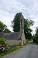
A route through the wooded countryside of Mahalon, passing through a protected area for water catchment – the Poulguidou Pond – and the well-preserved hamlet of Lambabu.Fountains, a chapel and a cross bear witness to this village’s past.
Please note: The bridge over the Goyen has collapsed. Head to Mahalon via Landudec, then Guiler-sur-Goyen.
Route megalithique from Pointe de la Torche
 6.76 mi
+33 ft
-39 ft
3h 10
Moderate
Departure from Plomeur (Finistère)
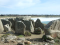
Starting at Pointe de la Torche, dominated by its eroded tumulus which reveals a dolmen and the remains of a covered passageway, the route runs along the coast and past the famous rocks of Saint-Guénolé.
Other megalithic monuments dot this route.
Grand Tour of Plogoff
 14.52 mi
+1,499 ft
-1,480 ft
8h 00
Difficult
Departure from Plogoff (Finistère)
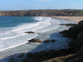
This long hike combines two routes already available on Visorando: “Land and Sea around Plogoff” and “Tour of Pointe du Raz from Plogoff”.It takes you past some of the most iconic spots in this town at the tip of Finistère: Baie des Trépassés, Pointe du Raz and the sheltered harbours of Bestrée, Feunteun Aoad and Pors Loubous, not to mention the beautiful architectural heritage, including two chapels.
Pont-l’Abbé River, Croaziou Chapel and Kérazan Manor
 7.19 mi
+46 ft
-46 ft
3h 20
Moderate
Departure from Pont-l'Abbé (Finistère)
After starting on the towpath, the route continues alongside the Rivière de Pont-l’Abbé.
The return journey takes you through the countryside, where you can discover a chapel and two manor houses.
The Plozévet countryside and the seaside via Penhors
 6.86 mi
+102 ft
-102 ft
3h 15
Moderate
Departure from Plozévet (Finistère)
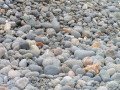
Chapels, an old mill, unspoilt countryside, a restored bread oven and the seaside via the small port of Penhors and its pebble beach. Return via paths through the fields.
Walk around Pointe du Raz from Plogoff
 10.17 mi
+1,148 ft
-1,148 ft
5h 40
Moderate
Departure from Plogoff (Finistère)
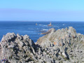
From the village of Plogoff, approach the famous Pointe du Raz from the north via the coastal path that climbs up from the Baie des Trépassés: a beautiful view of the Raz de Sein, the Vieille lighthouse and, further afield, the Île de Sein. The route continues along the south coast following the GR® ®34.
Loop via Kérity, the Pointe de Penmarch and the old Birinik train line
 6.77 mi
+30 ft
-30 ft
3h 10
Moderate
Departure from Penmarch (Finistère)
From the market town of Penmarch, this route leads to the seafront, past the Port de Kérity, the Pointe de Penmarch with its imposing Eckmül lighthouse, and the Chapel of Notre-Dame de la Joie right on the seafront. The return journey takes you along the old railway line between Pont-l'Abbé and Saint-Guénolé.