Mougau peat bog and the Commana ridges

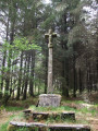
After a visit to the beautiful Mougau Vihan covered walkway, there is a long stretch through the neighbouring bog (with well-maintained boardwalks) before beginning the climb up to the ridge: discover the cross (Croaz Mélar) and its history, followed by a gentle descent.

Details

74332655
Creation:
Last update:
Last review:
  • Walking
    Activity: Walking
  • ↔
    Distance: 4.38 mi
  • ◔
    Average duration: 2h 25 
  • ▲
    Difficulty: Moderate

  • ⚐
    Back to start: Yes
  • ↗
    Ascent: + 453 ft
  • ↘
    Descent: - 456 ft

  • ▲
    Highest point: 1,096 ft
  • ▼
    Lowest point: 682 ft

Photos

Description of the walk

Park in the car park near the Mougau Bihan covered walkway.

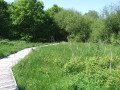
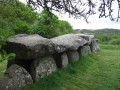
(S/E) From the car park, take the path leading to the covered walkway and take the time to explore it, trying to spot the engravings on the pillars (not easy to make out). With your back to the covered walkway, cross the road and enter the bog to follow the interpretive route (a long route along a superb boardwalk that winds through the bog). Continue until you reach a junction on a stony path.

 Yellow markings

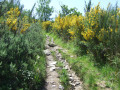
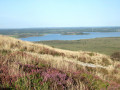
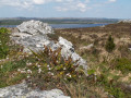
(1) Leave the bog route, turn left at a right angle and head up towards the ridge line along a path through heather, broom and ferns. This climb is quite steep but steady on a stony path (schist). You’ll emerge onto the ridge, where you’ll find the PR® “Les Pierres Bleues” (viewpoint over Lake Brennilis and the Tuchenn Kador peak at 385 m, which obscures the summit and Saint-Michel Chapel).

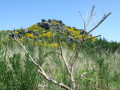
(2) Turn right and follow the ridge, which offers afine view of Commana and the surrounding countryside. Pass close to old slate quarries hidden amongst the vegetation. Continue to the Croas Mélar crossroads (signposted).

(3) Carry on straight ahead along a wide, carriageable track that winds down through a woodland; after about a hundred metres, look out for the monumental cross known as Croaz Mélar amongst the fir trees – there is a path leading to it.

 (4) Retrace your steps back to the Croaz Mélar crossroads (Croas on the map).

(3) Turn left, begin a steady descent along a narrow path lined with broom and arrive at an area of fields and meadows.

(5) At the PR® fork in the road, take the right-hand branch and continue until you reach a road.

(6) Ignore the road leading to the hamlet of Roscoat and its imposing farm, and carry on straight ahead along the road for about 400 m.

(7) Take a sharp right-hand bend onto a stony track to re-enter the peat bog and return to the fork in the path from the outward journey.

(1) Turn left and, following the route in the opposite direction to the outward journey, return to the car park at the covered walkway at Mougau Bihan (S/E). 

Waypoints

  1. S/E : mi 0 - alt. 692 ft - Car park at the Mougau Bihan covered walkway - Allée Couverte de Mougau Bihan
  2. 1 : mi 0.6 - alt. 778 ft - Crossroads on the circular loop
  3. 2 : mi 1.2 - alt. 1,073 ft - Ridge
  4. 3 : mi 2.21 - alt. 925 ft - Croaz Mélar crossroads
  5. 4 : mi 2.26 - alt. 902 ft - Croaz Mélar
  6. 5 : mi 2.87 - alt. 768 ft - PR junction
  7. 6 : mi 3.24 - alt. 719 ft - Road junction
  8. 7 : mi 3.46 - alt. 689 ft - Junction leading to the bog
  9. S/E : mi 4.38 - alt. 692 ft - Car park at the Mougau Bihan covered walkway - Allée Couverte de Mougau Bihan

Notes

Between (1) and (2), the climb is quite steep but steady.

There are numerous information boards in the peat bog.

Worth a visit

Always be cautious and plan ahead when you're outdoors. Visorando and the author of this route cannot be held responsible for any accidents occurring on this route.

The GR® and PR® markings are the intellectual property of the Fédération Française de Randonnée Pédestre.

Reviews and comments

4.8 / 5
Based on 3 reviews

Reliability of the description
5 / 5
Ease of following the route
4.7 / 5
Route interest
4.7 / 5
User 25125212

Overall rating : 5 / 5

Date of your route : Jul 06, 2026
Reliability of the description : ★★★★★ Very good
Ease of following the route : ★★★★★ Very good
Route interest : ★★★★★ Very good
Very busy route : No

A lovely walk – the peat bog creates a rather surprising atmosphere
The climb is quite long but not too difficult; it’s the stones that are the most troublesome, but once at the top, it’s lovely. And a picnic near the large, magnificent covered walkway rounds off a lovely day
I’d recommend it even though it isn’t very long

Machine-translated

Mary2309
Mary2309

Overall rating : 5 / 5

Date of your route : Jun 08, 2025
Reliability of the description : ★★★★★ Very good
Ease of following the route : ★★★★★ Very good
Route interest : ★★★★★ Very good
Very busy route : No

A lovely walk with beautiful views over the ridges.
The narrow, stony path climbs steeply at the start, after the footbridges, but the rest of the walk is easy and offers lovely scenery.

Machine-translated

Bernes29
Bernes29

Overall rating : 4.3 / 5

Date of your route : May 26, 2025
Reliability of the description : ★★★★★ Very good
Ease of following the route : ★★★★☆ Good
Route interest : ★★★★☆ Good
Very busy route : No

A lovely walk
The peat bog is very well explained and documented
Lovely scenery from the ridges
It’s very pleasant in the sunshine

Machine-translated

Other walks in the area

For more walks, use our search engine .

The GPS track and description are the property of this route's author. Please do not copy them without permission.