Country:
 City:
City:


Head to the village of Plomelin, where you’ll find the Espace Kerné sports centre, opposite the Lucie Aubrac State Primary School. Plenty of parking spaces.
(S/E) Opposite the school, turn left towards Hent Kerfram; follow this road to the left for about 50 metres, then turn right onto Hent Éric Tabarly to enter a residential area. Ignore a road on the left and, just after that, look out for the start of a footpath between the houses.
Blue signposting
(1) Turn left onto this path which winds its way between the houses, cross Hent Jacques Cartier, and at the end, turn right to reach a small roundabout. Continue left until you reach the community gardens.
Yellow signposting
(2) Turn left, ignore the side paths and carry on along the small road towards Kergoad Farm.
(3) Continue straight on along a wooded path until you reach a small road at a place called Ti Pin.
No signposting
(4) Turn left onto this road and follow it through the woods until you reach the D20, Route des Châteaux.
(5) Cross this district road with care and turn immediately right to follow the footpath running parallel to the road as far as the entrance pillars to Kerouzien (signposted ‘centre équestre’).
Yellow markings
(6) Turn left onto the small road (30 km/h speed limit) and head downhill to a small car park on the left, just before entering the woods.
GR® ®34 andGR®38White and Red
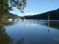
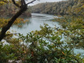
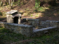
(7) At the signpost, follow the coastal path, passing close to a fountain (incorrectly marked on IGN maps) and following a stream. Go past a flight of steps and reach the banks of the Odet where the small stream flows into it. Continue keeping the river on your right until you reach a Fork in the road (visible on OSM).
(8) Keep to the right to stay as close to the water as possible and continue along a low wall. Further on, pass under an archway of old rhododendrons and reach a footbridge over a small bend in the river.
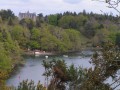
(9) Cross the footbridge, taking a moment to glance to the left at the Château du Perennou, perched in the woods. Continue along the coastal path and, as you approach the Gallo-Roman baths, keep to the right along the path closest to the river to reach the well-restored baths (a lovely spot for a break). These are thought to be linked to a villa, currently under excavation, situated about 400 metres further up the hill and built towards the end of the 1st century AD (not visible).
(10) Carry on climbing steadily, gradually moving away from the Odet; ignore two paths through the woods that lead down to the riverbank and arrive at a small road near a car park with picnic tables.
(11) Turn right and follow this small dead-end road, which serves two houses. Pass through a gate and continue, always looking down over the river. Cross a slightly tricky section—an old, dilapidated staircase, an uprooted tree and loose stones—and arrive at a junction near a signpost.
(12) Ignore a path coming from the left and carry on straight ahead, following a bend in the river below until you reach another fork.
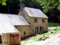
(13) Ignore the path on the left which climbs into the woods and gradually descend along the bend known as Les Vire-Court (see: Nearby). Continue, alternating between moderate ascents and descents, to reach the Rossulien site, where there is a mill restored in 2020 (a lovely spot for a break, especially if the mill is in operation).
FormerPR® trail marked in yellow – the markings are rather faded
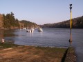
(14) Turn right onto the small road leading down to the slipway.
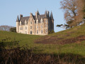
(15) Just before the slipway, at the signpost marked ‘Escalier du Marquis’, take a small flight of steps and continue along the path that runs alongside the river. Carry on, following the fence on the left which marks the boundary of the Château de Kerambleïz estate. You’ll reach a small cove which you go round by crossing a stream: on the left, there’s a lovely view of the château and, on the right, an old wash house. Carry on to the right, climbing the ‘Escalier du Marquis’—a staircase made of wooden logs—until you reach a road, which you follow to the left.
(16) When you reach Kervevenn Farm, continue along the road as it curves to the left. Pass the turn-off for Kerrrien on your right and carry on straight ahead until you reach the junction with the D20 at a place called Kroaz an Trébé.
(17) Cross the D20 with care and continue straight on along the road towards the village of Plomelin.
Near Trébé Farm, you’ll see a small stone cross, from which the name Kroaz an Trébé derives.
No signposting
Ignore two turnings to the right as well as the turn-off to Kergulvenn on the left.
(18) Immediately afterwards, turn left onto Rue Hent Victor Roussin, which leads to a housing estate. When the road bends to the right, head between the hedges of the houses to follow a path (visible on OSM) which turns right, running alongside a stream. Follow this path, part of which is a boardwalk over the wetland. At the crossroads of paths, ignore a path leading off to the right and head up the start of a street.
(19) At the school, turn left onto a footpath (visible on OSM) and, when you reach the road, follow it to the right to return to the car park near the Salle Kerné (S/E).

 Visorando Member

 Easy
Easy