Country:
 City:
City:


Park on Place Betziesdorf (a twin town of Plomelin), opposite the town hall.
Another car park, opposite the Lucie Aubrac State Primary School and near the Espace Kerné sports centre. Plenty of parking spaces.
(S/E) With your back to the car park, head towards Hent Kerfram; follow the road to the left for about 50 metres, then turn right into the first street leading to the private school and the media centre (signposted). Leave this street and continue opposite along a footpath. Turn left between the Pôle Enfance and a car park to come out onto Hent Éric Tabarly, in a residential area. Turn right and, almost immediately, look out for the start of a footpath between the houses.
Blue signposting in the opposite direction
(1) Turn left onto this path which winds its way between the houses, cross Hent Jacques Cartier, and at the end, turn right to reach a small roundabout. Go round it on the right and continue to the left until you reach a Fork in the road.
(2) Turn right towards Kergwenn, walking alongside the community gardens. Go round the Kergwenn farm on the right and continue along the path, which joins a road in the Kergwenn housing estate. Go straight on; you’ll notice two large eucalyptus trees on the left in a grassy area. At the end, take the first turn left then right to join a path leading to a roundabout, near a shopping area. Go round it on the left and, shortly afterwards, follow the footpath running parallel to the road, pass the sign marking the exit from Plomelin and carry on until you reach the start of a path on the right (sign: ‘No motorised vehicles’).
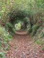
(3) Turn onto this lovely sunken lane lined with trees, which at times form a canopy, and continue straight on until you reach a cross-path.
(4) Turn right and you’ll emerge behind the houses in Kergoff. Follow the street to the left, ignore the one on the right, and carry on until you reach a garage on your right. Turn right onto a grassy path leading down towards Rue Kergoff Traon; follow this to the left until you reach a cross street, just before a roundabout.
Head right towards the roundabout, go round it, cross at the pedestrian crossing and walk along the start of Hent Menhir until you reach the “Kergoff” bus stop.
(5) Turn right onto a path that descends alongside a stream; pass the Distillerie des Menhirs on your right – whose flagship product is buckwheat whisky (tours available) – and emerge onto Hent Saint-Philibert.
Yellow signposting
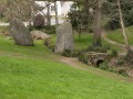
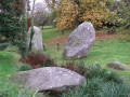
(6) Cross at the pedestrian crossing, go round the menhirs on the left and take a stone bridge to cross a stream. Continue down into the valley alongside the stream, cross it (via a culvert) and leave it behind, heading towards Le CAT de Kernevenn. At the wide path, turn left, walk alongside the greenhouses, keep the buildings on your right and follow the road towards Hent Saint-Philibert, with the housing estate on your left.
Blue signposting
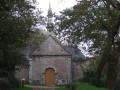
(7) Turn right onto the path running alongside the road and, before the cross, turn off towards the Saint-Philibert Chapel (picnic table). Continue along a path. At a bend at the edge of a meadow, look out for a fountain set slightly back from the path, then emerge onto a road; follow it to the right towards the hamlet of Kervouyenn.
(8) Continue along the path that branches off to the right between meadows and pastures and leads onto a access road to a house, before joining, near Trébé, the road leading to the village of Plomelin. Cross it carefully, keeping as close as possible to the left-hand verge. Continue to the right for about 400 m until you reach Rue Hent Victor Roussin, which serves a housing estate.
(9) Turn left onto this street and, when it bends to the right, head between the hedges of the houses to follow a path (visible on OSM) which bends to the right, running alongside a stream. Follow this path, part of which is a boardwalk over the wetland. At the crossroads of paths, turn right then left to reach the car park via Rue Leur Sant Merynn (S/E).
 Visorando Member

 Moderate