Country:
 City:
City:


Beuzec-Conq is a district within the municipality of Concarneau. It was also a former municipality that merged with Concarneau in 1945. It is situated to the north-east of Concarneau, about 3 km away.
The walk starts from the car park behind the church, near the basketball court.
(S/E) From the car park, turn right onto Rue de Stang Coulz, using the right-hand pavement until you reach the end of the street. At the sign marking the village boundary, cross the road and walk to the left.
Signposted by sign No. 2 ‘La Haie – Le Moros’ (yellow line)
Continue down this road, taking care as it is narrow; cross a stream and you’ll reach a three-way junction (this section is the least pleasant but cannot be avoided).
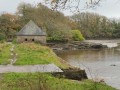
(1) Turn right at the sign for “Toul Bleis (Bleiz), La Haie” onto a small road closed to lorries. On the left, amongst the bamboo, look out for an old wash house.
Carry on along this small, tree-lined road – where the trees sometimes form a canopy – until you reach a crossroad marked by a ‘Stop’ sign. Take a short detour to the left to admire a lovely, beautifully restored bread oven, then continue to the right.
Yellow and red signposting
(2) Turn left towards the Moulin de la Haie, signposted as a dead end. Begin a lovely descent towards this old mill. The narrow road with its hairpin bends is very steep (10 per cent) with moss in the middle. You’ll arrive at the entrance to the private grounds of the former Moulin de la Haie, which has now become a Gîte de France.
(3) Turn right as signposted, go down a series of rather slippery steps and cross a footbridge over the Ruisseau du Val. Turn right and continue between an overhanging copse and the stream on your right, which gradually moves away from the path. Carry on straight ahead and look out for a spring on your left, flanked by a small drinking trough.
You’ll reach the entrance to the old Moulin Neuf, which you go round to the left to come out onto a road. Turn right, walk along the grassy verge on the right towards the Brunec water reservoir and cross the Moros coastal river as it flows into it.
(4) Follow the footpath on the right which runs alongside this reservoir, which supplies water to the Concarneau area. A few signs, unfortunately rather faded, provide information about the mills in the area and the role of the reservoir.
Note the fish pass.
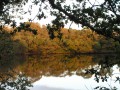
(5) Ignore the road on the right (sign explaining the various walking routes) and carry on straight ahead along the Étang du Moros; on the right, somewhat hidden amongst the vegetation, near a marshy area, are the remains of an ancient Gallic bridge. Carry on through the woods, go down a flight of steps and continue along the edge of the lake and the edge of the woods. You’ll reach the D783 road bridge.
(6) Pass under the bridge, cross a footbridge over the Moros, turn right then left, and follow the path uphill through the woods to go round a property and reach a road which you should take down to the right.
(7) Before reaching the property, turn left to continue through the woodland on the path overlooking the pond (this is the trickiest part of the route). Soon, you’ll catch a glimpse of Stang-ar-Lin Manor to your left, slightly higher up. Carry on until you reach a path.
(8) Turn left onto a gentle uphill path alongside a stream, where the murmur of small waterfalls accompanies you. Pass close to the Saint-Budoc Fountain (wash house on the map) and, just afterwards, under a large oak tree, you’ll notice a spring flowing from the rock (fountain on the map).
Continue this steady climb past a housing estate until you reach a road.
(9) Turn left and follow the street alongside the housing estate, then alongside a field. Turn right and join a road.
(10) Follow it to the left, pass a statue and arrive at the old Beuzec-Conq lighthouse.
(11) Enter the grounds of Kériolet Castle and follow the path leading to it. Take a moment to admire this Baroque castle. Walk 100 metres to the left and back to see the rear of the castle. Head left towards the park exit, coming out opposite a statue of the Virgin Mary.
(12) Turn right and follow the street towards the church. Walk between the church and the war memorial, which is topped by a cockerel. You’ll arrive at the car park to the right of the church (S/E).
 Visorando Member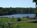


 Easy
Easy 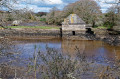
 Difficult