Country:
 City:


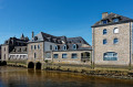
Park at Quai Saint-Laurent on the banks of the Rivière de Pont-L’Abbé.
GR34 Marked in white and red +PR® in yellow
(S/E) Head towards the end of the quay and join the towpath. Pass a pretty fountain. On the opposite bank, you’ll see the Pors Moro shipyard and the old tide mill, which has been beautifully restored as a home. Continue along the river and cross the first embankment, over which a stream flows.
(1) Carry on, cross a second dyke and reach the end of the towpath opposite a dyke offering a view of Île Tudy (you can walk there for a short round trip).
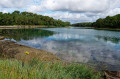
(2) Near a ruined house (a former pub), the path enters the woods, following the River Pont-L’Abbé, in which you’ll spot several small islands such as Île Chevalier. You’ll reach the Menhir Mouillé de Penglaouic.
(3) Go round it on the right, leaving a path along the riverbank on your left, which leads further on to a footbridge at the end of a small cove. Continue along the path that runs alongside the river (theGR® route has been altered).
Go round a house, cross a footbridge and carry on along the river. You’ll reach the bridge leading to Queffen Island (private) and continue along this road until the bend
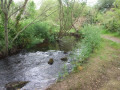
(4). Turn left onto a path that curves to the right and cross a stream via a bridge formed by a long, flat stone.
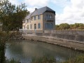
Carry on to the left (note the three old oak trees) and you’ll reach the fully restored former Dourdy tide mill (now used by the Family Allowance Fund and for meetings).
(5) Follow the path along the riverbank, which skirts the Domaine du Dourdy, a former holiday village (view of the castle on the right), and reach the bridge leading to Île Garo (a private island; you can walk to the shore at the end of the bridge).
Turn right and continue alongside the former holiday village.
At the entrance to the Château du Dourdy, ignore the road on the right and carry on straight ahead. Turn left and cross the newly built bridge over the Anse de Pen an Veur (sign for the old tide mill).
No signposting
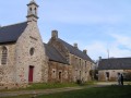
(6) At the sign for ‘Allée Blanche’ – a private road open to pedestrians – turn right and follow this tree-lined lane, which leads onto the D2 opposite the Croaziou Chapel. Cross the road and walk round the chapel to see the wayside cross.
(7) With your back to the chapel, cross the roundabout at the pedestrian crossings and turn right onto Rue de Sculer towards the Manoir de Kérazan (eco-museum), ignoring the side streets.
At a fork in the road, turn left onto a disused track and walk past the entrance to the Manoir de Kérazan (eco-museum).
(8) Cross the D2 with extreme caution – there is no protected crossing – and turn left into a beech-lined lane leading to the Kerabel farm. Walk around the farm and join a farm track.
YellowPR® signposting (relatively inconspicuous)
(9) Turn right onto this track, which narrows in places and becomes a sunken track before widening again and passing through a wooded area. You’ll arrive at the edge of the Pont-L’Abbé bypass.
No markings
(10) Cross with extreme caution – there is no protected crossing – and follow the tarmac cycle and footpath to the right towards a roundabout. Go round the roundabout on the left and continue along the cycle path towards Loctudy, skirting a woodland until you reach a ruined house (alternative route in the practical information section).
YellowPR® signposting (relatively inconspicuous)
(11) Turn left into the woods and continue straight on through the meadows (often occupied by horses from the nearby Rosquerno equestrian centre). Walk alongside the wall, from which you can see the top of the Manoir de Trévanec and its beautiful entrance gate (note, on your right, in a meadow, the old dovecote, now overgrown with vegetation, as well as, by the side of the path, a fountain and a washhouse, which were unfortunately rather neglected when I passed by). You’ll reach a residential area; turn left onto the street, ignoring the first three streets on the right, until you come to a narrow lane (Chemin du Guerdy).
(12) Follow this narrow lane, which winds its way round the residential areas, passes a school on your left and leads to a children’s playground. You’ll emerge onto a street near a roundabout.
(13) Take the street almost opposite until you reach a metal staircase leading down to the car park near the towpath (S/E).

 Visorando Member
 Easy