Country:
 City:
City:


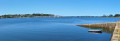
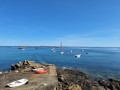
From Plouguerneau, follow the D71 towards Lilia, drive through the village and head for Kervenni Beach. At the corner of a large crêperie, turn right, then right again into a small street where a car park is signposted on the left.
(S/E) From the car park, take the signposted footpath on the left leading to Kervenni Beach. Turn right and continue along the beach on the pavement (it may be possible to walk along the beach depending on the tide).
(1) Leave the road and head towards the small grassy headland, where you can admire a modern sculpture entitled “Empreintes” by Eric Theret (1998). Continue to the left until you reach the viewpoint sign.
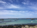
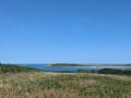
(2) Take this path which climbs up to the Pointe de Kastell Ac’h viewpoint, offering a sweeping panoramic view of Île Vierge and its two lighthouses, as well as the numerous islets in the vicinity. Head back down and you’ll come to another sculpture, “Victor Hugo” by Coutelle (1922). Head back along the road, pass Lilia harbour and continue to the end of this road.
GR ®34, marked in white and red
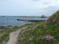
(3) Continue along the top of the beach, then climb up to the grassy headland of Beg ar Rest, a natural environment rich in wildflowers but also very fragile. At the headland, near a remnant of the Atlantic Wall, stands a modern granite sculpture, “L’œil du cyclope” by Georges Rammel (1990).
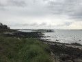
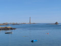
(4) Follow the coastal path, which offers views of Wrac’h Island and its small lighthouse, a landmark for access to the Port of Aber-Wrac’h. Pass a granite sculpture by Ghislaine Vernejoux, “Laouer Sant-Karan” (the stone trough, 1992), which recalls the legend of Saint Cava, a Breton saint said to have landed there on a stone trough – a legend associated with several Breton saints who came from Ireland.
Head to one of the car parks at Saint-Cava’s Grande Plage where, at low tide, you can make out a rock covered in seaweed emerging from the water. This is a menhir that is now submerged at every tide.
(5) Continue across the dune, then along a short stretch of road that ends at the beach. Carry on along the top of the beach until you reach a small road.
(6) Follow this small road, which leads away from the coast as the coastal path does not continue here
Opposite the gate to a private property, turn left onto a path and you’ll come to a fork.
Blue-marked PR
(7) Leave theGR® trail, which continues straight ahead, and turn right onto a narrow path leading to a sandy beach. On the right, a modern statue by Catherine Hure, ‘Lune chavirée’ (1990), offering a view of the two small Wrach Islands, one of which still has a house on it, and, opposite, Enez Terch, known as the ‘Americans’ Island’ because, in 1918, they established a seaplane base there, of which a hangar remains.
(8) Head left along the top of the beach to reach Pointe de Beg ar Roz , where a large modern sculpture by Tetso Harada, “Rozmeur”, has been installed. On the opposite shore lies the harbour of Aber Wrac’h, which is mainly used for fishing and recreational boating.
(9) Set off again along the small road and rejoin theGR® coming from the left.
GR®34, marked in white and red
Walk alongside the small harbour, where a small-scale maritime industry has established itself, including an oyster and abalone farm.
(10) Turn right, go round the back of the cove – a coastal wetland – pass close to the hamlet of Keridaouen and reach a crossroads near the hamlet of Kergos.
(11) Turn right and follow this small road, ignoring all turnings on the left, until you come out of a bend at Kerougoun.
(12) Leave the road and take the coastal path, which turns left, following the shoreline, and continues straight on through the fields until it reaches some houses. Turn right, then right again at the crossroads, until you reach the sign for Saint-Antoine.
No signposting
(13) Set off to the left along the small dead-end road which leads to a headland opposite a property, with a view of the Port of Aber Wrac’h. Continue along the beach until you reach a small road that joins it.
(14) Take this road to return to the Saint-Antoine junction.
GR ®34, marked in white and red
(13) Continue straight on along the right bank of the Aber Wrac’h to the small harbour at Perros.
From this harbour, a ferry operates to the opposite bank (see practical information).
(15) Retrace your steps and follow the outbound route in the opposite direction back to the Kergoz crossroads.
Blue-marked PR trail
(11) Carry on straight ahead; at the first crossroads, turn right and walk through the hamlet of Kerskao, past the old house with its well, until you reach the village of Lillia. Turn right onto the main street to visit a dolmen.
(16) Retrace your steps, walk round the church in Lillia and take in the monumental statue ‘The Mother and Child’ by François Breton.
No signposts
Ignore the first street on the right and carry on until you reach a T-junction.
(17) Turn left, pass a junction and, shortly afterwards, you’ll find the car park on the right (S/E).


 Association / Club / Walk leader
 Difficult
 Visorando Member
 Easy
Easy