


Département de la Drôme

 Local authority
 Premium user
Sign up:
Published route(s)
 Tours and detours of the Lez
 5.57 mi
 +715 ft
 -722 ft
 3h 10
3h 10
 Moderate
 Departure from Roche-Saint-Secret-Béconne (Drôme)
A beautiful and enjoyable walk that allows you to discover the agricultural riches and built heritage of La Roche-Saint-Secret-Béconne.
 Châteauneuf-de-Mazenc - Dieulefit-Bourdeaux region
7.71 mi
+443 ft
-443 ft
1.5 hrs
Moderate
Departure from La Bégude-de-Mazenc (Drôme)
This route takes you through the woods and hills that begin to the east of La Bégude. It also leads you to the hilltop medieval village of Châteauneuf-de-Mazenc, where the breathtaking views will allow you to discover the fields and buildings of the Valdaine plain.
 The Col de Rousset - Les Gauras
2.66 mi
+712 ft
-725 ft
2 hrs
Moderate
Departure from Saint-Agnan-en-Vercors (Drôme)
This hike takes you across the Gauras meadows to admire the entire range of the Vercors high plateaus and its highest peak, the Grand-Veymont. To enjoy these panoramic views, you’ll need to climb the beautiful Gauras track and cross a magnificent beech forest dotted with silver firs. The descent is equally magical. Starting in the forest, the landscape then becomes spectacular as you approach the Col Naturel.
Font d'Urle - Chaud Clapier
2.29 mi
+259 ft
-266 ft
1.5 hrs
 Easy
Departure from Bouvante (Drôme)
Easy
Departure from Bouvante (Drôme)
This easy route allows you to discover both snowshoeing and the Chaud Clapier ski area. Alternating between woodland and groomed slopes, this hike reveals the small hamlet of Font d'Urle, nestled in the folds of the Serre Montué. It's an excellent way for young and old alike to enjoy snowshoeing in complete safety. However, the sometimes changeable weather conditions should not be overlooked.
Les Gagères from Chaud Clapier
 3.96 mi
+673 ft
-643 ft
3 hrs
3.96 mi
+673 ft
-643 ft
3 hrs
 Difficult
Departure from Bouvante (Drôme)
Difficult
Departure from Bouvante (Drôme)
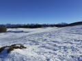
A snowshoe hike that allows you to discover the vast expanses characteristic of the Gagères. The plateau is often swept by the wind, which forms snowdrifts, thus modulating the landscape. Be aware that fog can roll in on this route and make the hike much more difficult. In good weather, hikers can enjoy magnificent views: a panorama of the Hauts Plateaux du Vercors mountain range and its highest peak, the Grand Veymont (2,341 metres above sea level).
Le Pas de Chovet starting from the Foyer de Fond du Grand Échaillon
4.69 mi
+925 ft
-938 ft
3 hrs
Moderate
Departure from Léoncel (Drôme)
Le Grand Échaillon under the snow is truly magical! Snowshoeing is the best way to discover landscapes like those along this route and appreciate the beauty of nature in winter. Between open spaces with sweeping panoramas and the intimacy of the undergrowth, this route will leave you longing for more snowy adventures.
Lus-la-Jarjatte - Le pré de la Lèbre
2.50 mi
+817 ft
-817 ft
2.5 hrs
Moderate
Departure from Lus-la-Croix-Haute (Drôme)
Starting from the ski resort of Lus, this route takes you through wild areas of beech and fir woodland and open spaces offering views of the Aiguilles de Lus (2,161m) or the Tête de Vachères (2,402m). A slight climb classifies this hike as moderate, but there are generally no technical difficulties to note; do take care, however, depending on weather conditions.
Col du Maupas from Font d'Urle-Chaud Clappier
4.22 mi
+653 ft
-646 ft
3 hrs
Moderate
Departure from Bouvante (Drôme)
Around the Sacha mountain, this snowshoe hike allows you to discover two sides of the Vercors landscape. At the Col de Carri, the landscape is forested and snow covers the entire area, giving walkers a taste of the Far North. At the Col de Maupas, the view extends over the Combe de l'Oscence and the more open environment supports lower vegetation.
Vassieux-en-Vercors - The Chemin des Feuilles
5.04 mi
+879 ft
-879 ft
4 hrs
Moderate
Departure from Vassieux-en-Vercors (Drôme)
A forest walk with beautiful views over the Vassieux-en-Vercors plain. There are no navigation difficulties on this route, which mainly follows wide tracks. The aspect of the slope ensures good snow cover and, above all, helps to preserve the snow when it is scarce elsewhere.
The Crêtes Trail starting from the Herbouilly Nordic Area
 4.58 mi
+827 ft
-810 ft
4 hrs
Difficult
Departure from Saint-Martin-en-Vercors (Drôme)
4.58 mi
+827 ft
-810 ft
4 hrs
Difficult
Departure from Saint-Martin-en-Vercors (Drôme)
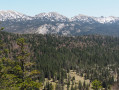
The trail starts in the forest and follows a path along wooded ridges with stunning views of the surrounding peaks. The spirit of Jack London and White Fang is never far away as you gaze out over the vast expanse of the Hauts Plateaux and the nature reserve. Enjoy a magnificent snowshoe hike in the magical world of the Vercors forest.
Undergrowth - Dieulefit-Bourdeaux area
5.94 mi
+240 ft
-266 ft
1 hr
Easy
Departure from Le Poët-Laval (Drôme)
Along the river, along a wide track, through the pinewoods and up a steep incline: these are just some of the variations that will give you your first taste of mountain biking in an always pleasant setting. Ideal for beginners and families!
The Herbouilly plain, starting from the Herbouilly Nordic Centre
2.70 mi
+325 ft
-305 ft
2.5 hrs
Moderate
Departure from Saint-Martin-en-Vercors (Drôme)
A wonderful way to explore this site via its forest trails, sun-drenched meadows and breathtaking viewpoints. It’s an opportunity to push your boundaries. First, with the engraved stone marker that has marked the boundary between the territories of the Lord of Sassenage and the Bishop of Die since the early 17th century. Then, with a little extra effort, you can reach the boundary between the Drôme and the Isère on a round trip to the Col d’Herbouilly (alternative route: +2 hours return).
Amidst lavender and chestnut trees – The Dieulefit-Bourdeaux region
6.39 mi
+702 ft
-702 ft
1.5 hrs
Moderate
Departure from Dieulefit (Drôme)
Lavender fields, pine forests, chestnut trees, a stone hamlet and breathtaking views of La Lance mountain… You can enjoy all these landscapes and panoramic views to the full on this easy ride.
Col de la Sambie - Monts du Matin
6.97 mi
+1,270 ft
-1,260 ft
1.5 hrs
Moderate
Departure from Rochefort-Samson (Drôme)
A beautiful route with a slight climb in the first section and a few sections where you’ll need to push your bike. Stunning views over the Rhône Valley. Passes through the Col de la Sambie and the villages of Barbières and Rochefort-Samson before returning at a leisurely pace to the Combe d’Oyans campsite.
Option to extend the route with circular loops 15 and 16 (Red and Black) from Barbières.
La Combe Oternaud and the Bois de Sizay - Pays de l'Herbasse
 7.77 mi
+794 ft
-781 ft
2 hrs
Moderate
Departure from Saint-Donat-sur-l'Herbasse (Drôme)
7.77 mi
+794 ft
-781 ft
2 hrs
Moderate
Departure from Saint-Donat-sur-l'Herbasse (Drôme)
A short route offering a taste of the main types of trails found in the Drôme des Collines: sand, gravel, woodland, valleys... The two main climbs are relatively steep and lead to some lovely views.
Bonne Combe - Porte de Drômardèche
8.08 mi
+679 ft
-679 ft
2 hrs
Easy
Departure from Hauterives (Drôme)
Right from the start of the route, you will have a great time on a fun little trail along the river. The only climb, which is a little long, will take you to the highest point of the circular route, offering you a beautiful view of the Hauterives valley.
The Saint-Germain Circuit - Porte de Drômardèche
5.40 mi
+463 ft
-463 ft
1.5 hrs
Easy
Departure from Hauterives (Drôme)
At the start of this circular route, single-track enthusiasts will enjoy this short, fun and fast trail along the Galaure. The slightly steep climb, alongside a field, will take you to the highest point of the route, where you can enjoy a superb view of the Galaure valley. The descent to Hauterives, through the woods, will give you a real thrill!
Around L’Herbasse – Pays de l’Herbasse
10.60 mi
+807 ft
-820 ft
2 hrs
Moderate
Departure from Saint-Donat-sur-l'Herbasse (Drôme)
This mountain bike ride begins with a fairly long and challenging climb. Your efforts will be richly rewarded by a magnificent panoramic view of the Vercors. The second section is much more easy-going, running alongside the river. Of particular note is the stretch past the Château de Charmes-sur-l’Herbasse, which overlooks the village.
Around the Tour d’Albon – Porte de Drômardèche
11.79 mi
+840 ft
-850 ft
2.5 hrs
Moderate
Departure from Albon (Drôme)
This magnificent route, winding through orchards and woodland, will take you on a tour of the Albon area. The long ridge path leading up to the Tour d’Albon offers a splendid panoramic view of the Rhône Valley, with vistas of the foothills of the Ardèche, Pilat and Vercors. The final descent is sure to delight you!
The Sandy Hills – Pays de l’Herbasse
19.60 mi
+2,310 ft
-2,293 ft
4 hrs
Difficult
Departure from Saint-Donat-sur-l'Herbasse (Drôme)
A beautiful route in the Herbasse area offering a dramatic change of scenery: sandy terrain and more Mediterranean vegetation.
Porte de DrômArdèche – Puy de Serves
16.44 mi
+3,077 ft
-3,061 ft
4 hrs
Difficult
Departure from Ponsas (Drôme)
This stunning route takes you through terrain that is very different from the other trails at the Drôme des Collines mountain biking site. The vegetation and ground conditions – with their mix of roots and stones – are similar to those found in the Ardèche. This physically demanding and technically challenging route offers beautiful views over the Rhône and Ardèche valleys.
Les Condamines – Monts du Matin
8.22 mi
+1,772 ft
-1,781 ft
2.5 hrs
Difficult
Departure from Saint-Vincent-la-Commanderie (Drôme)
The route starts at the foot of the Vercors foothills and follows a section shared with Circular Loop 17 (Massegrés) as far as Le Soufflot (alt. 804m). Once you’ve passed through the village, you’ll climb a steep track before eventually joining another track that’s much easier to ride on. You’ll enjoy the beautiful views over the Valence plain and the Ardèche. Take care on some of the descents! The route can quickly become slippery, muddy or sticky in wet weather.
Exploring the Saou Forest
9.15 mi
+791 ft
-787 ft
1.5 hrs
Easy
Departure from Saou (Drôme)
A discovery trail in the heart of the Saou Forest, along easy paths and tracks suitable for the whole family. In the heart of the forest, don’t miss the Auberge des Dauphins and its remarkable architecture.The Saou Forest, acquired as part of the Sensitive Natural Areas policy, is the Department’s largest property (2,500 ha). Listed as a protected site since 1942, it is now managed in accordance with the principles of sustainable development, in consultation with local stakeholders.
⚠️ Between 1 July and 15 September, Prefectural Order DDT-SEF-2026-0176 of 4 June 2026 concerning the temporary restriction of access to the Saou Forest and the Ambel Plateau in the event of a fire risk, assessed on a daily basis. A map is published every evening (around 5.30 pm) for the following day.
Le Muletier in the Saou Forest
11.22 mi
+1,867 ft
-1,864 ft
2 hrs
Moderate
Departure from Saou (Drôme)
A route in the Saou forest, where you’ll follow the tourist trail before heading down the Sentier Muletier. Please note that this descent is technical; some stony sections require caution!
L'Échelette in the Saou Forest
13.55 mi
+1,745 ft
-1,742 ft
2.5 hrs
Difficult
Departure from Saou (Drôme)
A challenging route, with a short section where you’ll need to carry your bike on the climb up to the Pas de l’Échelette. Enjoy the panoramic views of Crest, the Drôme valley and the Trois Becs!
⚠️ Between 1 July and 15 September, Prefectural Order DDT-SEF-2026-0176 of 4 June 2026 concerning temporary restrictions on access to the Saoû Forest and the Ambel Plateau in the event of a fire risk, assessed on a daily basis. A map is published every evening (around 5.30 pm) for the following day.
Rochecolombe in the Saou Forest
10.95 mi
+1,706 ft
-1,696 ft
2 hrs
Difficult
Departure from Saou (Drôme)
A beautiful route that will take you through the Saou Forest, then to the foot of Rochecolombe Mountain. The route follows fun and varied paths through the woods.
⚠️ Between 1 July and 15 September, Prefectural Order DDT-SEF-2026-0176 of 4 June 2026 concerning temporary restrictions on access to the Saou Forest and the Ambel Plateau in the event of a fire risk, assessed on a daily basis. A map is published every evening (around 5.30 pm) for the following day.
Grand tour of the Saou Forest
20.17 mi
+3,366 ft
-3,366 ft
4 hrs
Difficult
Departure from Saou (Drôme)
Head east to explore the tourist trail created by Maurice Burrus in 1930. The route passes at the foot of the Trois-Becs. To round off this walk, a descent along forest paths and tracks will make you forget the long climb.
The Saou Forest, acquired as part of the Sensitive Natural Areas policy, is the Department’s largest property. Listed as a protected site since 1942, it is managed in accordance with the principles of sustainable development, in consultation with local stakeholders.
⚠️ Between 1 July and 15 September, Prefectural Order DDT-SEF-2026-0176 of 4 June 2026 concerning the temporary restriction of access to the Saou Forest and the Ambel Plateau in the event of a fire risk, assessed on a daily basis. A map is published every evening (around 5.30 pm) for the following day.
Pays de Grignan - Vineyards and cabins
5.56 mi
+167 ft
-167 ft
1.5 hrs
Easy
Departure from Grignan (Drôme)
This route departs from Grignan and takes you along small roads and picturesque paths to visit the hamlet of La Grande Tuilière and the renowned Domaine de Montine wine estate. You will then take a path through the vineyards, with the added bonus of a beautiful view of the equally famous Château de Grignan. From there, a fun trail will take you back towards the village, then you will take the grassy paths to reach the end of your mountain bike ride.
Pays de Grignan - From tower to cave
11.90 mi
+279 ft
-302 ft
2.5 hrs
Moderate
Departure from Grignan (Drôme)
This easy route takes you on a tour of the south of Grignan, with its truffle oaks and lavender fields. You’ll pass by the Saint-Barthélémy Chapel and the village of Chamaret with its famous hilltop tower. You’ll follow a picturesque path along the River Lez. On the way back, you’ll pass the famous Rochecourbière Cave and catch a glimpse of Madame de Sévigné’s ‘period table’.
Pays de Grignan – The Roman Road
13.35 mi
+361 ft
-351 ft
2.5 hrs
Moderate
Departure from Chamaret (Drôme)
Starting amongst stone walls and lavender fields, you’ll then follow a path along the banks of the Lez to reach Le Calvaire, where the ancient Roman road begins. You’ll reach Colonzelle, then Chamaret via the Saint-Barthélémy Chapel. The route then takes you through the village’s narrow streets. You’ll come to the stone cross at Les Vicaires and walk alongside truffle oaks to the Grotte de Rochecourbière, before returning to the starting point.
Pays de Grignan - Rochecourbière
6.28 mi
+131 ft
-141 ft
1.5 hrs
Easy
Departure from Chamaret (Drôme)
This very easy route will first take you through the village and past the Chamaret Tower, then on to the market-gardening plateaus of Les Paluds and Les Marsenches. At a fork in the path, you’ll spot the beautiful stone cross at Les Vicaires, before discovering the fabulous Rochecourbière Cave and Madame de Sévigné’s stone table. Lovely paths through truffle oaks and lavender will take you back to Chamaret, passing by the wonderful Saint-Barthélémy Chapel.
The Crossroads - Pays de Grignan
19.47 mi
+1,112 ft
-1,112 ft
4 hrs
Difficult
Departure from Chamaret (Drôme)
This challenging route takes you along the banks of the Lez, then across the plain and up to the heights of Montségur-sur-Lauzon. This village has preserved the remains of the medieval castle and its ramparts, known as Vieux Montségur. You’ll continue along beautiful paths to the village of Solérieux. You will then climb to higher ground and arrive at a spot offering a superb view of Clansayes and its perched statue of the Virgin Mary. Following magnificent single tracks, you will cross part of the Rouvergue woods to reach Chamaret.
Pays de Grignan – The Invasions Trail
6.33 mi
+243 ft
-240 ft
1.5 hrs
Easy
Departure from Taulignan (Drôme)
This route will take you along the Taulignan Silk Road, with its old mill and two restored factories. You’ll continue your journey amongst lavender fields, vineyards and stone huts, passing very close to the La Clarté Notre-Dame des Dominicaines Monastery. The final section will take you along the Chemin des Invasions, where, via a short detour, you’ll catch a glimpse of the beautiful Saint-Marcel Chapel. You’ll finish your walk in the narrow streets of the medieval village of Taulignan.
Pays de Grignan – Truffle fields and vineyards
 13.84 mi
+669 ft
-673 ft
2.5 hrs
Moderate
Departure from Taulignan (Drôme)
13.84 mi
+669 ft
-673 ft
2.5 hrs
Moderate
Departure from Taulignan (Drôme)
This route allows you to explore the medieval town via the Porte Anguille, flanked by two towers. It then takes you to the foothills of Taulignan to discover an ancient Roman road. Further on, the Domaine Bramarel lies at the heart of France’s main truffle-producing region. You’ll reach the Silk Road as you pass the burnt-out factory, a former blacksmith’s workshop. The route ends on the Blaches plateau and its famous Côtes du Rhône AOC vineyards
Roche Colombe in the Saoû Forest region
5.65 mi
+1,962 ft
-1,942 ft
4h 20
Difficult
Departure from Saou (Drôme)
Roche Colombe is the stern of the great ship formed by the Saoû Forest, offering a remarkable view of the Vercors, the Drôme and the interior of the forest.
⚠️ Between 1 July and 15 September, Prefectural Order DDT-SEF-2026-0176 of 4 June 2026 concerning temporary restrictions on access to the Saoû Forest and the Ambel plateau in the event of a fire risk , assessed on a daily basis. A map is published every evening (around 5.30 pm) for the following day.
The Briesse Plateau - Dieulefit-Bourdeaux region
3.83 mi
+1,066 ft
-1,073 ft
2h 40
Moderate
Departure from Pont-de-Barret (Drôme)
Pleasant circular path, mostly shaded. The ascent and descent are steady and present no technical difficulty. After rain, the path is easier to walk in the opposite direction.
Les Balcons de La Roanne - Vallée de la Roanne
 7.16 mi
+2,405 ft
-2,418 ft
5h 25
Difficult
Departure from Saint-Benoit-en-Diois (Drôme)
7.16 mi
+2,405 ft
-2,418 ft
5h 25
Difficult
Departure from Saint-Benoit-en-Diois (Drôme)
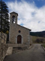
From Saint-Benoît, a hilltop village and strategic point, climb up the paths once used by farmers through the sunny south-facing slopes. They offer breathtaking views of the Roanne Gorges.
The old farms - Forêt de Saoû
 2.45 mi
+233 ft
-233 ft
1h 20
Easy
Departure from Saou (Drôme)
2.45 mi
+233 ft
-233 ft
1h 20
Easy
Departure from Saou (Drôme)
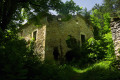
This walk will take you on a journey through the agricultural landscape of the Saoû Forest. The walk begins along the hay meadows at the foot of the forest. You will then pass close to the ruins of Raillon and Fuoc, remnants of the many farms that once stood at the foot of the forest. This walk is suitable for all-terrain pushchairs.Dogs must be kept on a lead.
⚠️ 1 July 2026: Between 1 July and 15 September,Prefectural Order DDT-SEF-2026-0176 of 4 June2026 concerning the temporary restriction of access to the Saoû Forest and the Ambel Plateau in the event of afirerisk, assessed on a daily basis. A map is published every evening (around 5.30 pm) for the following day.
Pré de l'Âne through the heart of the forest - Saoû Forest
 9.66 mi
+2,697 ft
-2,697 ft
6h 45
Difficult
Departure from Saou (Drôme)
9.66 mi
+2,697 ft
-2,697 ft
6h 45
Difficult
Departure from Saou (Drôme)
A lovely walk where ‘diversity’ is the watchword! This superb route, winding its way between two cliffs, takes you gradually uphill via the Grande Combe, amidst lush vegetation. The Pas de Siara offers a glimpse of the southern Alpine meadows of the Trois Becs, where sheep from neighbouring valleys graze during the summer grazing season. The descent is gentle through the beech forest, typical of the montane zone.
⚠️ Between 1 July and 15 September,Prefectural Order DDT-SEF-2026-0176 of 4 June2026 concerning the temporary restriction of access to the Saoû forest and the Ambel plateau in the event of afirerisk, which is assessed daily. A map is published every evening (around 5.30 pm) for the following day.
In the footsteps of the Huguenots in the Saoû Forest
2.27 mi
+381 ft
-381 ft
1h 25
Easy
Departure from Saou (Drôme)
A lovely, gentle round-trip walk that will take you in the footsteps of the Huguenots through the Saoû Forest. The walk is fully accessible to all-terrain pushchairs.
Les Clos - Saoû Forest
3.05 mi
+630 ft
-620 ft
1h 55
Easy
Departure from Saou (Drôme)
A short circular path through the forest, perfect for enjoying the shade. You’ll walk through a splendid beech forest on a north-facing slope.Dogs must be kept on a lead.
Les Châtelards - Dieulefit-Bourdeaux region
12.23 mi
+1,985 ft
-2,005 ft
7h 20
Difficult
Departure from La Bégude-de-Mazenc (Drôme)
A circular route offering a chance to discover the varied landscapes around La Bégude-de-Mazenc as well as the old village of Châteauneuf-de-Mazenc. With a route mainly through woodland, this long but technically easy hike will be very pleasant on hot summer days.
In the footsteps of the mule drivers - Saoû Forest
 4.66 mi
+1,020 ft
-1,027 ft
3h 00
Moderate
Departure from Saou (Drôme)
4.66 mi
+1,020 ft
-1,027 ft
3h 00
Moderate
Departure from Saou (Drôme)
This walk takes you along various historic routes through the Saoû Forest.You can start this circular walk from the Écogardes Office, heading towards Le Chemin de la Grande Combe, then follow the directions in the text.Dogs must be kept on a lead.
⚠️ Between 1 July and 15 September, Prefectural Order DDT-SEF-2026-0176 of 4 June 2026 concerning temporary restrictions on access to the Saoû Forest and the Ambel Plateau in the event of a fire risk, assessed on a daily basis. A map is published every evening (around 5.30 pm) for the following day.
Short Protestant route – Dieulefit-Bourdeaux region
3.13 mi
+384 ft
-381 ft
1h 45
Easy
Departure from Bourdeaux (Drôme)
A gentle walk offering a route through the countryside and a visit to the old village of Bourdeaux (La Viale).
Serre Antoine - Saoû Forest
 7.33 mi
+1,417 ft
-1,421 ft
4h 35
Moderate
Departure from Mornans (Drôme)
7.33 mi
+1,417 ft
-1,421 ft
4h 35
Moderate
Departure from Mornans (Drôme)
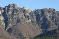
Sheltered by the imposing wall of the Saoû perched syncline, you will pass close to the ruins of Pradas and also enjoy unobstructed views over the Roubion valley.
⚠️ Between 1 July and 15 September, Prefectural Order DDT-SEF-2026-0176 of 4 June 2026 concerning temporary restrictions on access to the Saoû forest and the Ambel plateau in the event of a fire risk, assessed on a daily basis. A map is published every evening (around 5.30 pm) for the following day.
Bois Sec and Vaire - Saoû Forest
2.78 mi
+354 ft
-354 ft
1h 35
Easy
Departure from Francillon-sur-Roubion (Drôme)
After swimming in the Roubion, you can finish the descent at nightfall: Vaire is a remarkable platform for stargazing, at the foot of the southern slope of the Saoû syncline.
Please note: the route is impassable when the Roubion is in flood.
Bois de Vache - Saoû Forest
4.04 mi
+558 ft
-564 ft
2h 20
Easy
Departure from Le Poët-Célard (Drôme)
The hilltop village of Le Poët-Célard offers a journey back in time as you wander through its medieval streets leading up to the castle. Then discover the local area, including the Château de Saint-André.
The Gourdon Circuit – Dieulefit-Bourdeaux region
 5.05 mi
+1,394 ft
-1,417 ft
3h 30
Difficult
Departure from Bézaudun-sur-Bîne (Drôme)
5.05 mi
+1,394 ft
-1,417 ft
3h 30
Difficult
Departure from Bézaudun-sur-Bîne (Drôme)
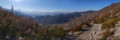
Although this circular walk can be done in either direction, in summer it is advisable to follow the route described to avoid the climb from Les Athénols to the Col de Gourdon, which is very exposed to the sun. It is possible to do just the Col de Gourdon–Fonderesse return walk via Floréal (6.6 km / +320 m / 2 hours 15 minutes).
To avoid disturbing the wildlife, dogs must be kept on a lead.
Saint-Christophe and Les Trois Bornes - Pays de Saillans
8.75 mi
+1,535 ft
-1,539 ft
5h 20
Moderate
Departure from Saillans (Drôme)
From the lively village of Saillans with its narrow streets, arcades and fountains, passing by the turquoise blue pools of Rieussec, climb up to the Saint-Christophe Chapel. It faces the Trois Becs!
Saint-Jean Chapel in the Dieulefit-Bourdeaux region
3.57 mi
+338 ft
-358 ft
1h 55
Easy
Departure from Bourdeaux (Drôme)
At the start of the circular route, the Soubrion river must be crossed by fording (the only authorised crossing point). However, if the water level does not allow for a safe crossing, the landowners permit use of their footbridge. Please respect this exception.