City tour of Romans: from the banks of the Isère to the arts and crafts

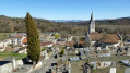
In the town itself, discover the traditional crafts and skills of the historic centre: leatherworkers, shoemakers, fan-makers, bookbinders, luthier, jewellers, visual artists, potters, upholsterers… and a glimpse into the hat-making tradition. Out in the countryside, this walk will take you on a leisurely stroll along the banks of the Isère.

Details

2308927
Creation:
Last update:
Last review:
  • Walking
    Activity: Walking
  • ↔
    Distance: 4.06 mi
  • ◔
    Average duration: 2h 00 
  • ▲
    Difficulty: Moderate

  • ⚐
    Back to start: Yes
  • ↗
    Ascent: + 105 ft
  • ↘
    Descent: - 102 ft

  • ▲
    Highest point: 541 ft
  • ▼
    Lowest point: 446 ft

Description of the walk

Starting point: Place Jean Jaurès in Romans.

(S/E) From the car park, head south and cross Place Gailly. At the end, turn right and head towards the Jacquemart Tower. Then turn left and walk down Côte Jacquemart. At number 13, turn left and walk alongside the Jean Vilar Theatre. Follow Rue du Secret, then turn right onto Rue Morin towards the bookshop. This leads onto Rue des Cordeliers.

(1) First turn left then right onto Rue des Degrés. At the end, turn right into Rue de la Banque. Pass a bookbinding shop and, at the next junction, turn right onto Rue Saint-Nicolas.

At the end, first turn left then right to follow Rue Mathieu de la Drôme. At the various junctions, carry on straight ahead, continuing along Place Maurice Faure. At the end, turn left. Just before the quays, turn right into Rue Pêcherie, known as the ‘rue des métiers d’art’ (artists’ street): fan-makers, potters, luthiers, visual artists, painters, sculptors and photographers all have their studios here. At No. 35, turn left down Rue Montessort.

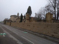
(2) At the roundabout, go straight on, then turn right along Place de la Presles. You’ll come to the tanners’ houses and an information board. At the end, turn left and walk round the Cité de la Musique on the right-hand side. At the corner, turn left onto the path leading up into Parc Saint-Romain (Parc François Mitterrand on the map). Leave the park heading towards the Rempart du Clos des Capucins via the path overlooking the park. You’ll come out onto Rue Bellevue, on the banks of the Isère.

(3) Follow the street southwards, keeping the river on your left. At a Fork in the road, turn left onto the Chemin de Halage. At the end, turn left onto the Allée des Ors. When you reach the riverbank, take the access path to the footbridge on your left.

(4) Cross the Isère via the footbridge. As you leave the footbridge, turn left immediately and walk alongside the river on your left, following the Quai Auguste Clément. As soon as possible, leave the tarmac and walk as close to the riverbank as you can. Before the bridge, climb the steps on the right to reach the Quai Tabary.

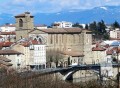
(5) Cross the Isère via the Pont Vieux. As you come off the bridge, turn right onto Quai Ulysse Chevalier and walk alongside the Collégiale Saint-Bernard on your left. Turn left at the chancel of the church. At the corner, cross Place aux Herbes to the right. Follow Rue des Carreaux, then Rue des Clercs. At the end, turn right onto Rue Sabaton. At the end, turn left onto Quai Chopin.

(6) Before the Pont Neuf, turn left into a small street. At thefirst junction, turn right. At the roundabout, turn left down the lane between the blocks of flats and the Côte Garenne.

(7) When you reach the swimming pool, turn left. Follow Rue Saint-Just. At the end, first turn left then right to follow Rue Louis Mandrin. At the junction, go straight on. Turn right, then left to walk alongside Place Jules Nadi. At the end, head up Côte des Cordeliers on the right. At the carved shoe, go up Côte Saint-Ursule on the right, then immediately turn left to reach Place Jean Jaurès (S/E).

Waypoints

  1. S/E : mi 0 - alt. 538 ft - Place Jean Jaurès
  2. 1 : mi 0.3 - alt. 482 ft - Rue des Cordeliers
  3. 2 : mi 0.72 - alt. 459 ft - Place de la Presles - Savasse (rivière)
  4. 3 : mi 1.2 - alt. 531 ft - Rue de Bellevue
  5. 4 : mi 2.04 - alt. 456 ft - Passerelle des Ors - Isère (rivière)
  6. 5 : mi 2.9 - alt. 479 ft - Pont Vieux
  7. 6 : mi 3.39 - alt. 463 ft - Before the Pont Neuf
  8. 7 : mi 3.59 - alt. 502 ft - Triboulet Swimming Pool
  9. S/E : mi 4.06 - alt. 538 ft - How to get to the starting point

Notes

This route is certified by the FFRandonnée.

It is strongly recommended that you set off with a detailed map. Make sure you have plenty of water and food, and wear suitable walking clothes.

For further information, contact the Valence Romans Tourisme Tourist Office in Romans: 04 75 02 28 72 / inforomans@valenceromanstourisme.com / www.valenceromanstourisme.com

Worth a visit

The Véloroute Voie Verte (VVV)

Isère Valley (V63)

Part of the national cycle route network, the V63 will eventually link the Drôme with Haute-Savoie. Along its 42 km stretch in the Drôme, from Châteauneuf-sur-Isère to Saint-Nazaire-en-Royans, it alternates between greenways and low-traffic routes.
It follows the course of the River Isère, from the gateway to the Royans region to its confluence with the River Rhône. At Pont-de-l’Isère, it joins the VVV ViaRhôna, which links Lake Geneva to the Mediterranean Sea.
The City Tour partly follows the Véloroute Voie Verte between the historic centre of Romans, the ‘shoe capital’, and the idyllic banks of Bourg de Péage, once world-famous for its felt hats made from beaver and rabbit fur. A mural on the Pont Vieux, heading towards the Musée de la Pogne, bears witness to this.
On the Bourg de Péage side, you’ll discover orange frames offering a view of Bourg de Péage’s iconic heritage.
Each frame features a QR code that allows you to listen to historical and heritage information about the town.

Reviews and comments

4.1 / 5
Based on 4 reviews

Reliability of the description
4.3 / 5
Ease of following the route
4 / 5
Route interest
4 / 5
guillonphilippe
guillonphilippe

Overall rating : 4.3 / 5

Date of your route : Jun 22, 2026
Reliability of the description : ★★★★☆ Good
Ease of following the route : ★★★★☆ Good
Route interest : ★★★★★ Very good
Very busy route : No

A leisurely route that encourages you to explore the old town of Romans

Machine-translated

User 13348575

Overall rating : 3.3 / 5

Date of your route : Jun 09, 2025
Reliability of the description : ★★★☆☆ Average
Ease of following the route : ★★★☆☆ Average
Route interest : ★★★★☆ Good
Very busy route : No

With the app's GPS and the paper description, you can manage, but you definitely need both.

Machine-translated

Mo et Calou
Mo et Calou
• Edited:

Overall rating : 4 / 5

Date of your route : Oct 31, 2022
Reliability of the description : ★★★★★ Very good
Ease of following the route : ★★★★★ Very good
Route interest : ★★☆☆☆ Disappointing
Very busy route : No

There’s no point in doing this route as there’s not much to see along the route. Very disappointed

Machine-translated

Josetteaubry
Josetteaubry

Overall rating : 4.7 / 5

Date of your route : Mar 10, 2020
Reliability of the description : ★★★★★ Very good
Ease of following the route : ★★★★☆ Good
Route interest : ★★★★★ Very good

This is a really interesting way to explore Romans-sur-Isère!!
Thank you sooo much!!

Machine-translated

Other walks in the area

For more walks, use our search engine .

The GPS track and description are the property of this route's author. Please do not copy them without permission.