Les Raccourcis – Monts du matin

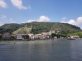
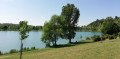
The first part of the route climbs along the road, then follows a shaded path. The descent features a few technical sections, leading down to the stream running alongside the campsite.
Please note: this route should be avoided in wet weather and is not particularly suitable for electric mountain bikes.

Details

n°2308904
Creation:
Last update:
Last review:
  • Mountain biking
    Activity: Mountain biking
  • ↔
    Distance: 5.99 mi
  • ◔
    Duration according to the author: 1.5 hrs 
  • ▲
    Difficulty: Moderate

  • ⚐
    Back to start: Yes
  • ↗
    Ascent: + 1,178 ft
  • ↘
    Descent: - 1,155 ft

  • ▲
    Highest point: 2,543 ft
  • ▼
    Lowest point: 1,411 ft
  • ⚐ Country: France
  • ⚐
  • ⚐ City: Barbières (26300)
  • ⚑
    Start/End: N 44.952601° / E 5.14396°
  • ❏
    IGN map(s): Ref. 3136ET, 3136SB

  • ◶
    Type of surface:
  •  
     
     
    ■ 33% Road ■ 34% Byway ■ 33% Path
  • ⇧
    Bike carrying: Not specified
  • ▲
    Difficulty: Not specified
  • Hour-by-hour weather

Description of the route

The start is located on the outskirts of the village of Barbières, at the foot of the Col de Tourniol.

_Mountain bike route marker no. 15._

(S/E) From Le Pertuis, head towards the Barbières signpost and follow signs for the Route des Ducs. Continue until you reach the Route des Ducs signpost.

(1) Continue straight on towards Chemin des Quarante Fonts. Pass through the hamlet of Les Ducs. At a hairpin bend to the left, take the dirt track on the right.

(2) Carry on straight ahead, ignoring the track leading uphill to the right. Cross the ford and head towards La Chabannerie.

(3) Pass two houses and turn right onto the track leading uphill. You’ll come to a small stream.

(4) Cross it and head down into the pine forest until you reach the Torrent de Barberolle.

(5) Cross this too and turn right. Pass the ‘Chemin de Cany’ signpost and continue towards La Liore.

(6) Take care. At the ‘La Liore’ signpost, cross the road and turn left onto a path that descends and joins a road.

(7) Follow it to the right for 100 metres and take the path that drops sharply to the right. Caution: technical path.

(8) At a hairpin bend, at La Mulatière, take the road to the left for 250 metres, then leave it at a left-hand bend.

(9) Cross the stream, then follow it until you reach Camping Le Gallo Romain. Head for the ‘Route des Ducs’ signpost.

(1) Turn right and follow the same route as on the way there to return to the Pertuis car park. (S/E).


Waypoints

  1. S/E : mi 0 - alt. 1,414 ft - Le Pertuis car park. Near the - Barberolle (Rivière)
  2. 1 : mi 0.74 - alt. 1,581 ft - Poteau Route des Ducs.
  3. 2 : mi 2.11 - alt. 2,149 ft - Home
  4. 3 : mi 2.48 - alt. 2,201 ft - La Chabannerie
  5. 4 : mi 2.76 - alt. 2,306 ft - Small stream
  6. 5 : mi 3.02 - alt. 2,372 ft - Barberolle Torrent
  7. 6 : mi 3.65 - alt. 2,543 ft - La Liore signpost
  8. 7 : mi 4.05 - alt. 2,339 ft - Route
  9. 8 : mi 4.62 - alt. 1,896 ft - La Muletière
  10. 9 : mi 5.02 - alt. 1,588 ft - Crossing the stream
  11. S/E : mi 5.99 - alt. 1,414 ft - Le Pertuis car park

Notes

It is strongly recommended that you take the IGN map no. 3136SB with you. Mountain bikers must be self-sufficient; professional guides are available if required. Emergency numbers: 18 or 112.
Enquiries at the Valence Romans Tourist Office in Valence: 04 75 44 90 40. infovalence@valenceromanstourisme.com.
Valence Romans Tourist Office

Reviews and comments

4 / 5
Based on 2 reviews

Reliability of the description
3.5 / 5
Ease of following the route
3.5 / 5
Route interest
5 / 5
Département de la Drôme

Hello,

thank you for your feedback. If you encounter any issues with signposting and/or trail maintenance, please do not hesitate to report them via https://sentinelles.sportsdenature.fr/ (website or mobile app). Your report will be forwarded directly to the route manager to help optimise the monitoring and maintenance of the trails.

We hope you enjoy some lovely walks in the Drôme!

Machine-translated

Laurette
Laurette

Overall rating : 4.3 / 5

Date of your route : Nov 04, 2024
Reliability of the description : ★★★★☆ Good
Ease of following the route : ★★★★☆ Good
Route interest : ★★★★★ Very good
Very busy route : No

The walk is well described, which is just as well, as the path is a bit overgrown on the first part of the route.
At the end of the descent, there was too much water in the stream, so once we reached the campsite, we completed the circular route via the local road.

Machine-translated

barniery yves
barniery yves

Overall rating : 3.7 / 5

Date of your route : Aug 15, 2022
Reliability of the description : ★★★☆☆ Average
Ease of following the route : ★★★☆☆ Average
Route interest : ★★★★★ Very good
Very busy route : No

Quite a technical route, actually, especially on the descent; we passed through a farm with lots of dogs tied up but very agitated; we also came across some cows whose path we were using; a lovely walk

Machine-translated

Other walks in the area

For more walks, use our search engine .

The GPS track and description are the property of this route's author. Please do not copy them without permission.