Géry Plateau and the Jabron in Montélimar

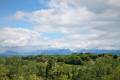
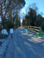
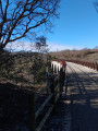
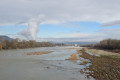
You’ll follow a shaded path along the banks of the Jabron, much loved by walkers, before climbing slightly up onto the Géry plateau. Situated on the heights above Montélimar, the Géry plateau offers a magnificent view over the Valdaine plain to the south and east of Montélimar. Incidentally, this plateau was once the capital of a Celtic people known as the Ségovéllaunes (meaning ‘victorious chiefs’). They are said to have built an oppidum there during antiquity, up until the 1st century BC.

Details

6503014
Creation:
Last update:
Last review:
  • Walking
    Activity: Walking
  • ↔
    Distance: 6.24 mi
  • ◔
    Average duration: 3h 10 
  • ▲
    Difficulty: Easy

  • ⚐
    Back to start: Yes
  • ↗
    Ascent: + 341 ft
  • ↘
    Descent: - 312 ft

  • ▲
    Highest point: 535 ft
  • ▼
    Lowest point: 272 ft

Photos

Description of the walk

Park in the car park at the Gymnase des Alexis, Chemin des Alexis.

(S/E) Turn right onto Rue des Ramières and continue straight on. After 50 m, turn right and cross the park to the banks of the Jabron. Turn left and follow the river for around 800 m.

(1) Take the small path on the left at the Jabron housing estate, then join Avenue d’Espoulette on the left.

(2) Turn left onto Chemin de la Resse. At the end, turn left onto Chemin sous Géry, then right onto Rue Léo Lagrange, and walk alongside the MJC.

(3) Turn right onto Chemin de Géry, go uphill and turn left onto Chemin du Bois de Lion. The view opens up. Continue straight on across the Géry plateau and head up into the housing estate. Pushchairs should continue straight on.

(4) At the car park beneath the pine trees, turn left onto the small path that leads down to the bottom of the woods.

(5) Once at the bottom of the wooded valley, cross over to the opposite side, behind the sports facilities, to join a path along the ridge. Follow this path to the edge of the forest. Go round the pump track/BMX track and then join the road via the path.
At the junction with Chemin de Margerie, continue to the left.

.(6) Turn right onto Chemin de Ruty. Continue straight on to reach the roundabout, then head straight ahead to rejoin the Jabron greenway.

(7) Follow the Jabron Greenway to the right until you reach the first bridge.

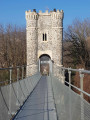
(8) Head down to the right, along the riverbank (kept clear by flocks of sheep), between Roubion and Jabron. Pass under the Pont du Garigliano and carry on straight ahead along the path to return to the private tennis court.

(1) Head straight on, retracing your steps along the route you took on the way there to return to the car park (S/E).

Waypoints

  1. S/E : mi 0 - alt. 272 ft - Alexis Sports Centre
  2. 1 : mi 0.45 - alt. 285 ft - Tennis court
  3. 2 : mi 0.77 - alt. 289 ft - Avenue d’Espoulette
  4. 3 : mi 0.99 - alt. 305 ft - Géry Path
  5. 4 : mi 1.81 - alt. 515 ft - Bois de Lion
  6. 5 : mi 2.14 - alt. 407 ft - Sports facilities at the Bois du Lion
  7. 6 : mi 3.3 - alt. 505 ft - Ruty Path
  8. 7 : mi 4.31 - alt. 325 ft - Banks of the - Jabron (rivière) - Affluent du Rhône
  9. 8 : mi 5.07 - alt. 308 ft - Garigliano Bridge
  10. S/E : mi 6.24 - alt. 272 ft - Les Alexis car park

Notes

Soothing little ‘waterfalls’ on the way back, along the Jabron.

Worth a visit

Panoramic view of the Saoû forest and Savasse (to the north).
Lavender fields on the Géry plateau in June and July.

Reviews and comments

4.3 / 5
Based on 2 reviews

Reliability of the description
4.5 / 5
Ease of following the route
4.5 / 5
Route interest
4 / 5
Agnes2607
Agnes2607

Overall rating : 4 / 5

Date of your route : Sep 16, 2024
Reliability of the description : ★★★★☆ Good
Ease of following the route : ★★★★☆ Good
Route interest : ★★★★☆ Good
Very busy route : No

A very pleasant walk, but not with the wind. We couldn’t really enjoy the walk because the wind was too strong. The walk is easy and enjoyable, but not particularly interesting (a mixture of tarmac and stones).

Machine-translated

jipette69
jipette69

Overall rating : 4.7 / 5

Date of your route : Sep 11, 2022
Reliability of the description : ★★★★★ Very good
Ease of following the route : ★★★★★ Very good
Route interest : ★★★★☆ Good
Very busy route : No

A lovely walk, mainly along tarmac roads. There are two changes to be made to the route.
At point No. 1: the gate is locked. You’ll need to look for a path a little further on (300 metres) on the left which leads to Allée Michel Besson. At the end, turn left onto Rue Ludwig Van Beethoven, which will take you back onto the route.
At point No. 6, do not turn right: the orchard path no longer exists between the two houses. At the roundabout, cross over and carry on straight ahead, and you’ll rejoin the path. Please note there is no pedestrian crossing.
Thank you for this walk.

Machine-translated

Other walks in the area

For more walks, use our search engine .

The GPS track and description are the property of this route's author. Please do not copy them without permission.