Pierre Rousse, starting from Puygiron

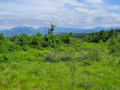
Starting from the hilltop village of Puygiron, this leisurely route offers a variety of landscapes and views.
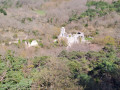
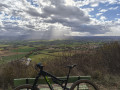
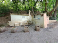
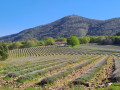
Start this route in the heart of Puygiron, home to a listed 12th-century castle. It offers a superb vantage point, overlooking the Valdaine plain and the village’s ancient alleyways. Continue along narrow paths bordering lavender fields and through woodland, as well as along small country lanes.

Details

n°26840226
Creation:
Last update:
Last review:
  • Mountain biking
    Activity: Mountain biking
  • ↔
    Distance: 7.50 mi
  • ◔
    Duration according to the author: 1.5 hrs 
  • ▲
    Difficulty: Moderate

  • ⚐
    Back to start: Yes
  • ↗
    Ascent: + 561 ft
  • ↘
    Descent: - 548 ft

  • ▲
    Highest point: 863 ft
  • ▼
    Lowest point: 495 ft
  • ⚐ Country: France
  • ⚐
    Area: Dauphiné
  • ⚐ City: Puygiron (26160)
  • ⚑
    Start/End: N 44.541° / E 4.84744°
  • ❏
    IGN map(s): Ref. 3038SB

  • ◶
    Type of surface:
  •  
     
     
    ■ 20% Road ■ 65% Byway ■ 15% Path
  • ⇧
    Bike carrying: No
  • ▲
    Difficulty: Easy
  • Hour-by-hour weather

Photos

Description of the route

Start from the Boulodrome car park at the foot of the village of Puygiron.

Blue signposting

(S/E) Climb up to the old village.

(1) Turn right onto the Petit Chemin de la Croix. Join a small road on the right and continue straight on.

(2) Leave the road to the right, taking the Chemin des Amandiers, which runs through the heart of the fields.
Join the Route de Saint-Bonnet on the left.

(3) At the junction between the roads and the footpath, carry on straight ahead along the path known as the ‘Chemin des Lavandes’, which leads to the Pont de la Cabane. Ignore the footpaths branching off to the right and continue along the path through the fields.

(4) After passing Grange Neuve, at the crossroads, turn right onto the Chemin de Grangeneuve, which skirts the woodland on your right.

(5) Join the Route de la Bâtie and turn right, heading south towards La Touche. Pass in front of the Bois de Naïza farm.

(6) Shortly after passing a truffle oak plantation, look out for the start of the path on the right-hand side of the road, leading into the Bois de Naïza.

(7) Stay on the main path and ignore the turn-offs to the left. The path becomes a small road at Notre-Dame-de-Mastaize.

(8) At the crossroads, turn right, then take the right-hand fork at the next junction. Stay on this same path, which changes its name at the boundary between the municipalities to become Chemin de Gournier. Pass the hamlet of Les Durands and reach thesecond turn-off on the right.

(9) Follow the road, which turns into a footpath through the fields.

(10) Head towards the hamlet of Coste Chaude on the right and walk between the houses to rejoin the footpath. Please be aware that you may encounter pedestrians. Turn left to head back down towards the village of Puygiron, ignoring the turn-offs to the right.

(11) After the edge of the field, head towards the cross and the Route de Saint-Bonnet. Continue straight on until you reach the Boulodrome car park (S/E).

Waypoints

  1. S/E : mi 0 - alt. 541 ft - Boulodrome car park
  2. 1 : mi 0.14 - alt. 604 ft - Petit chemin de la Croix
  3. 2 : mi 0.78 - alt. 541 ft - Chemin des Amandiers
  4. 3 : mi 1.45 - alt. 650 ft - Chemin des Lavandes
  5. 4 : mi 2.31 - alt. 581 ft - Grangeneuve
  6. 5 : mi 2.81 - alt. 577 ft - Route de la Bâtie
  7. 6 : mi 3.26 - alt. 633 ft - Bois Naïza
  8. 7 : mi 3.66 - alt. 837 ft - Path to Mastaize Cemetery
  9. 8 : mi 4.24 - alt. 712 ft - Cavaillon
  10. 9 : mi 5.84 - alt. 725 ft - Les Durands
  11. 10 : mi 6.24 - alt. 702 ft - Coste Chaude hamlet
  12. 11 : mi 7.43 - alt. 538 ft - The Cross
  13. S/E : mi 7.5 - alt. 541 ft - Boulodrome car park

Reviews and comments

4.7 / 5
Based on 1 review

Reliability of the description
5 / 5
Ease of following the route
4 / 5
Route interest
5 / 5
pascal031691
pascal031691

Overall rating : 4.7 / 5

Date of your route : Dec 07, 2023
Reliability of the description : ★★★★★ Very good
Ease of following the route : ★★★★☆ Good
Route interest : ★★★★★ Very good
Very busy route : No

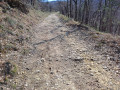
A very pleasant route; we combined it with the St Pantaléon-les-Vignes route to make a longer circular route. Well signposted, although the rocky section in the final third isn’t very well marked.
Thank you

Machine-translated

Other walks in the area

For more walks, use our search engine .

The GPS track and description are the property of this route's author. Please do not copy them without permission.