Serre Rosier

Starting from the Château des Tourrettes, this walk takes you on an unexpected journey into the heart of the natural countryside.

Details

n°25246890
Creation:
Last update:
Last review:
  • Walking
    Activity: Walking
  • ↔
    Distance: 2.54 mi
  • ◔
    Average duration: 1h 45 
  • ▲
    Difficulty: Easy

  • ⚐
    Back to start: Yes
  • ↗
    Ascent: + 653 ft
  • ↘
    Descent: - 630 ft

  • ▲
    Highest point: 1,181 ft
  • ▼
    Lowest point: 538 ft

Photos

Description of the walk

To return to the starting point, walk up past the Les Tourrettes town hall and turn right onto Rue Saint-Didier. Continue along Chemin de Chaussay. Pass the Saint-Didier Chapel on your right and walk uphill to join the path leading to the old village. Park at the bend or just before the ‘residents only’ sign. There is only space for two to three cars at most.

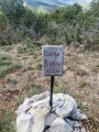
(S/E) Take the path on the right that leads down into the ravine, just before the first house. Turn left next to the pond.

(1) The path follows the bottom of the ravine for a while before a steep climb to the right. Turn left.
The route levels out as you approach the hamlet of Le Serre, which you can see on your left at the fork.

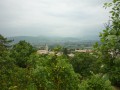
(2) Continue along a path on the right. At the junction, take the path leading uphill to the right (view of the hamlet of Platet).

(3) Keep to the right at the next fork and begin the ascent of Serre la Trappe du Loup. Stay on the track until you reach the summit. You’ll come to a wide forest track with hunting lookouts.

(4) Turn right to begin the descent.

(5) At a sharp bend, take the path that goes straight down. Cross the main track and head straight on along the small path that leads down.
Follow the path to return to the starting point, with a view of the medieval castle (S/E).


Waypoints

  1. S/E : mi 0 - alt. 587 ft - The old village of Les Tourrettes
  2. 1 : mi 0.1 - alt. 577 ft - Bottom of the ravine
  3. 2 : mi 0.32 - alt. 587 ft - The hamlet of Le Serre
  4. 3 : mi 0.68 - alt. 591 ft - Start of the ascent of the Serre
  5. 4 : mi 1.58 - alt. 1,152 ft - Forest track
  6. 5 : mi 1.76 - alt. 1,142 ft - Hairpin bend
  7. S/E : mi 2.54 - alt. 591 ft - The old village of Les Tourrettes

Notes

The old village of Les Tourrettes, with its castle, is private property. Please respect the residents and do not enter.

Reviews and comments

3.6 / 5
Based on 3 reviews

Reliability of the description
4 / 5
Ease of following the route
4 / 5
Route interest
2.7 / 5
Vincent Guillon
Vincent Guillon

Overall rating : 4.3 / 5

Date of your route : Jul 22, 2025
Reliability of the description : ★★★★☆ Good
Ease of following the route : ★★★★★ Very good
Route interest : ★★★★☆ Good
Very busy route : No

With GPS tracking of the hike, we had no difficulty following the route.

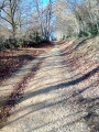
The circuit allows you to enjoy a pleasant time in the heart of nature. The paths are wide, except at the start in the canyon, where the trail is narrow. Be sure to take advantage of the viewpoints on the climb, as the view is obscured by trees in the "summit" area

Machine-translated

Xav26D
Xav26D

Overall rating : 3.5 / 5

Date of your route : Jan 01, 2025
Reliability of the description : Not used / Not applicable
Ease of following the route : ★★★★☆ Good
Route interest : ★★★☆☆ Average
Very busy route : No

A pleasant walk. A great way to get some fresh air.

Machine-translated

Département de la Drôme

Hello @Ghelderode,

I’m sorry to hear that you don’t find our walks to your liking. The walks in Les Tourrettes are steeped in history and family tradition.
If you’re looking for more walks with scenic views and a more technical challenge, I can recommend the Croix de Siméon walk in Allan, Sainte-Euphémie in Manas, or Le Janeston in Rochefort-en-Valdaine.
I hope you’ll enjoy these.

Machine-translated

Ghelderode
Ghelderode

Overall rating : 2.7 / 5

Date of your route : Oct 24, 2022
Reliability of the description : ★★★★☆ Good
Ease of following the route : ★★★☆☆ Average
Route interest : ★☆☆☆☆ Very disappointing
Very busy route : No

Hello,
Apart from the Château des Tourettes (which you can’t visit as it’s privately owned), this route is of no interest.
Unless you’re a keen sports enthusiast looking to train.
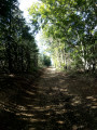
The entire route is under cover and offers only two or three spots from which to view the landscape.
What’s more, it passes through a private hunting ground lined with watchtowers.
This is the second time I’ve followed routes suggested by the Montélimar Agglomération Tourist Office, and both times I’ve been disappointed.
So I won’t be going on any more walks organised by this organisation.
Kind regards

Machine-translated

Other walks in the area

For more walks, use our search engine .

The GPS track and description are the property of this route's author. Please do not copy them without permission.