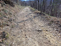
La Combe du Verger – Drôme Sud Provence

This route will delight purists and nature lovers alike.
You’ll set off to explore Clansayes and its ‘perched’ statue of the Virgin Mary, followed by its unique plateau. The return route takes you along the historic truffle-farming trail, with a steep and technical descent leading you to the finish.

Details

n°2308925
Creation:
Last update:
Last review:
  • Mountain biking
    Activity: Mountain biking
  • ↔
    Distance: 15.13 mi
  • ◔
    Duration according to the author: 2.5 hrs 
  • ▲
    Difficulty: Difficult

  • ⚐
    Back to start: Yes
  • ↗
    Ascent: + 915 ft
  • ↘
    Descent: - 912 ft

  • ▲
    Highest point: 1,043 ft
  • ▼
    Lowest point: 285 ft

Description of the route

Mountain bike route no. 10.

(S/E) At Place Chausy, at the signpost for Saint-Paul-Trois-Châteaux, turn right and follow signpost no. 10 to leave the village.

(1) Turn left. Further on, turn right and cross Châtillon Hill via a path through the woodland.

(2) Turn left. A little further on, turn right onto a track leading to the Combe du Verger.

(3) Caution: Carry on straight ahead to the D571. Turn right. A little further on, turn right onto a path to reach Clansayes.

(4) Continue straight on, climbing up onto the plateau. Pass through La Montagne. Carry on along the road.

(5) Turn right onto a single track through the woodland. Reach a small road and head uphill to the left.

(6) Turn right onto a path through the broom. Follow the signposts to Les Homais.

(7) Turn right onto a path through the woodland and continue to the right to reach Les Garrigues.

(8) Caution: Turn right and head down a track. Cross a road. Follow signpost no. 10 until you reach a technical climb.

(9) At the junction, turn left. Further on, take the single track to the right through the woodland.

(10) Caution: Cross the road. Take a downhill path which becomes technical. Reach La Côte du Serre.

(11) Caution: Carry on straight ahead to reach the historic truffle ground. Continue down the very technical Chameau descent.

(12) Caution: Turn right. Follow the signposts to the Chemin de Montélit. Return to the starting point (S/E).

Waypoints

  1. S/E : mi 0 - alt. 305 ft - Place Chausy, Saint-Paul-Trois-Châteaux
  2. 1 : mi 0.98 - alt. 331 ft - Turn left at the fork
  3. 2 : mi 1.87 - alt. 364 ft - Turn left at the fork
  4. 3 : mi 3.13 - alt. 522 ft - Combe du Verger
  5. 4 : mi 4.64 - alt. 787 ft - Clansayes
  6. 5 : mi 6 - alt. 869 ft - Turn right onto a single track through the woodland
  7. 6 : mi 6.48 - alt. 899 ft - Turn right onto a path
  8. 7 : mi 8.07 - alt. 994 ft - Poteau les Homais
  9. 8 : mi 8.95 - alt. 955 ft - Les Heaths
  10. 9 : mi 10.47 - alt. 955 ft - At the junction, turn left
  11. 10 : mi 10.78 - alt. 945 ft - Road crossing
  12. 11 : mi 11.63 - alt. 646 ft - The Côte du Serre
  13. 12 : mi 13.23 - alt. 335 ft - Turn right at the fork
  14. S/E : mi 15.13 - alt. 305 ft - Place Chausy, Saint-Paul-Trois-Châteaux

Notes

We strongly recommend taking IGN map no. 3039ET with you. Mountain bikers must be self-sufficient; professional guides are available if required. Emergency numbers: 18 or 112

Further information is available from the Drôme Sud Provence Tourist Office: 04 75 96 59 60
Drôme Sud Provence Tourist Office

Reviews and comments

5 / 5
Based on 1 review

Reliability of the description
5 / 5
Ease of following the route
5 / 5
Route interest
5 / 5
Carillion
Carillion

Overall rating : 5 / 5

Date of your route : Feb 03, 2025
Reliability of the description : ★★★★★ Very good
Ease of following the route : ★★★★★ Very good
Route interest : ★★★★★ Very good
Very busy route : No

Machine-translated

Other walks in the area

For more walks, use our search engine .

The GPS track and description are the property of this route's author. Please do not copy them without permission.