Col de Perette from Saint-Marcel-lès-Sauzet

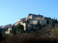
This walk is a natural gem just a stone’s throw from the town of Montélimar: a village built around the Cluniac priory of Saint-Marcel.

Details

25990791
Creation:
Last update:
Last review:
  • Walking
    Activity: Walking
  • ↔
    Distance: 4.35 mi
  • ◔
    Average duration: 2h 45 
  • ▲
    Difficulty: Easy

  • ⚐
    Back to start: Yes
  • ↗
    Ascent: + 840 ft
  • ↘
    Descent: - 823 ft

  • ▲
    Highest point: 948 ft
  • ▼
    Lowest point: 371 ft

Photos

Description of the walk

Starting point: Place de la Mairie, Saint-Marcel-lès-Sauzet

(S/E) Follow the D6 towards Sauzet (north-east).

(1) Turn left onto the Chemin de la Grande Carrière and, when you reach the road, first turn right then left and continue along the path running alongside the field to reach the Chemin de Lavalenche.

(2) At the signpost for “Les Maitairies” (alt. 120m), follow the signs for Col de Perette to the left. Join the Chemin du Collet. After passing above the farm, turn left onto a path that climbs and you’ll soon reach a fork.

(3) Turn right onto the footpath, staying on the main track.

(4) At the junction with the Chemin des Fours, which leads downhill, continue to the right along the path.

(5) At the crossroads above the Chêne Vert housing estate, continue uphill to the right towards La Montagne. Follow the ridge to reach the Col de Perrette.

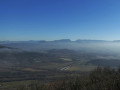
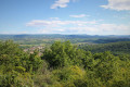
(6) Carry on straight ahead to reach the summit of Serre Rond (viewpoint to the north over the Rhône valley as far as Crussol Castle), then continue along the path which descends the south-western slope. You’ll reach a road.

(7) Turn left onto this road and, at the bend, take the Chemin des Bois to the Plein Sud housing estate.

(8) Walk along the wall on the left, going up the small path in line with Rue du Noyer. At the end, turn right and walk down past the cemetery via Montée de Maisonneuve.

(9) Turn left onto Route de la Coucourde and cross the D6 to return to the car park (S/E).

Waypoints

  1. S/E : mi 0 - alt. 371 ft - Town Hall Square
  2. 1 : mi 0.31 - alt. 390 ft - Junction
  3. 2 : mi 0.78 - alt. 463 ft - Chemin de Lavalenche
  4. 3 : mi 1.21 - alt. 607 ft - Ascent of the Mountain
  5. 4 : mi 1.82 - alt. 692 ft - Chemin des Fours
  6. 5 : mi 2 - alt. 715 ft - Holm Oak
  7. 6 : mi 2.63 - alt. 791 ft - Col de Perrette
  8. 7 : mi 3.31 - alt. 627 ft - Road junction
  9. 8 : mi 3.86 - alt. 482 ft - Path on the left
  10. 9 : mi 4.26 - alt. 374 ft - Route de la Coucourde
  11. S/E : mi 4.35 - alt. 371 ft - Town Hall Square

Worth a visit

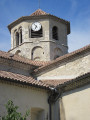
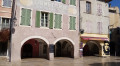
Off the route, visit the old village and explore the 12th-century Romanesque church, the priory and its bald cypresses (Laxidium), and the washhouse.

Reviews and comments

3.6 / 5
Based on 5 reviews

Reliability of the description
3.5 / 5
Ease of following the route
3.8 / 5
Route interest
3.4 / 5
tcheuma
tcheuma

Overall rating : 4.5 / 5

Date of your route : Jun 08, 2025
Reliability of the description : Not used / Not applicable
Ease of following the route : ★★★★★ Very good
Route interest : ★★★★☆ Good
Very busy route : No

We didn't follow the written description, instead following the route on the map and our GPS. We really enjoyed this hike along small paths. We had a beautiful view from the top of "La Montagne". However, the view from Serre Rond was disappointing, hidden by vegetation. The path up to Serre Rond is very steep, as is the descent.
The village of Sauzet is well worth a visit, with its many narrow streets and beautiful views. Unfortunately, the mountains in the distance were barely visible, shrouded in dust particles from the huge fires in Canada.

Machine-translated

Francine84
Francine84

Overall rating : 2.7 / 5

Date of your route : Sep 11, 2023
Reliability of the description : ★★★☆☆ Average
Ease of following the route : ★★★☆☆ Average
Route interest : ★★☆☆☆ Disappointing
Very busy route : No

A disappointing information sheet from the Montélimar Tourist Office. In fact, between points (2) and (3), the route no longer corresponds at all to the yellow markings and therefore takes us along unmaintained paths.
Furthermore, the enticing description – “discover the old quarries, the ruins and the lime kiln cave” – does absolutely nothing to help you discover anything at all. I personally made several return trips, including along the “Chemin des Fours”, and asked locals in the Chêne Vert neighbourhood, but found nothing.
What a shame!
Putting all that aside and following the clearly visible yellow markings, accompanied by the VTT16 markings, the circular route is interesting, alternating between easy paths and steeper slopes requiring greater attention and sustained effort.
I’ll go back to look for the quarry and cave if I manage to get more information. The village council doesn’t have any 😔.

Machine-translated

parastat
parastat

Overall rating : 3.7 / 5

Date of your route : Apr 09, 2023
Reliability of the description : ★★★☆☆ Average
Ease of following the route : ★★★☆☆ Average
Route interest : ★★★★★ Very good
Very busy route : No

The signposting on the ground differs in several places from that shown on the map.
The yellow markings are well spaced out, so the route is easy to follow.

A lovely little walk, with no difficulty and few roads.

Machine-translated

Arnaud Chn
Arnaud Chn

Overall rating : 4.7 / 5

Date of your route : Mar 05, 2023
Reliability of the description : ★★★★★ Very good
Ease of following the route : ★★★★★ Very good
Route interest : ★★★★☆ Good
Very busy route : No

A lovely short walk with a chapel near the start – unfortunately, it was closed on the day of our visit. Between point 1 and point 2, a real little Drôme-style safari awaits you: chickens, geese, a pig, ponies, horses and even a squirrel! Then, after point 2, the climb begins, with a few sections that are quite steep and slightly slippery in places due to the presence of breadcrumbs on the ground. At the highest point (276 m), there isn’t much of a clear view, but it’s a little further on, on the descent (3.340 km) and then at the round greenhouse, that the view opens up.
The return journey after point 4 is a little less interesting, following wide paths and then the road.
Despite strong winds in the Rhône Valley that day, we were completely sheltered. We only came across two other walkers.
In sunny, windy weather, it’s ideal.

Machine-translated

mesrandosard
mesrandosard

Overall rating : 2.7 / 5

Date of your route : Sep 18, 2022
Reliability of the description : ★★★☆☆ Average
Ease of following the route : ★★★☆☆ Average
Route interest : ★★☆☆☆ Disappointing
Very busy route : No

A pleasant path, but it runs through the trees.
The vegetation is varied and pleasant, with squirrels. Unfortunately, there are very few unobstructed views.
Well worth a visit, as recommended, is the old village.

Machine-translated

Other walks in the area

For more walks, use our search engine .

The GPS track and description are the property of this route's author. Please do not copy them without permission.