


BRUYERE56

 Visorando Member
 Premium user
 - Gender: man
Sign up:
Published route(s)
 Tour du cirque glaciaire du Ballon d'Alsace à partir du Lac d'Alfeld
 9.70 mi
 +2,480 ft
 -2,461 ft
 6h 35
6h 35
 Moderate
 Departure from Sewen (Haut-Rhin)
Belle randonnée en montagne entre forêts et chaumes d'altitude.
Eguisheim - Tour of the castles of Hagueneck, Hohlandsburg and Husseren
 11.54 mi
+2,444 ft
-2,444 ft
7h 25
11.54 mi
+2,444 ft
-2,444 ft
7h 25
 Difficult
Departure from Eguisheim (Haut-Rhin)
Difficult
Departure from Eguisheim (Haut-Rhin)
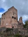
A magnificent hike through vineyards and forests from Eguisheim, taking in five castles overlooking the Alsace plain south of Colmar.
From the Eguisheim campsite, climb through the vineyards to the Haguenek Tower, then to Hohlansburg Castle via the Herzog Trail, passing by the Fontaine de la Dame fountain, then under the Rocher Turenne rock and the Abri de Stauffen shelter, then return via the Three Castles overlooking Husseren-les-Châteaux and the vineyards overlooking Eguisheim.
Schlumpf and Baerenkopf ridges from Lamadeleine-Val-des-Anges
8.51 mi
+1,900 ft
-1,903 ft
5h 35
Moderate
Departure from Lamadeleine-Val-des-Anges (Territoire-de-Belfort)
Starting from the small village of Lamadeleine-Val-des-Anges at the bottom of the Madeleine river valley, there is a pleasant climb through the forest to the Lochberg Pass via the Sept Chemins and Chat passes. From the Col du Lochberg, a circular route will allow us to discover the stubble fields and ridges of the Schlumpf with beautiful views of the upper Doller valley and the nearby peaks, as well as its magnificent log shelters (Sommerseite, Graber) before returning to the pass via the Fennematt and the Source de la Doller. Return to the starting point via the summit of Baerenkopf, Haquin and Trou du Loup.
Circular of the Miotte, Justices and Citadel forts in Belfort
 3.31 mi
+407 ft
-413 ft
1h 55
3.31 mi
+407 ft
-413 ft
1h 55
 Easy
Departure from Belfort (Territoire-de-Belfort)
Easy
Departure from Belfort (Territoire-de-Belfort)
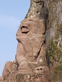
Circular in short version with limited elevation changes, the fortifications overlooking the old town of Belfort passing by the Tour de la Miotte, the Porte du Vallon then the Fort de la Justice and its dovecote, the top of the Glacis, the national cemetery, then the Citadel Tower and passage at the foot of the Lion before crossing the Brisach Gate, all enhanced by magnificent views of the city, its monuments and its surroundings.
Lepuix–Col du Chantoiseau–Tremonkopf–Les Plaines–Wissgrut–Le Gros Hêtre
 11.10 mi
+2,431 ft
-2,405 ft
7h 15
Moderate
Departure from Lepuix (Territoire-de-Belfort)
11.10 mi
+2,431 ft
-2,405 ft
7h 15
Moderate
Departure from Lepuix (Territoire-de-Belfort)
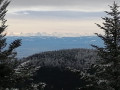
The route starts in the village of Lepuix, situated at the foot of the southern slope of the Ballon d’Alsace. A pleasant climb through the forest towards the scree slopes of the southern ridges of the Ballon d’Alsace and La Gentiane in the Les Plaines and Wissgrut area, offering magnificent views of the neighbouring mountain ranges: the Grand Ballon, the Black Forest, the Jura, and as far as the Bernese Alps with their legendary peaks (Eiger, Mönch, Jungfrau, etc.)
⚠️Dog kennel between 14 and 15 – best avoided if you have a nervous dog; see comment dated 5 May 2025.
The Thannerhubel and Rossberg mountain pastures from Bourbach le Haut
 9.34 mi
+2,582 ft
-2,559 ft
6h 35
Moderate
Departure from Bourbach-le-Haut (Haut-Rhin)
9.34 mi
+2,582 ft
-2,559 ft
6h 35
Moderate
Departure from Bourbach-le-Haut (Haut-Rhin)
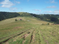
Starting from the centre of Bourbach-le-Haut, this is a lovely mountain walk accessible to most people, allowing you to explore – after passing through pleasant forests on both the ascent and descent – the Thannerhubel and Rossberg ridges and to enjoy magnificent 360° views of the Bernese Alps (Eiger, Munsch, Jungfrau...) and even the Mont Blanc massif, the Black Forest and the Vosges mountains (Grand Ballon, Markstein, etc.)
The Boundstone Trail from Nommay to Brevilliers in the Principality of Montbéliard
10.78 mi
+699 ft
-682 ft
5h 35
Moderate
Departure from Nommay (Doubs)
In addition to the Historical Trail of the Boundary Stones of the Principality of Montbéliard, which runs between Villars-lès-Blamont and Bussurel, this circular walk starting from Nommay follows thethird stage of the Historical Trail of the Boundary Stones on its outward leg.
This easy walk, in addition to its historical interest, passes through beautiful forests with open undergrowth, spanning three departments of Franche-Comté and situated in the immediate vicinity of the towns of Belfort and Montbéliard.
The Signal du Glaserberg from the source of the Ill and via the Col du Neuneich
 10.00 mi
+1,450 ft
-1,444 ft
5h 50
Moderate
Departure from Winkel (Haut-Rhin)
10.00 mi
+1,450 ft
-1,444 ft
5h 50
Moderate
Departure from Winkel (Haut-Rhin)
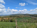
This hike allows you to discover parts of the region's history during the Second World War, in the context of the liberation of Alsace, by following part of the Sentier des Marocains (Moroccan Trail). It also allows you to discover magnificent landscapes in the Swiss Jura, the Sundgau and the foothills of the Vosges and the Black Forest, then to follow the source of the Ill on your return to the starting point.
The Drumont circular route from Fellering via the Haselkopf and the Gustiberg
9.91 mi
+2,490 ft
-2,490 ft
6h 45
Difficult
Departure from Fellering (Haut-Rhin)
Starting from Fellering, the hike takes you through a pleasant forest climb to Langmatt, where you join the ridge path near the Haselkopf, before reaching the Drumont, and returning via the Gustiberg and the Fellering peat bog. From the unobstructed summit of the Drumont, there is a magnificent view over the Thur valley and the surrounding Vosges peaks.
The Arcier springs with return via the heights of Chalèze
4.32 mi
+768 ft
-748 ft
2h 40
Moderate
Departure from Vaire-Arcier (Doubs)
Near Besançon, discover the beautiful hamlet of Arcier and its water sources, which contribute significantly to the water supply of Besançon and the valley overlooking them, and return via the heights of Chalèze and La Canaie via the Côte de Joux.
The Molkenrain via Rehbrunnel and the Ostein rock
9.41 mi
+2,510 ft
-2,523 ft
6h 30
Difficult
Departure from Haut-Rhin
Ascent to the summit of Molkenrain, situated opposite the Grand Ballon and next to the Hartmannswillerkopf, starting from Steinbach and passing through the viewpoints at Rehbrunnel and Rocher d’Ostein, as well as the Pyramides and Turenne camps, then returning via the Molkenrain ridge and the Col d’Herrenfluh,
An accessible hike enjoying pleasant forest paths and high-altitude stubble fields that offer remarkable views and panoramas whilst passing through historic sites.
Le Vieux Tilleul and Fort de la Dame Blanche as seen from Les Petites Baraques
8.83 mi
+1,430 ft
-1,457 ft
5h 20
Moderate
Departure from Besançon (Doubs)
On the outskirts of Besançon, starting from Les Petites Baraques (Chailluz Forest), theGR® de Pays Ceinture de Besançon trail takes you up to the ridge, which you then follow for nearly 6 km, from Le Vieux Tilleul above the Prè Brenot industrial estate to the Fort de la Dame Blanche viewpoint above Bonnay. The return route takes you through the Chailluz Forest, allowing you to walk alongside its wildlife reserve.
Vernazza – Corniglia via San Bernardino and return via the coastal path
6.48 mi
+2,995 ft
-2,972 ft
5h 35
Difficult
Departure from Vernazza (La Spezia)
A beautiful walk offering a wide variety of landscapes between the coast and the ridges, passing through terraced farmland. Starting from Vernazza, the walk passes through San Bernardino before reaching the ridge at Sella della Cigoletta, then descends to Corniglia, the only village in the Cinque Terre not overlooking the sea. After visiting this unique village, the return to Vernazza follows the magnificent coastal path (SVA).
Monterosso to Vernazza via Madonna di Soviore, Madonna di Reggio and Monte Santa Croce
 5.94 mi
+2,162 ft
-2,146 ft
4h 35
Moderate
Departure from Monterosso al Mare (La Spezia)
5.94 mi
+2,162 ft
-2,146 ft
4h 35
Moderate
Departure from Monterosso al Mare (La Spezia)
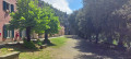
Hike starting from Monterosso al Mare, exploring the local heritage and offering beautiful views of the hinterland and the coast. From the village’s railway station, cross through the old part of the village, passing beneath the Aurora Tower, then climb up to the important 10th-century sanctuary of the Madonna di Soviore; follow the ridge path via Monte Santa Croce before a pleasant and fairly easy descent to Vernazza via the 13th-century Madonna di Reggio.
Col Amic - Thierenbach and its basilica from Wuenheim
 9.40 mi
+2,175 ft
-2,182 ft
6h 15
Moderate
Departure from Soultz-Haut-Rhin (Haut-Rhin)
9.40 mi
+2,175 ft
-2,182 ft
6h 15
Moderate
Departure from Soultz-Haut-Rhin (Haut-Rhin)
Starting from Wuenheim near Soultz, this hike offers a wealth of historical and cultural heritage discoveries, taking you through beautiful forests in the foothills of the Vosges mountains to Col Amic on the Route des Crêtes, passing historic sites from the 1914-1918 war near Hartmannswillerkopf: Zimmermann Cross, Baratin Shelter and Sicurani Chapel, then return via the Kohlschlag farm inn, Holzwasen, St Anne's Chapel, Notre-Dame de Thierenbach Basilica and the Jewish cemetery in Jungholtz.
Circular walk of the Miners' Chapel and the geological trail from Sentheim
 5.25 mi
+400 ft
-404 ft
2h 45
Easy
Departure from Sentheim (Haut-Rhin)
5.25 mi
+400 ft
-404 ft
2h 45
Easy
Departure from Sentheim (Haut-Rhin)
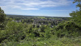
From the car park at Sentheim church, cross the Doller river and climb the hill above the village via the Way of the Cross and its thirteen stations, the Virgin of Rollenberg, the Eichwald forest and the old sports trail. Return via Knapphutte and the Miners' Chapel, then take a section of the geological discovery trail.
Circular route of La Madeleine from the Étang du Moulin des Bois
4.52 mi
+69 ft
-69 ft
2h 10
Easy
Departure from Bessoncourt (Territoire-de-Belfort)
Starting from the Étang du Moulin car park, explore the villages of Phaffans and Lacollonge on an easy circular route around the River La Madeleine, offering beautiful views of the Southern Vosges from the Planche des Belles Filles to the Grand Ballon.
Tour of the four lakes via various viewpoints and the Pic de l'Aigle
 9.53 mi
+1,499 ft
-1,476 ft
5h 40
Difficult
Departure from Le Frasnois (Jura)
9.53 mi
+1,499 ft
-1,476 ft
5h 40
Difficult
Departure from Le Frasnois (Jura)
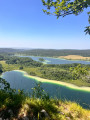
From the car park in the hamlet of La Fromagerie, which also provides access to the Cascades du Hérisson from above, cross Le Frasnois and follow the banks of Lac de Narlay before climbing up to discover several magnificent viewpoints overlooking the emerald-coloured lakes (Ilay, Narlay, Grand and Petit Maclu), some of which are unnamed and wild, and those of the Quatre Lacs, Trois Lacs and Pic de l'Aigle, then return to the starting point along the Lac d'Ilay.
Tour of the Princes' Ponds and discovery of Saint-Julien-lès-Montbéliard
 6.56 mi
+581 ft
-581 ft
3h 30
Moderate
Departure from Raynans (Doubs)
6.56 mi
+581 ft
-581 ft
3h 30
Moderate
Departure from Raynans (Doubs)
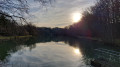
The Princes' ponds, named after the Württemberg family who ruled the duchy, are located in the heart of the Rupt valley. Drained two centuries ago, they were refilled with water in 1991 and then stocked with fish. Improvements have been made to secure the surroundings for visitors to this true haven of peace. After a tour of the ponds, the circular offers the opportunity to discover the heritage of Saint-Julien-lès-Montbéliard with a return trip through the villages of Issans and Raynans.
Rehbrunnel and Wotan Oak from Thann, return via the Rangen vineyard
 8.42 mi
+1,936 ft
-1,909 ft
5h 35
Moderate
Departure from Thann (Haut-Rhin)
8.42 mi
+1,936 ft
-1,909 ft
5h 35
Moderate
Departure from Thann (Haut-Rhin)
Starting from Thann, a pleasant climb through the forest towards the Wotan Oak viewpoint (Rehbrunnel shelter) via the greenway, passing at the foot of the Drachenfells then through Heida Platzala and the Waldkapelle. Return via the Col de Grumbach, the ruins of Engelbourg Castle (Witch’s Eye), and a climb to the Croix du Rangen and its viewpoint before a pleasant descent winding through the vineyards, whilst enjoying the magnificent panoramic view over Thann and the Thur Valley.
Circular between Col du Haag, Storkenkopf and Grand Ballon from Firstacker
10.10 mi
+2,228 ft
-2,228 ft
6h 35
Moderate
Departure from Soultz-Haut-Rhin (Haut-Rhin)
A beautiful hike, wild in all seasons, through stubble fields and beautiful forests, passing the summit of the Grand Ballon (360° view) from the Firstacker car park, via the stubble fields of Gerstacker, the Haag Pass, around the Storkenkopf in the forest, then up to the summit of the Grand Ballon (Diables Bleus monument and radar dome) before descending via the modified GR®5 route between the Col du Grand Ballon (La Vue des Alpes restaurant) and the Ferme-auberge du Grand Ballon.
Ostein Farm and Rock, Camp Turenne and Molkenrain from Bitschwiller
10.05 mi
+2,559 ft
-2,549 ft
6h 50
Difficult
Departure from Bitschwiller-lès-Thann (Haut-Rhin)
Starting from Bitschwiller-lès-Thann, climb to Camp Turenne via the Wickenbaechle path, the Ostein Farm Inn, the Triade shelter and Rocher d’Ostein, then climb to Molkenrain via the Friends of Nature refuge. Return via Camp Turenne, Baerenthal, Camp des Pyramides, Place des Canaris and Roche Albert. This loop walk passes numerous vantage points overlooking the Thur Valley and the surrounding peaks, such as Thanner Hubel and the Grand Ballon, as well as iconic historical sites on theFirst World War front.
From Lachtelweiher, a circular route that passes via the summits of the Baerenkopf and the Sudel
9.05 mi
+1,821 ft
-1,821 ft
5h 45
Moderate
Departure from Haut-Rhin
From Lachtelweiher (in the municipality of Kirchberg), a pleasant circular route follows the Doller valley, passing over the peaks of Baerenkopf and Sudel in the Southern Vosges and through the farmhouse inns at Lochberg and Bruckenwald. This circular route also has historical interest as it follows, for a long stretch along the ridge, theGR®5, which runs along the former border between France and Germany from 1871 until the First World War.
Laval circular – Marchand de Nuages plateau in Gréoux-les-Bains
 5.25 mi
+781 ft
-774 ft
3h 05
Easy
Departure from Gréoux-les-Bains (Alpes-de-Haute-Provence)
5.25 mi
+781 ft
-774 ft
3h 05
Easy
Departure from Gréoux-les-Bains (Alpes-de-Haute-Provence)
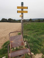
A walk starting from Laval that takes you up the Ravin de Laval to La Bouscole, then, after crossing the Ravin du Pauron, on to the Marchand de Nuages plateau, where there is a 360° panoramic view. The descent leads towards the ruins of Pujol; as you leave the plateau, you’ll see the dam and Lake Esparron on your left. Discover a variety of landscapes, ranging from farmland at the bottom of the Ravin de Laval and heath to a sparsely vegetated plateau.
From the village fountains to the Fort and Bermont Viaduct in Dorans
 7.64 mi
+525 ft
-551 ft
4h 00
Moderate
Departure from Dorans (Territoire-de-Belfort)
7.64 mi
+525 ft
-551 ft
4h 00
Moderate
Departure from Dorans (Territoire-de-Belfort)
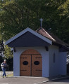
A circular route allowing you to explore two villages near Belfort, both rich in heritage: Bermont, with the Church of Saint-Laurent, the Savoureuse Viaduct and the Fort du Bois d'Oye; and Dorans, with the Chapel of Notre-Dame du Chêne and the fountain route. There are numerous vantage points along the route.
Camp Turenne, Ostein Rock via the Rangen Cross, Engelbourg from Thann
8.74 mi
+1,900 ft
-1,880 ft
5h 40
Moderate
Departure from Thann (Haut-Rhin)
Starting from the Kattenbach car park, a pleasant climb via the Croix du Rangen, through the vineyards, passing through Waldkapelle, Pastetenplatz and the Becherkopf shelter, to Camp Turenne – a historic site – and the Ostein rock, renowned for its views over the Thur Valley and the surrounding peaks. Return via theGR®5, passing Camp des Pyramides, Place des Canaries, the Col de Grumbach and the Ruins of Engelbourg (the Witch’s Eye) overlooking Thann to enjoy the view.
The Oberwald and Sainte-Anne Chapel Circular Route, starting from Lauw
3.63 mi
+125 ft
-138 ft
1h 45
Easy
Departure from Lauw (Haut-Rhin)
From the centre of Lauw, enjoy a pleasant walk through fields and the beautiful deciduous forests of the Oberwald, returning from Sentheim via the Chapel of St Anne and past the Hohlenstein Cave before following the banks of the Doller.
Chaumes du Ballon d’Alsace between the Col du Ballon and Wissgrut
10.34 mi
+2,178 ft
-2,182 ft
6h 40
Moderate
Departure from Lepuix (Territoire-de-Belfort)
Starting from the large car park at Malvaux, in the commune of Lepuix, follow theGR®®5uphill to the Ballon d’Alsace via the Saut de la Truite, the Rummel Waterfall, the Étang des Roseaux, the Grande Goutte refuge and the Bomb Disposal Unit Monument. To enjoy panoramic views, follow the path along the ridges of the Ballon d’Alsace, from the Col du Ballon via the Bérézina, down the Piste Mannheimer, past La Gentiane to the ridges of the Wissgrut. Descend via the Gros Hêtre and the Col du Houx, then return via the Roche du Cerf and the Saut de la Cuvotte.
From Oderen up to Trehkopf via Uhufels and Gommkopf, returning via Katzensteg
10.32 mi
+2,782 ft
-2,772 ft
7h 10
Moderate
Departure from Oderen (Haut-Rhin)
From Oderen, a magnificent climb to Trehkopf, a paradise for paragliders, passing by the viewpoints of Uhufels and Gommkopf over the valley and the surrounding Vosges peaks, via the Treackerké shelter and the old Trehkopf cemetery, following pleasant paths mostly through the forest. After enjoying the ridges of Trehkopf and Jungfrauenkopf and a 360° view, the return journey will take you via the Treh farmhouse inn, Sainte-Anne Chapel, the Schalm shelter, the Katzensteg viewpoint and the Hensbach woods.
Saint-Ursanne – La Caquerelle – Les Rangiers via Outremont
10.17 mi
+2,251 ft
-2,270 ft
6h 40
Difficult
Departure from Saint-Ursanne (Canton of Jura)
Climb to the Hermitage of Saint-Ursicinus, with access to two viewpoints over Saint-Ursanne, then continue along a signposted path towards the Outremont farm, the ridge and down to La Caquerelle. Optional round trip to the Col des Rangiers and the viewpoint from the CAS chalet. Descent to Saint-Ursanne across meadows, then cross the Doubs to enter the old town via the Pont Saint-Jean and the gate of the same name.
Mont-Miroir, Roche de Ruan, Faux Verger, starting from Maîche
11.86 mi
+1,834 ft
-1,821 ft
7h 05
Difficult
Departure from Maîche (Doubs)
From the centre of Maîche, head up via the Étang de la Goule to Mont Miroir and its ski lift, then continue to the Roche de Ruan viewpoint. Descend towards the town, then climb back up the hill to the Saint-Michel Chapel overlooking Maîche. Then head downhill, passing through the Château du Désert park, before following the Faux Verger circular route, and returning via La Lizerne and the Château de Mérode. This pleasant circular route offers numerous viewpoints, including the one at Faux Verger, which provides a truly 360° view of the surrounding landscape, from the Vosges to the Swiss Jura, and even as far as the Bernese Alps, weather permitting.
Rocher du Bourbet, Waroly caves and waterfalls from Maîche
10.97 mi
+1,555 ft
-1,529 ft
6h 25
Moderate
Departure from Maîche (Doubs)
Starting from Maîche, pass through Les Bréseux to see, in particular, its Comtois-style church with magnificent modern stained glass windows, then on to Rochet du Bourbet, a viewpoint over the Dessoubre valley and picnic area. Return via the QuatreGrottes de Waroly, the Waroly waterfalls and the hamlet of La Lizerne. Several interesting viewpoints: Rochet du Bourbet, on the way down to the Château de l'Ermitage, then on the way back up to the hamlet of La Lizerne, among others.
Mont-Dommage, Cuves de Bléfond and Croix du Châtard from Baume-les-Dames
9.38 mi
+1,946 ft
-1,919 ft
6h 00
Moderate
Departure from Baume-les-Dames (Doubs)
Starting from Baume-les-Dames, discover magnificent, breathtaking views of the town, the Doubs valley and the Cusancin, before the trail joins the Doubs via the path leading to Mont Dommage. Pass by the Chassignole viewpoint and along the Sentier de la Croix and the Roche de Châtard. You’ll also discover unique geological features of limestone massifs, such as the Bléfond potholes.
Lacs des Perches and Neuweiher via Haute Beers and Gresson in Rimbach
9.84 mi
+2,484 ft
-2,480 ft
6h 40
Moderate
Departure from Rimbach-près-Masevaux (Haut-Rhin)
A pleasant, undulating hike between the lakes of the Vosges, offering magnificent views, high-altitude thatched roofs and open, varied landscapes. Starting from Rimbach near Masevaux, head towards Basse Bers, then Lac des Perches, climb up to the pass of the same name, followed by the GR®5 trail overlooking the lake, towards Haute Beers (shelter). Gentle descent via the Seppiweg to the Neuweiher lakes, then climb towards Gresson (farmhouse inn). Descent to Ermensbach via the magnificent log cabin shelter of Lagerwald Hutte, then along the hillside to the church in Rimbach.
Gorges du Pichoux, Lac Vert, Combe des Beusses from Undervelier
10.95 mi
+2,467 ft
-2,470 ft
7h 10
Difficult
Departure from Sornetan (Canton of Bern)
Starting from Les Blanches-Fontaines south of Undervelier (Canton of Jura), this hike offers a magnificent ascent of the Sorne river and its gorges dotted with several waterfalls, passing by Lac Vert, all in a wild environment, to the hamlet of Pichoux, then climbing up to the plateau overlooking the gorges to enjoy a magnificent view. Continue along the plateau via Rebévelier, then a moderately pleasant descent down the Côte de Tirmenté to the Combe des Beusses. Return to the lush vegetation at the bottom of the valley via the Combe es Monin (home to a private foundation dedicated to children), then a short climb to Blanche Maison with another beautiful view of the landscape and a hilly descent passing above the Pré de Joux, then through several pastures towards Undervelier. Short link along the road, climbing up the Sorne to the start.
Grotte du Grenier, Lac de Moron, Tête de Calvin and Saut du Doubs
11.27 mi
+2,441 ft
-2,441 ft
7h 20
Difficult
Departure from Villers-le-Lac (Doubs)
Depart from Le Pissoux, descend to the Grotte de Grenier above the Doubs and cross the river on stepping stones, allowing you to cross dry-shod downstream from the Châtelot dam, followed by the magnificent marked trail on the right bank of the Doubs (Lac du Moron) on the Swiss side. At the Saut du Doubs, head back and forth to the Tête de Calvin to see the meanders of the Doubs basins stretching from Viller-le-Lac to the Saut du Doubs from above, then cross the Doubs via the footbridge upstream of the Saut du Doubs, pass by the viewpoints overlooking the Saut du Doubs and climb directly up through the forest to Le Pissoux, via the Belvédère du Châtelard overlooking Lac de Moron.
Galtz loop via Trois-Épis, Wineck Castle from Ammerschwihr
10.05 mi
+1,775 ft
-1,798 ft
6h 10
Moderate
Departure from Ammerschwihr (Haut-Rhin)
Departure from Ammerschwihr, a famous village in the Alsatian vineyards, crossing the Ammerschwihr golf course and climbing to the Roche du Corbeau before crossing the Trois-Épis health resort and climbing to the Galtz monument, the Alsatian Corcovado. The return to Ammerschwihr is via the Château du Wineck (near Katzenthal) and the famous Kaefferkopf grand cru vineyard.This hike offers the chance to discover varied landscapes, from high-altitude forests to grand cru vineyards, passing by magnificent viewpoints such as the Rocher du Corbeau and the Galtz, and the ruins of the old hamlet of Meywihr near Ammerschwihr, which also has a rich historical heritage.
Tour of the Petit Ballon stubble fields starting from the Col de Boenlesgrab
10.42 mi
+2,569 ft
-2,549 ft
7h 00
Difficult
Departure from Rouffach (Haut-Rhin)
Departure from the Col de Boenlesgrab, passing by the Refuge de la Schellimat, near Hilzen, via Bockswasen, then by the Refuge des Amis de la Nature below the summit of the Petit Ballon, then continuing after the summit along the ridges via the Col du Petit Ballon, Steinberg and its megaliths, then Grothkopf.Return via the farmsteads of Kahlenwassen (near the Virage Pinot) and Buchwald, the former intermediate station of the German cable car, then via the Strohberg farmstead before descending via Brudermatt to the Col du Boenlesgrab. This hike takes you across magnificent high-altitude stubble fields and offers numerous 360° views of the Vosges peaks and nearby Alsatian valleys.
Le Chasseral via Combe Grède and Dairy Farm de Morat from Villeret
11.29 mi
+3,442 ft
-3,432 ft
8h 10
 Very difficult
Departure from Villeret (Canton de Berne) (Canton of Bern)
Very difficult
Departure from Villeret (Canton de Berne) (Canton of Bern)
Departure from Villeret in the Bernese Jura near Saint-Imier, climb via the Combe Grède, passing through Pré aux Auges, Les Limes, then along the ridge overlooking the Métairie de Morat facing the Chasseral, before reaching and following the ridge leading directly to the signal (television tower) and the summit of the Chasseral. The magnificent view from the summit ridge amply rewards hikers for their efforts on the climb, allowing them to enjoy, in particular, the three lakes (Biel, Neuchâtel and Morat) and the highest peaks of the Bernese Alps in good weather. The descent is via Pré aux Auges and the dairy farms of the Planes and Métairie aux Renards. A beautiful encounter on the descent, with a herd of chamois above the Métairie des Plânes.
Virgin of Alsace, Sickertbach Pass and Rocher de la Croix
5.87 mi
+1,273 ft
-1,280 ft
3h 50
Moderate
Departure from Sickert (Haut-Rhin)
Starting from the centre of Sickert, a beautiful hike offering views of the Virgin of Alsace overlooking the Doller Valley, then ascending the Sickertbach valley, passing the Sickertbach Shelter and the pass of the same name, and returning via the foot of the Falkenstein to the Col de Luttersberg to enjoy the magnificent view from the Rocher de la Croix. Descent towards Sickert via the charming Chapel of the Owls (Kutzakapalala).
The Hochburg via the Cols d'Hundsruck, Schirm and Rocher du Poilu
12.04 mi
+2,110 ft
-2,096 ft
7h 20
Difficult
Departure from Sentheim (Haut-Rhin)
From the car park at Sentheim church, a pleasant, undulating hike passes through Spannplatz between Bourbach-le-Bas and Rammerstatt, climbing towards the Col d'Hundsruck via the Hochburg shelter, where you can enjoy beautiful views of the Swiss Jura and the Bernese Alps in good weather. Then descend towards Bourbach-le-Haut, passing through the Col du Schirm and climbing up to the Rocher du Poilu to enjoy the magnificent view despite the somewhat overgrown forest, before returning to Sentheim via the Chapelle des Mineurs and part of the Geological Trail and Hasenwald.
Camp Turenne, Rocher d’Ostein and Roche Albert in a circular route from Thann
10.29 mi
+2,185 ft
-2,159 ft
6h 40
Moderate
Departure from Thann (Haut-Rhin)
Start from Thann Kattenbach, climb to Camp Turenne via the Croix du Rangen overlooking the grand cru of the same name. Pass by the Waldkapelle and the Rehbrunnel shelters, near the Wotan Oak and Becherkopf, to the Camp Turenne monument, then a round trip to Rocher Ostein, offering magnificent views over the Thur valley and the neighbouring Vosges peaks. Descent via Camp des Pyramides, Place des Canaris and the Roche Albert viewpoint, followed by the Greenway along the Thur and a climb to Engelbourg (Œil de la Sorcière) to enjoy the view over Thann.
Montaigu viewpoint and viewpoint overlooking Saint-Hippolyte
11.39 mi
+1,998 ft
-1,969 ft
7h 00
Difficult
Departure from Bief (Doubs)
From leat, along the Doubs, climb up the valley via the Côte du Savu, passing near Chatillon-sous-Maîche and by the fountain and statue of Saint-Léger, dating from 1721, to the 360° viewpoint at Montaigu overlooking, on one side, the Terres de Chaux and the Crêtes du Lomont all the way to the Pays de Montbéliard, with the Vosges in the background; on the other side, the Jura Plateaus and, in particular, the Chasseral; and, in the foreground, Mont Miroir. The return route takes you through Valoreille and the Combe d'Amotte, to the Pain de Sucre overlooking the Doubs valley and the viewpoint overlooking Saint-Hippolyte, at the confluence of the Dessoubre and the Doubs, via the GRP®, returning to leat via the Grand Recet.
Cirque de Consolation circular walk, taking in viewpoints and balcony-style paths
9.40 mi
+2,198 ft
-2,178 ft
6h 15
Difficult
Departure from Consolation-Maisonnettes (Doubs)
From the car park at the Monastère de Consolation, explore the Cirque and the Val de Consolation, with its many springs (Dessoubre, Lançot, Tabourot and Noire), via the viewpoints at La Roche du Prêtre, Chauve Roche and La Roche Sainte-Catherine, and its balcony-style paths winding through rocky outcrops, offering breathtaking views.
The Hundsruck and Schirm Passes and Bourbach-le-Haut as seen from Bourbach-le-Bas
9.00 mi
+1,841 ft
-1,824 ft
5h 45
Moderate
Departure from Bourbach-le-Bas (Haut-Rhin)
A pleasant, undulating walk through varied landscapes, starting from Bourbach-le-Bas, passing through Spannplatz and the Krastkopf graves, near the summit of the Kohlberg, then on to the National Monument to the Shock Troops, where you can enjoy the view over the Doller Valley and the Thannerhubel and Rossberg massifs, followed by a descent via the Col d’Hundsruck, a walk through Bourbach-le-Haut and a return via the Col du Schirm.
A circular route through the Val d’Ajoie and the Faux d’Enson, starting from Damvant
10.40 mi
+1,598 ft
-1,614 ft
6h 10
Moderate
Departure from Damvant (Canton of Jura)
Starting from the centre of Damvant, this figure-of-eight route follows the French-Swiss border, running alongside the Prehistoric Park and the Reclère Caves. The route passes through the charming village of Roche d’Or before climbing up to La Faux d’Enson and its panoramic tower. Return via the ridge forming the border before passing through the two Swiss farms at La Vaux and Montavon and returning via the entrance to the Reclère Prehistoric Park and Caves. In fine weather, there are stunning views as far as the Bernese Alps from the Faux d’Enson observation tower, as well as across the Doubs valley on the French side whilst following the border on the return journey.