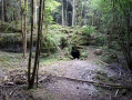
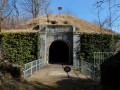
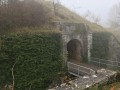
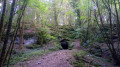
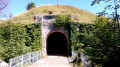
Le Vieux Tilleul and Fort de la Dame Blanche as seen from Les Petites Baraques

On the outskirts of Besançon, starting from Les Petites Baraques (Chailluz Forest), theGR® de Pays Ceinture de Besançon trail takes you up to the ridge, which you then follow for nearly 6 km, from Le Vieux Tilleul above the Prè Brenot industrial estate to the Fort de la Dame Blanche viewpoint above Bonnay. The return route takes you through the Chailluz Forest, allowing you to walk alongside its wildlife reserve.

Details

8009297
Creation:
Last update:
Last review:
  • Walking
    Activity: Walking
  • ↔
    Distance: 8.83 mi
  • ◔
    Average duration: 5h 20 
  • ▲
    Difficulty: Moderate

  • ⚐
    Back to start: Yes
  • ↗
    Ascent: + 1,430 ft
  • ↘
    Descent: - 1,457 ft

  • ▲
    Highest point: 1,975 ft
  • ▼
    Lowest point: 1,004 ft
  • ⚐ Country: France
  • ⚐ City: Besançon (25000)
  • ⚑
    Start/End: N 47.296092° / E 6.030599°
  • ❏
    IGN map(s): Ref. 3323ET
  • Hour-by-hour weather

Description of the walk

Park in the Petites Baraques car park.

(S/E) From the car park, set off along the Chemin Fonds de Chailluz forest track, heading south-west, and follow it for nearly 1 km until you reach a junction at elevation 326.

(1) Turn right onto the signpostedGR® de Pays Ceinture de Besançon trail. After one kilometre, you’ll reach a junction with a forest track.

(2) Follow the forest track to the right, passing under the motorway, then, a few dozen metres further on, take the path on the left which initially runs alongside the A36. After a turning area on the forest track, take the signposted path which continues straight ahead.

(3) Turn right onto the path and begin the ascent towards the Vieux Tilleul, dating from 1699. Walk 10 metres past it.

(4) Turn right; the path follows the ridge to the Fort de la Dame Blanche for nearly 6 km.

(5) At the junction of the paths, at elevation 399, carry on straight ahead. Join the forest track and follow it to the left.

(6) Continue along the path that follows the ridge, leaving the track to your right.

(7) After rejoining the forest track and crossing the Chemin de Bonnay, continue along the ridge path to the Fort de la Dame Blanche.

(8) A viewpoint offering views over the Ognon Valley and the Southern Vosges.
Turn back along the forest road for about 200 metres.

(9) At the junction, turn left onto the Chemin de la Charrière du Fort, which descends directly south.

(10) At the junction, follow the Route Forestière du Bas de la Côte to the right. Then, 100 metres further on, carry straight on down the road, pass under the motorway and reach a crossroads.

(11) Turn right onto this path, which runs alongside the motorway for around 300 metres, then continue south-west for around 1 km, following the fence of the wildlife park.

(12) At the junction with the Route Forestière du Ramier, cross it and continue straight on along the signposted Saint Nicolas Trail for 800 m until you reach another junction of signposted trails.

(13) Turn right and head uphill to join the forest road and Les Petites Baraques (S/E).

Waypoints

  1. S/E : mi 0 - alt. 1,243 ft - Car park - Parking les petites baraques
  2. 1 : mi 0.57 - alt. 1,060 ft - Junction: Road x GRP Besançon Ring Trail
  3. 2 : mi 1.28 - alt. 1,007 ft - Junction: GRP – forest track
  4. 3 : mi 2.16 - alt. 1,184 ft - End of forest road, signposted path
  5. 4 : mi 2.37 - alt. 1,293 ft - Old Linden Tree
  6. 5 : mi 3.04 - alt. 1,309 ft - Trail junction
  7. 6 : mi 4.18 - alt. 1,542 ft - Tallenay Path × Forest Road
  8. 7 : mi 4.61 - alt. 1,772 ft - Bonnay Path x Forest Road
  9. 8 : mi 6.02 - alt. 1,959 ft - Viewpoint at the - Fort de la Dame Blanche
  10. 9 : mi 6.15 - alt. 1,929 ft - Forest road x Chemin de la Charrière
  11. 10 : mi 6.85 - alt. 1,388 ft - Junction of footpath and forest track
  12. 11 : mi 7.28 - alt. 1,257 ft - Crossing with forest tracks
  13. 12 : mi 8.07 - alt. 1,148 ft - Marked trail × Forest track
  14. 13 : mi 8.5 - alt. 1,129 ft - Junction with signposted paths
  15. S/E : mi 8.83 - alt. 1,243 ft - Car park - Parking les petites baraques

Notes

The signposting for walkers leaves something to be desired. Up to waypoint (7), the signposting is the same as that for mountain bike routes 122/124, which is more clearly visible.
The ridge path from the waypoint (7) to Fort de la Dame Blanche (8) has a few sections where the path runs close to the cliff edge.
Take care in wet weather on the slippery limestone rocks.

Watch out for the often numerousmountain bikers; conversely, mountain bikers should also be mindful of walkers.

Always be cautious and plan ahead when you're outdoors. Visorando and the author of this route cannot be held responsible for any accidents occurring on this route.

The GR® and PR® markings are the intellectual property of the Fédération Française de Randonnée Pédestre.

Reviews and comments

5 / 5
Based on 2 reviews

Reliability of the description
5 / 5
Ease of following the route
5 / 5
Route interest
5 / 5
DROUILLOT
DROUILLOT

Overall rating : 5 / 5

Date of your route : Aug 16, 2026
Reliability of the description : ★★★★★ Very good
Ease of following the route : ★★★★★ Very good
Route interest : ★★★★★ Very good
Very busy route : No

The route description and clearly marked signposts guide us effortlessly along this woodland trail, which alternates between open and shaded sections.
There are a few lovely views in addition to the viewpoint. Before turning back at the viewpoint (8), take the second path on the left, which is lined with a stone wall, to admire the ruins of the Fort de la Dame Blanche.
There are no technical difficulties. You just need to be careful on the long descent (9), as the stones roll underfoot.
Like the hiker before us, and for the same reasons, we parked in the ‘Les Morlots’ hunting car park.
There are two picnic tables at the “Petites Baraques” site (S/E).
Thanks to “BRUYERE56” for this enjoyable walk.

Machine-translated

camino70
camino70

Overall rating : 5 / 5

Date of your route : Oct 16, 2022
Reliability of the description : ★★★★★ Very good
Ease of following the route : ★★★★★ Very good
Route interest : ★★★★★ Very good
Very busy route : No

The car park at Les Petites Baraques is no longer accessible by car. (See the decree issued by the Mayor of Besançon on 18 July 2022 prohibiting vehicle traffic on the roads in the Chailluz Forest). We parked in the car park just past the Ecuries des Morlots and started the walk at point no. 2. This wasn’t a problem at all. A very pleasant route with magnificent views over the Ognon Valley – and to top it all off, the weather was lovely! Thank you, Bruyere56, for sharing these beautiful trails with us.

Machine-translated

Other walks in the area

For more walks, use our search engine .

The GPS track and description are the property of this route's author. Please do not copy them without permission.