


 Country:

 City:


Visitors’ car park at La Mine d’Argent campsite in Moosch.
(S/E) From the car park, take the road, following the Yellow Triangle signposts towards the Gsang farmhouse inn, until you reach a fork in the road.
(1) Continue along the main road, ignoring the path on the left.
(2) Carry on straight ahead at the path branching off to the left towards the waterfalls.
(3) Leave the main track at an altitude of 549 and take the path on the left, signposted with a Yellow Triangle. Cross the stream and then, further on, join the forest track just before a junction.
(4) Carry on straight ahead along the main track, following the same signposting.
(5) At the next junction, take the path on the left uphill. Pass the Unterkrappenfel Rocks.
(7) At the next junction, turn left onto the unmarked path leading to the Abri Kolabi, then return the way you came.
(7) Turn left. Continue straight on along the forest track marked with a Yellow Triangle until you reach Gsang.
(8) Walk past the Ferme-Auberge du Gsang and continue along the path marked with a Red Triangle.
(9) Leave the path marked with a Red Triangle and follow the unmarked path on the right, heading uphill towards Waldmatt.
(10) At the pass, near the Rossberg-Waldmatt mountain hut, turn right onto theGR®5, marked with a Red Rectangle. Leave theGR®5after about 300 m and head straight up, westwards, towards the summit of the Rossberg. (An alternative route allows you to bypass the summit by veering slightly to the right).
(11) Descend north-west towards Vogelstein.
(12) When you rejoin theGR®5, continue straight on along it heading north-west. At the viewpoint overlooking the Wegscheid Volcanic Forest Nature Reserve, head down following theGR®5towards Belacker.
(13) Walk past the Belacker Farm Inn, then take the forest track on the right, marked with a Yellow Rectangle.
(14) Leave the forest track and take the path on the right, marked with a Yellow Rectangle.
(15) At the junction with the forest track, take the path on the right.
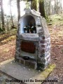
(16) At the Col des Dreimarkstein (des Trois Couronnes), head slightly to the right onto the path marked with a Blue Triangle.
(17) Leave the forest track and take the path down to the right, marked with a Blue Triangle.
(18) As you descend, take the path on the right marked with a Blue Triangle. Cross the campsite, then head down to the left to return to the visitors’ car park (S/E).

 Visorando Member

 Tourist office
 Easy

 Difficult

 Very difficult

