Mont-Miroir, Roche de Ruan, Faux Verger, starting from Maîche

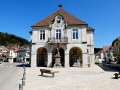
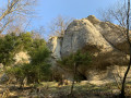
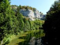
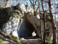
From the centre of Maîche, head up via the Étang de la Goule to Mont Miroir and its ski lift, then continue to the Roche de Ruan viewpoint. Descend towards the town, then climb back up the hill to the Saint-Michel Chapel overlooking Maîche. Then head downhill, passing through the Château du Désert park, before following the Faux Verger circular route, and returning via La Lizerne and the Château de Mérode. This pleasant circular route offers numerous viewpoints, including the one at Faux Verger, which provides a truly 360° view of the surrounding landscape, from the Vosges to the Swiss Jura, and even as far as the Bernese Alps, weather permitting.

Details

66003575
Creation:
Last update:
Last review:
  • Walking
    Activity: Walking
  • ↔
    Distance: 11.86 mi
  • ◔
    Average duration: 7h 05 
  • ▲
    Difficulty: Difficult

  • ⚐
    Back to start: Yes
  • ↗
    Ascent: + 1,834 ft
  • ↘
    Descent: - 1,821 ft

  • ▲
    Highest point: 3,205 ft
  • ▼
    Lowest point: 2,398 ft

Description of the walk

Park in the Rasse car park, Rue des Boutons d’Or, near the post office and opposite the medical centre. 

(S/E) Leave the car park, turn right and head up Rue des Boutons d’Or, heading east. Turn right, then left, before reaching Place du Champ de Foire. You’ll arrive at Rue de Saint-Hippolyt (D437); turn left onto it and follow it for twenty metres.

(1) Turn right onto Rue d’Alsace, then left at the next junction with Rue du Belvédère. Continue to number 20. 

(2) Take the stairs on the right, cross Rue sous Montjoie, and continue uphill. Then turn left into Rue Montjoie.

(3) Take the signposted path on the right, which climbs through the woods and joins a road at a viewpoint. 

(4) Head right onto the signposted path. Carry on, and, before reaching the road, take the signposted path on the right, which rejoins the road further on. 

(5) Cross the road carefully and head for the path opposite. Return to the road, follow it to the left for about a hundred metres, then turn right off it to reach the Étang de Goule. 

(6) Walk round the pond on the right-hand side, then, at the crossroads, take the forest track that climbs up to the right.

(7) At the junction, turn left, then carry on straight ahead along the forest track. Continue to the end to reach a point a few dozen metres from the Mont Miroir ski lift. 

(8) Head up to the right. When you reach the fence, turn left into the pasture and head towards a picnic table. Then cross the pasture to the right, heading for the bend in the access road to Mont-Miroir, to make use of the gap in the fence. Walk straight down along the road.

(9) At the junction, take the signposted path on the right, then cross the pasture and head down into the woodland. Turn right to climb for 20 metres and reach the Roche de Ruan viewpoint. 

(10) Retrace your steps, turn right and continue downhill. Cross a forest track, then turn right onto the road below, Rue de l’Europe. 

(11) Turn left onto Rue de la Roche de Ruan. Continue to the right at the end of this street, then turn left at the junction with Rue de la Gare, and emerge onto Rue Sainte-Anne, turning left onto it.

(12) Before the roundabout, cross Rue Sainte-Anne and take the path on the right, heading up towards Saint-Michel Hill. Then veer left to reach the Saint-Michel Chapel. 

(13) Walk down to Chemin de la Chapelle, and turn right onto it to reach Avenue du Maréchal Leclerc.

(14) Cross the avenue at the pedestrian crossing to enter the grounds of the Château du Désert.

(15) Walk round the castle on the left, cross the park and, at the exit, head up the street on the left to rejoin Avenue du Maréchal Leclerc. 

(16) Cross at the protected crossing, take the access road to the cemetery, and walk round it on the left. Return to Avenue du Maréchal Leclerc one last time. 

(17) Cross it and head straight on to Rue du Stade. Walk past the Tuileries Stadium. 

(18) Take the street on the left (Chemin de la Combe Missey). 

(19) Before this street joins the D437, turn right onto the signposted path leading uphill towards Le Faux Verger.

(20) At the junction with the small road, turn right and continue for about 200 metres. Turn left, just in front of the house, to follow the Faux Verger circular loop and reach the orientation table. 

(21) Start heading straight down the hill; then, once you’re behind the same house, turn left towards La Lizerne. On the descent, the signposted path turns left, then right, and follows a straighter section before coming out onto the D231 at the entrance to the hamlet. 

(22) Take the D231 on the right. When this departmental road turns left, follow the signposted path on the right, which joins the D464. 

(23) Cross the road , taking great care due to the lack of visibility, and take the signposted path which descends and then climbs back up through the woodland. Cross the D272 and continue straight ahead along the signposted path, which leads onto a small road near Mérode Castle, situated on the right.

(24) Turn right to head down towards Maîche. At the small roundabout, turn left onto Rue Gaston Mariotte, then go straight on at the next junction to reach the car park where you started (S/E). 

Waypoints

  1. S/E : mi 0 - alt. 2,497 ft - Car park: Place de l’Église
  2. 1 : mi 0.32 - alt. 2,559 ft - Junction of Rue Saint-Hippolyte and Rue d’Alsace
  3. 2 : mi 0.41 - alt. 2,589 ft - Stairs on the right
  4. 3 : mi 0.5 - alt. 2,657 ft - Marked path on the right
  5. 4 : mi 0.68 - alt. 2,835 ft - Viewpoint
  6. 5 : mi 0.99 - alt. 2,953 ft - Montjoie, junction of the signposted path and the road
  7. 6 : mi 1.23 - alt. 2,867 ft - Étang de Goule (Maîche)
  8. 7 : mi 1.49 - alt. 2,946 ft - Junction of marked and unmarked paths
  9. 8 : mi 1.97 - alt. 3,077 ft - Junction with marked trails, turn right
  10. 9 : mi 2.48 - alt. 3,133 ft - Junction between road and marked trail
  11. 10 : mi 3.01 - alt. 3,018 ft - Viewpoint at the - Roche de Ruan (Maîche)
  12. 11 : mi 3.48 - alt. 2,644 ft - Rue de la Roche de Ruan
  13. 12 : mi 3.77 - alt. 2,641 ft - Path on the right
  14. 13 : mi 4.21 - alt. 2,700 ft - Chapelle Saint-Michel
  15. 14 : mi 4.52 - alt. 2,572 ft - Avenue du Maréchal Leclerc
  16. 15 : mi 4.67 - alt. 2,592 ft - Château du Désert
  17. 16 : mi 4.88 - alt. 2,641 ft - Avenue du Maréchal Leclerc
  18. 17 : mi 5.19 - alt. 2,654 ft - Avenue du Maréchal Leclerc
  19. 18 : mi 5.4 - alt. 2,608 ft - Combe Missey Path
  20. 19 : mi 6.02 - alt. 2,707 ft - Picnic tables, signposted path to the right
  21. 20 : mi 7.44 - alt. 3,035 ft - Junction of marked path and road
  22. 21 : mi 8.31 - alt. 3,205 ft - Faux Verger – orientation table
  23. 22 : mi 10.2 - alt. 2,444 ft - La Lizerne, D231
  24. 23 : mi 10.73 - alt. 2,448 ft - D464
  25. 24 : mi 11.39 - alt. 2,598 ft - Road crossings
  26. S/E : mi 11.86 - alt. 2,497 ft - Start point car park

Notes

A note regarding the blue and yellow markings: on several occasions, the markings on the ground do not correspond exactly to those on the IGN base map.

There are no water points along the route.

Benches and picnic tables are available at various locations: at the top of the Mont-Miroir ski lift, near the water sports centre close to the Chapelle Saint Michel, as well as benches next to the chapel and picnic tables at the summit of the Faux Verger.

Take care on the limestone rocks in wet weather.

Worth a visit

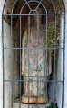
(13) Saint Michel Chapel.

(15) Château du Désert and its grounds, a cultural site. 

Reviews and comments

4.8 / 5
Based on 2 reviews

Reliability of the description
5 / 5
Ease of following the route
4.5 / 5
Route interest
5 / 5
christv
christv

Overall rating : 4.7 / 5

Date of your route : Aug 19, 2026
Reliability of the description : ★★★★★ Very good
Ease of following the route : ★★★★☆ Good
Route interest : ★★★★★ Very good
Very busy route : No

A lovely walk, mostly in the shade. A beautiful view at Le Faux Verger. No particular difficulties.
Many thanks to the author for sharing this.

Machine-translated

Meillet J-A
Meillet J-A

Overall rating : 5 / 5

Date of your route : Aug 04, 2025
Reliability of the description : ★★★★★ Very good
Ease of following the route : ★★★★★ Very good
Route interest : ★★★★★ Very good
Very busy route : No

A very beautiful hike, easy to follow, except between points 21 and 22 where we had to follow the signposts rather than the trail.
The paths are very pleasant, and there are often tables or benches where you can stop for a rest.
The description is accurate.
Thank you for sharing.

Machine-translated

Other walks in the area

For more walks, use our search engine .

The GPS track and description are the property of this route's author. Please do not copy them without permission.