


 Country:

 City:
City:


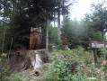
The route starts from the car park in the village centre, just before the school and opposite the fire station.
(S/E) From the car park, head up towards the church and then down the footpath to the right of the church to reach the junction with Rue des Rochelles.
(1) Turn left onto Rue Maienberg as you head uphill, then take care when crossing Route Joffre and take the path opposite. It climbs, then crosses Rue Felsenberg and continues along the path (marked with a Red Cross). It joins a forest track which leads to the access road to the Buissonnets farmhouse inn.
(2) At the car park serving the farmhouse inn, continue straight on along a forest track (marked with a Red Cross sign), leaving Les Buissonnets on your left. After a right-hand bend, you’ll reach a crossroads (at the bottom of the Martisplatz site).
(3) Leave the marked trail and take the path on the left, heading uphill. At the next junction, continue straight on along the main path, ignoring the marked trails. Ignore a path on the right and continue to a Y-junction.
(4) Turn right uphill and pass close to the car park for the Thannerhubel climbing area.
(5) Continue straight up, then, on emerging from the forest, take the path on the left (marked with a Yellow Cross). This joins a sharp bend on the main path above the Thannerhubel ski lift. Pass under the ski lift and, just before the Thannerhubel mountain hut, take the path leading uphill to the left (marked with a Yellow Cross and a Red Rectangle and a White Rectangle).
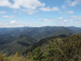
(6) Head up towards the Thannerhubel orientation table, which offers magnificent views, then descend towards the Waldmatt refuge at the junction with theGR®5.
(7) At the junction to the right of the refuge, go through the fence and turn right towards the Gsang FA.
(8) On the slope, to avoid descending to the junction of marked paths further down, turn left across the meadows and join the Red Triangle-marked path leading to the Gsang mountain pasture.
(9) Walk past the farm and continue along the edge of the meadow (marked with a Red Triangle).
(10) After a left-hand bend, at the junction of marked paths, turn left uphill towards Vogelstein (Blue Triangle markings). Further on, the path turns right and approaches theGR®5, which it joins near the Rocher de Vogelstein.
(11) From the rock, the view is magnificent. Descend from the rock and head right to return towards the Rossberg ridges, veering away fromthe GR®5(Red Rectangle) on your left. Walk alongside the stone wall serving as a fence, without crossing it, towards the summit of the Rossberg. Sheltered behind the summit rock of the Rossberg (coming from Vogelstein) stands a small statue of the Virgin Mary. Head back down to the left towards the Waldmatt mountain hut.
(12) At the junction of marked paths (near the Mulhouse Ski Club chalet), turn right along the hillside (marked with red and white rectangles). Enter the forest until you reach the Rocher du Corbeau, which can be made out just past a hairpin bend on the forest track that the marked path joins.
(13) Follow the markings by turning left and leaving the forest track for a footpath, then pass beneath the Rocher du Corbeau and its White Cross.
(14) Directly below the Rocher du Corbeau, instead of taking the signposted path to the right, continue for a few metres and turn right onto a well-trodden, unmarked track, which very quickly joins the Blue Disc signposted path, coming from the right from the FA des Buissonets.
(15) At the junction, carry straight on downhill along the main track (marked with a Blue Disc) until you reach the junction of the Bildbuche forest tracks.
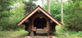
(16) At Bildbuche, take the signposted path (Blue Disc markings) furthest to the left, just before the small wayside shrine with a cross. Continue straight on downhill (Blue Disc markings) until you reach Rue des Charbonniers in Bourbach-le-Haut.
At the junction with Rue Saint Michel, go straight on to join the main road (Route Joffre), the centre of Bourbach and the car park where you started (S/E).


 Visorando Member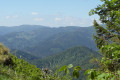

 Easy
Easy 
 Tourist office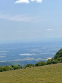
 Difficult
