A varied route on the Circuit des Bornes starting from Blamont

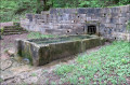
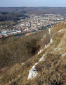
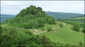
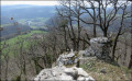
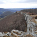
The section of the Circuit des Bornes between Blamont, Pierrefontaine-lès-Blamont and Villars-lès-Blamont takes in heritage sites, numerous water fountains, the Tante Airie cave, gun emplacements near Fort du Lomont, and then runs alongside the Franco-Swiss border with its boundary markers, as well as the source of the Creuse and its wash house. There may be views of the Chasseral and the Bernese Alps in good weather,

Details

n°30314429
Creation:
Last update:
Last review:
  • Walking
    Activity: Walking
  • ↔
    Distance: 10.81 mi
  • ◔
    Average duration: 6h 40 
  • ▲
    Difficulty: Moderate

  • ⚐
    Back to start: Yes
  • ↗
    Ascent: + 1,982 ft
  • ↘
    Descent: - 2,001 ft

  • ▲
    Highest point: 2,674 ft
  • ▼
    Lowest point: 1,391 ft

Description of the walk

Car park at Place des Tilleuls in Blamont, opposite the Auberge de Tante Airie near the church.

(S/E) Set off due east, leaving the church on your left, then the care home, and pass under the ramparts.

(1) Take the path on the right which descends into the forest (marked RH, ‘Sentier des Bornes’, route 4A).

(2) Cross the forest track and carry on straight ahead.

(3) Pass the Fontaine de Vaugonderis, situated below the path on the left, and carry on straight ahead. At the next junction, take the path on the right

(4) At Tante Airie’s cave, continue to the left at the foot of some small cliffs until you reach the D73.

(5) Cross the road with care and take the path opposite. At the next junction, take the path on the left which climbs into the forest.

(6) At the junction of the paths, follow the path on the left to the site of the old Lomont batteries.

(7) At the junction with theGR®5, head straight up and back to the nearby viewpoint. Retrace your steps.

(7) Set off again to the right, following theGR®5and the Sentier des Bornes.

(8) At the next junction, take the path immediately on the right and cross the pasture to the road. Follow the road to the left as far as the Villa des Roses.

(9) At this point, take the path that climbs into the forest on the right and passes in front of the Poil de Chien shelter.

(10) Continue straight on until you reach the French-Swiss border.

(11) At the junction of the signposted paths, take the Sentier des Bornes on the left, between France and Switzerland.

(12) At the junction with the D73 at the border post between Villars-lès-Blamont and Damvant, cross the road and head up into the woods opposite, continuing to follow the border.

(13) At the junction in the Bois des Trembles, turn left towards Villars-lès-Blamont. At thefirst junction in the village, turn left, then go straight on at the next one. Keep to the right at the T-junction and continue to the temple.

(14) Turn right onto Rue de Danache.

(15) Don’t miss the start of the poorly marked path in a left-hand bend just before another right-hand bend on the main track. If you do miss it, carry on straight ahead and take the first path on the left towards the farmstead, which you’ll need to go round to rejoin the marked path at the edge of the woodland.

(16) At the crossroads of paths, take the one on the left leading down into the woods. At the next junction, take the path on the right.

(17) At the Fontaine Ronde, carry on straight ahead. At the road junction by the stream, take the path on the left and follow it up the left bank. At the junction where the path joins a track, head straight on to the source of the Creuse and its wash house.

(18) From the source, follow the path which climbs up the hillside through the forest until you reach the entrance to Blamont at the church. Walk up Rue Viette on the right to return to the starting point (S/E).
Waypoints

  1. S/E : mi 0 - alt. 1,824 ft - Car park at Place des Tilleuls, Blamont
  2. 1 : mi 0.28 - alt. 1,798 ft - Junction: road and footpath
  3. 2 : mi 0.53 - alt. 1,654 ft - Forest track
  4. 3 : mi 0.6 - alt. 1,604 ft - Vaugonderis Fountain
  5. 4 : mi 0.93 - alt. 1,719 ft - Tante Airie Cave
  6. 5 : mi 1.39 - alt. 1,873 ft - D73
  7. 6 : mi 2.19 - alt. 2,451 ft - Junction of marked and unmarked paths
  8. 7 : mi 2.41 - alt. 2,641 ft - Junction with the GR®5
  9. 8 : mi 2.76 - alt. 2,589 ft - GR5 junction/marked trail
  10. 9 : mi 3.54 - alt. 2,477 ft - Villa des Roses
  11. 10 : mi 4.02 - alt. 2,543 ft - Poil de Chien
  12. 11 : mi 4.5 - alt. 2,477 ft - Swiss border crossing at Le Cerneux-Le Jonchet
  13. 12 : mi 5.51 - alt. 1,995 ft - Junction with the D73 at the Swiss border
  14. 13 : mi 6.45 - alt. 2,215 ft - Swiss border crossing at Bois des Trembles
  15. 14 : mi 7.62 - alt. 1,978 ft - Temple
  16. 15 : mi 8.22 - alt. 1,903 ft - Junction of a track and a signposted path
  17. 16 : mi 8.56 - alt. 1,775 ft - Danache pasture junction
  18. 17 : mi 9.2 - alt. 1,450 ft - Fontaine Ronde
  19. 18 : mi 10.39 - alt. 1,604 ft - Source of the Creuse
  20. S/E : mi 10.81 - alt. 1,824 ft - Car park at Place des Tilleuls, Blamont

Notes

There are several fountains and wash houses along the route (at Vaugonderis, Ronde, and the wash house at the source of the Creuse), but the water is not necessarily safe to drink unless otherwise stated.

This walk follows, for the most part, the Circuit des Bornes – Upper Section (4A), signposted by the Association La Randonnée Hérimoncourtoise, whom we must thank for the quality of the route. The association has also specifically signposted the Circuit des Bornes – Lower Section (4B), which also starts from Blamont; the final section of this route, passing by the Creuse resurgence, was also included in this walk.

Always be cautious and plan ahead when you're outdoors. Visorando and the author of this route cannot be held responsible for any accidents occurring on this route.

The GR® and PR® markings are the intellectual property of the Fédération Française de Randonnée Pédestre.

Reviews and comments

5 / 5
Based on 1 review

Reliability of the description
5 / 5
Ease of following the route
5 / 5
Route interest
5 / 5
fredmotard
fredmotard

Overall rating : 5 / 5

Date of your route : Apr 07, 2025
Reliability of the description : ★★★★★ Very good
Ease of following the route : ★★★★★ Very good
Route interest : ★★★★★ Very good
Very busy route : Yes

Things to do in spring

Machine-translated

Other walks in the area

For more walks, use our search engine .

The GPS track and description are the property of this route's author. Please do not copy them without permission.