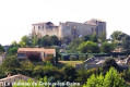
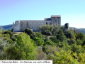
Laval circular – Marchand de Nuages plateau in Gréoux-les-Bains

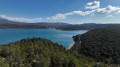
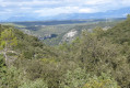
A walk starting from Laval that takes you up the Ravin de Laval to La Bouscole, then, after crossing the Ravin du Pauron, on to the Marchand de Nuages plateau, where there is a 360° panoramic view. The descent leads towards the ruins of Pujol; as you leave the plateau, you’ll see the dam and Lake Esparron on your left. Discover a variety of landscapes, ranging from farmland at the bottom of the Ravin de Laval and heath to a sparsely vegetated plateau.

Details

41435988
Creation:
Last update:
Last review:
  • Walking
    Activity: Walking
  • ↔
    Distance: 5.25 mi
  • ◔
    Average duration: 3h 05 
  • ▲
    Difficulty: Easy

  • ⚐
    Back to start: Yes
  • ↗
    Ascent: + 781 ft
  • ↘
    Descent: - 774 ft

  • ▲
    Highest point: 1,693 ft
  • ▼
    Lowest point: 1,142 ft

Photos

Description of the walk

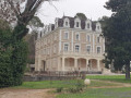
After passing the main entrance to Laval Castle, there is a car park along the road on the left, opposite the riding centre and before the entrance to it.

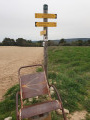
(S/E) Walk up the path for about twenty metres, then turn left onto the signposted trail, after passing the entrance to the château’s outbuildings on your left (access to accommodation). Walk up through the forest, veer left to skirt the rear of the château and reach a crossroads.

(1) Turn right, skirting the treetop adventure park and then the campsite, and head up the valley through the woodland.

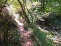
(2) Turn right and continue up the Ravin de Laval, first through the woodland, then along the edge of the forest, until you reach La Bouscole.

(3) Turn right and head uphill, south-east, through the woodland. Continue along the ridge.

(4) At the junction, turn left and head down towards the Ravin du Pauron.

(5) At the crossroads, take the second signposted path on the right and head back up. At the next junction with an unmarked path, turn right and head for the Marchand de Nuages plateau.

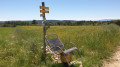
(6) At the junction of marked paths, turn right onto theGR®4andGRP® Tour du Lac d’Esparron, following the dual white/red and yellow/red markings. Keep left at the next two junctions.

(7) At the junction, turn right, continuing to follow the dual markings, and head down to the ruins of Pujol.

(8) Turn right, then right again at the junction about 150 metres further on.

(9) At the bottom of the descent, turn right and rejoin the road you arrived on. Turn right again, pass the castle entrance once more and you’ll find the car park on your left (S/E).

Waypoints

  1. S/E : mi 0 - alt. 1,175 ft - Car park before the riding centre
  2. 1 : mi 0.2 - alt. 1,145 ft - Castle, crossroads, turn right
  3. 2 : mi 0.6 - alt. 1,175 ft - Trail junction, turn right
  4. 3 : mi 1.54 - alt. 1,263 ft - La Bouscole
  5. 4 : mi 2.38 - alt. 1,647 ft - Descent to the left
  6. 5 : mi 2.5 - alt. 1,555 ft - Pauron Ravine
  7. 6 : mi 2.91 - alt. 1,693 ft - Marchand de Nuages, crossroads
  8. 7 : mi 3.69 - alt. 1,640 ft - Junction, on the right
  9. 8 : mi 4.42 - alt. 1,204 ft - Pujol, ruins
  10. 9 : mi 5.01 - alt. 1,148 ft - Trail junction, turn right
  11. S/E : mi 5.25 - alt. 1,175 ft - Car park before the riding centre

Notes

There are no shelters or water points along the hiking route.

Worth a visit

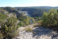
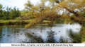
360° view at Le Marchand de Nuages, then on the descent, a view of the gravity dam at Lac d’Esparron.

Always be cautious and plan ahead when you're outdoors. Visorando and the author of this route cannot be held responsible for any accidents occurring on this route.

The GR® and PR® markings are the intellectual property of the Fédération Française de Randonnée Pédestre.

Reviews and comments

4.6 / 5
Based on 3 reviews

Reliability of the description
4.7 / 5
Ease of following the route
4.7 / 5
Route interest
4.3 / 5
Suzon
Suzon

Overall rating : 4 / 5

Date of your route : Nov 02, 2024
Reliability of the description : ★★★★☆ Good
Ease of following the route : ★★★★☆ Good
Route interest : ★★★★☆ Good
Very busy route : No

A lovely ride, especially the stretch through the forest on the way back. It wasn’t easy to find the starting point, as there were no signs for a riding centre. In the end, we took a chance and parked in the castle car park, then walked up the little street to the right of the car park – and sure enough, we ended up right where the horses were, and that’s where the ride began! The return route simply took us back to the car park, so in my opinion that’s the easiest way.
The view over the plateau is magnificent. The return leg – apart from the stretch along the field you have to follow for a while before entering the forest – was my favourite part of the route.

Machine-translated

randononak
randononak

Overall rating : 5 / 5

Date of your route : Oct 15, 2024
Reliability of the description : ★★★★★ Very good
Ease of following the route : ★★★★★ Very good
Route interest : ★★★★★ Very good
Very busy route : Yes

A pleasant route with no difficulties. A lovely view.

Machine-translated

aline gereys
aline gereys

Overall rating : 4.7 / 5

Date of your route : Apr 07, 2024
Reliability of the description : ★★★★★ Very good
Ease of following the route : ★★★★★ Very good
Route interest : ★★★★☆ Good
Very busy route : No

Staying at the Centre de Vacances Bleues in Château Laval, there’s no need to park to go on this walk; the Laval Ravine trail is lovely, with its boxwood and views out over fields of lavender (too early for the flowers to be in bloom – what a shame!); at the Marchand de Nuages plateau, the 360° view must surely have been stunning, but the weather was too overcast, with no blue sky to appreciate it that day... some sections of the path are very stony (with large pebbles), which may require careful attention, particularly on the descent. A lovely walk

Machine-translated

didou34
didou34

A lovely walk in slightly rainy weather. Thanks to BRUYERE56 for this route

Machine-translated

AUDO13
AUDO13

Hello, it seems the walk isn’t fully signposted. Are there any sections on private land? Thank you.

Machine-translated

Other walks in the area

For more walks, use our search engine .

The GPS track and description are the property of this route's author. Please do not copy them without permission.